Download
3D Flyover
Add to list
More
4.0 km
~1 hrs 28 min
410 m
Out and Back
“Conveniently accessible, the Skyline Trail West to Mount Van Cott offers stunning views and a moderate challenge.”
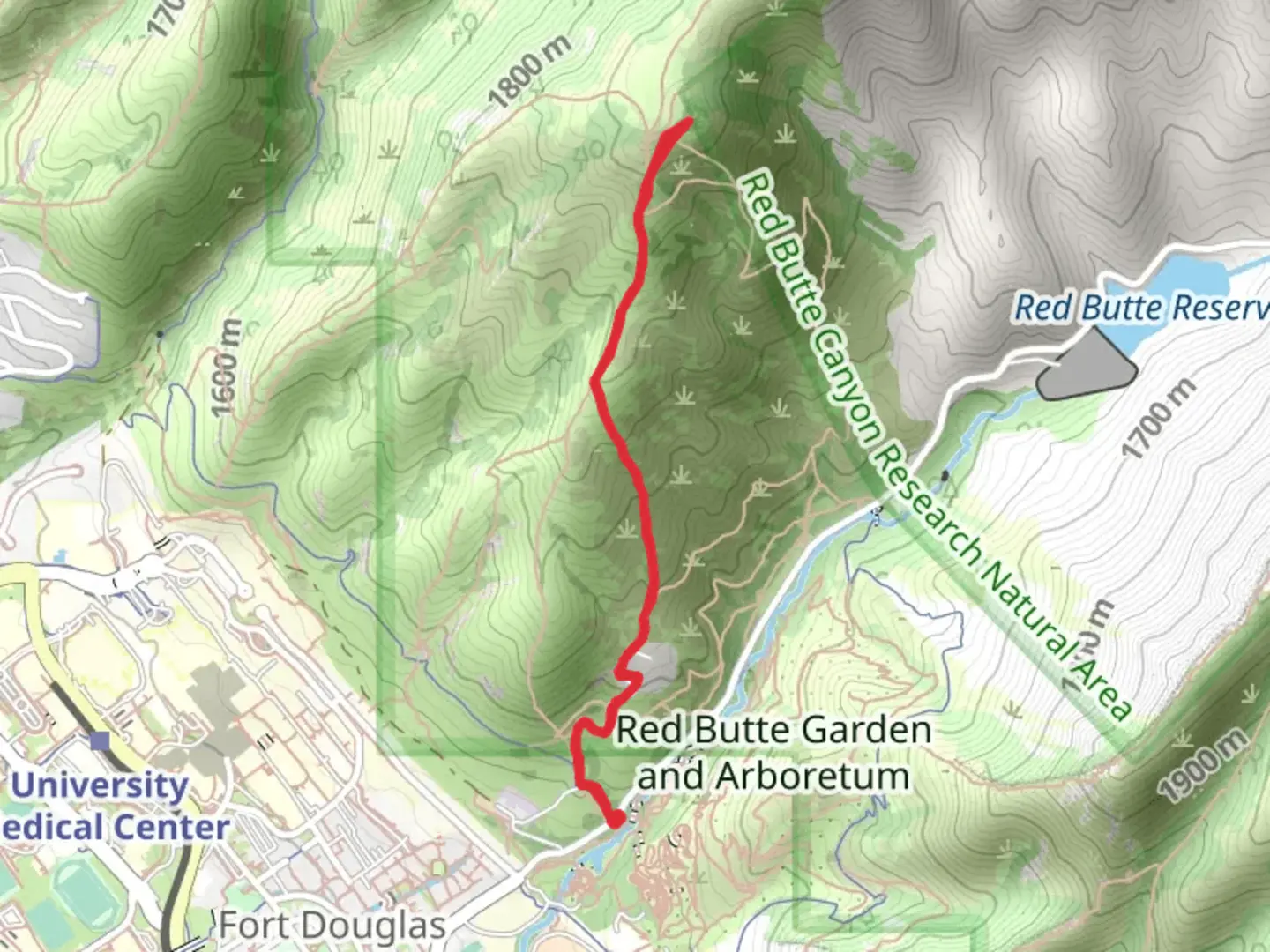
Starting near Salt Lake County, Utah, the Skyline Trail West and Mount Van Cott trailhead is conveniently accessible by car or public transport. If driving, you can park near the University of Utah, specifically around the Red Butte Garden area. For those using public transport, the Utah Transit Authority (UTA) offers bus services that stop near the University of Utah, making it a short walk to the trailhead.
Trail Overview
This out-and-back trail spans approximately 4 kilometers (2.5 miles) with an elevation gain of around 400 meters (1,312 feet). Rated as medium difficulty, it offers a rewarding challenge for hikers of varying experience levels. The trail is well-marked, but it's always a good idea to have a reliable navigation tool like HiiKER to ensure you stay on track.
Initial Ascent
The trail begins with a moderate incline, winding through a mix of scrub oak and sagebrush. Early on, you'll encounter a series of switchbacks that help to manage the elevation gain. As you ascend, take a moment to look back and enjoy the expanding views of the Salt Lake Valley and the Great Salt Lake in the distance.
Mid-Trail Highlights
At approximately 1.5 kilometers (0.9 miles) into the hike, you'll reach a plateau that offers a brief respite from the climb. This is a great spot to hydrate and take in the panoramic views. From here, the trail continues to climb but at a more gradual pace. Keep an eye out for local wildlife, including mule deer and various bird species such as hawks and falcons.
Historical Significance
The area around Mount Van Cott holds historical significance, particularly related to the early settlers of Salt Lake City. The nearby University of Utah, founded in 1850, is one of the oldest institutions in the western United States. The trail itself offers a glimpse into the natural landscape that early pioneers would have encountered.
Final Ascent and Summit
The final push to the summit of Mount Van Cott involves a steeper incline. As you approach the 2-kilometer (1.2 miles) mark, the vegetation becomes sparser, giving way to rocky outcrops. The summit offers breathtaking 360-degree views, including the Wasatch Range to the east and the urban sprawl of Salt Lake City to the west.
Descent
The return journey follows the same path, allowing you to enjoy the views from a different perspective. The descent is generally easier but requires careful footing, especially on the steeper sections.
Practical Tips
- Water: Ensure you carry enough water, especially during the hotter months.
- Footwear: Sturdy hiking boots are recommended due to the rocky terrain.
- Weather: Check the weather forecast before heading out, as conditions can change rapidly.
- Navigation: Use HiiKER for real-time trail navigation and updates.
This trail offers a perfect blend of natural beauty, moderate challenge, and historical context, making it a must-visit for hikers in the Salt Lake County area.

What to expect?
Activity types
Comments and Reviews
User comments, reviews and discussions about the Skyline Trail West and Mount Van Cott, Utah.
4.58
average rating out of 5
19 rating(s)