Download
Preview
Add to list
More
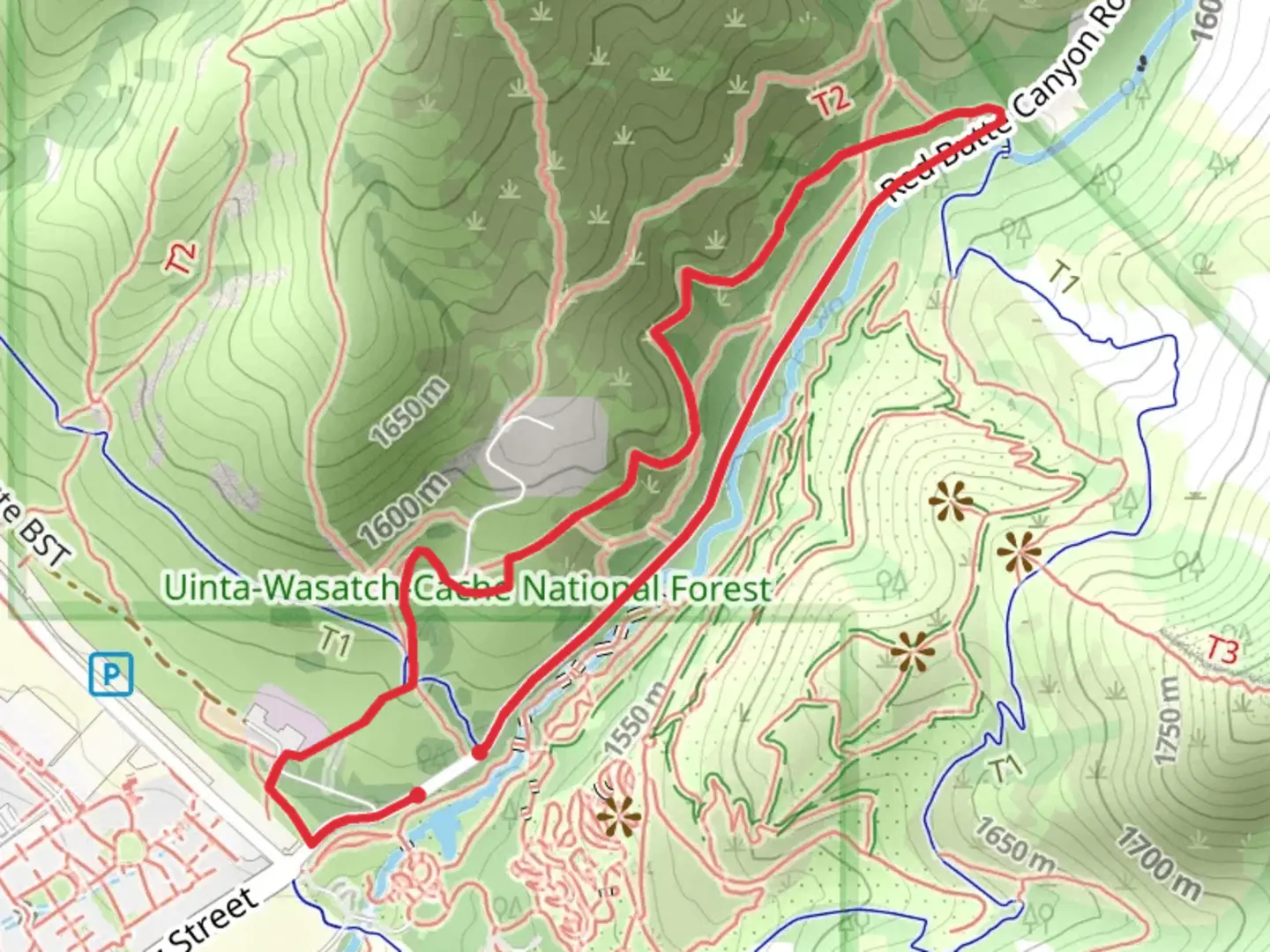
2.8 km
~43 min
102 m
Loop
“The Red Butte North and Creek Loop offers a scenic, moderately challenging 3 km hike with historical and natural beauty.”
Starting near Salt Lake County, Utah, the Red Butte North and Red Butte Creek Loop is a delightful 3 km (1.86 miles) loop trail with an elevation gain of approximately 100 meters (328 feet). This trail is rated as medium difficulty, making it suitable for moderately experienced hikers.
Getting There
To reach the trailhead, you can drive or use public transportation. If driving, head towards the Red Butte Garden, located at 300 Wakara Way, Salt Lake City, UT 84108. There is ample parking available near the garden. For those using public transport, take the UTA bus route 220, which stops near the University of Utah. From there, it's a short walk to the trailhead.
Trail Navigation
Using HiiKER for navigation is highly recommended to ensure you stay on track. The trail is well-marked, but having a reliable navigation tool can enhance your hiking experience.
Trail Highlights
As you begin your hike, you'll notice the trail meandering through a mix of open meadows and shaded areas. The initial section is relatively flat, making it a good warm-up before you start gaining elevation. About 0.5 km (0.31 miles) in, you'll start to ascend gradually.
Flora and Fauna
The trail is rich in native flora, including sagebrush, wildflowers, and various grasses. Keep an eye out for mule deer, which are commonly seen in this area. Birdwatchers will also enjoy spotting species like the American kestrel and red-tailed hawk.
Red Butte Creek
Around the 1.5 km (0.93 miles) mark, you'll encounter Red Butte Creek. This is a great spot to take a short break and enjoy the soothing sounds of the flowing water. The creek is home to various small fish and amphibians, adding to the natural beauty of the area.
Historical Significance
The region around Red Butte has historical significance dating back to the early settlers and Native American tribes. The area was used for various purposes, including as a water source and for its rich plant life. The nearby Red Butte Garden also offers insights into the botanical history of the region.
Final Stretch
As you continue, the trail loops back towards the starting point. The descent offers stunning views of the surrounding landscape, including the Salt Lake Valley and the distant Wasatch Mountains. The final 0.5 km (0.31 miles) is a gentle downhill walk, making for a pleasant end to your hike.
Safety and Preparation
Given the moderate difficulty, it's advisable to wear sturdy hiking boots and bring plenty of water, especially during the warmer months. The trail can be slippery after rain, so check weather conditions before heading out. Always let someone know your hiking plans and estimated return time.
This trail offers a perfect blend of natural beauty, moderate challenge, and historical context, making it a rewarding experience for those who venture out.

What to expect?
Activity types
Comments and Reviews
User comments, reviews and discussions about the Red Butte North and Red Butte Creek Loop, Utah.
4.5
average rating out of 5
20 rating(s)