
Download
3D Flyover
Add to list
More
7.5 km
~2 hrs 2 min
330 m
Loop
“Experience a 7-kilometer scenic loop showcasing diverse wildlife, historical sites, and breathtaking landscapes.”
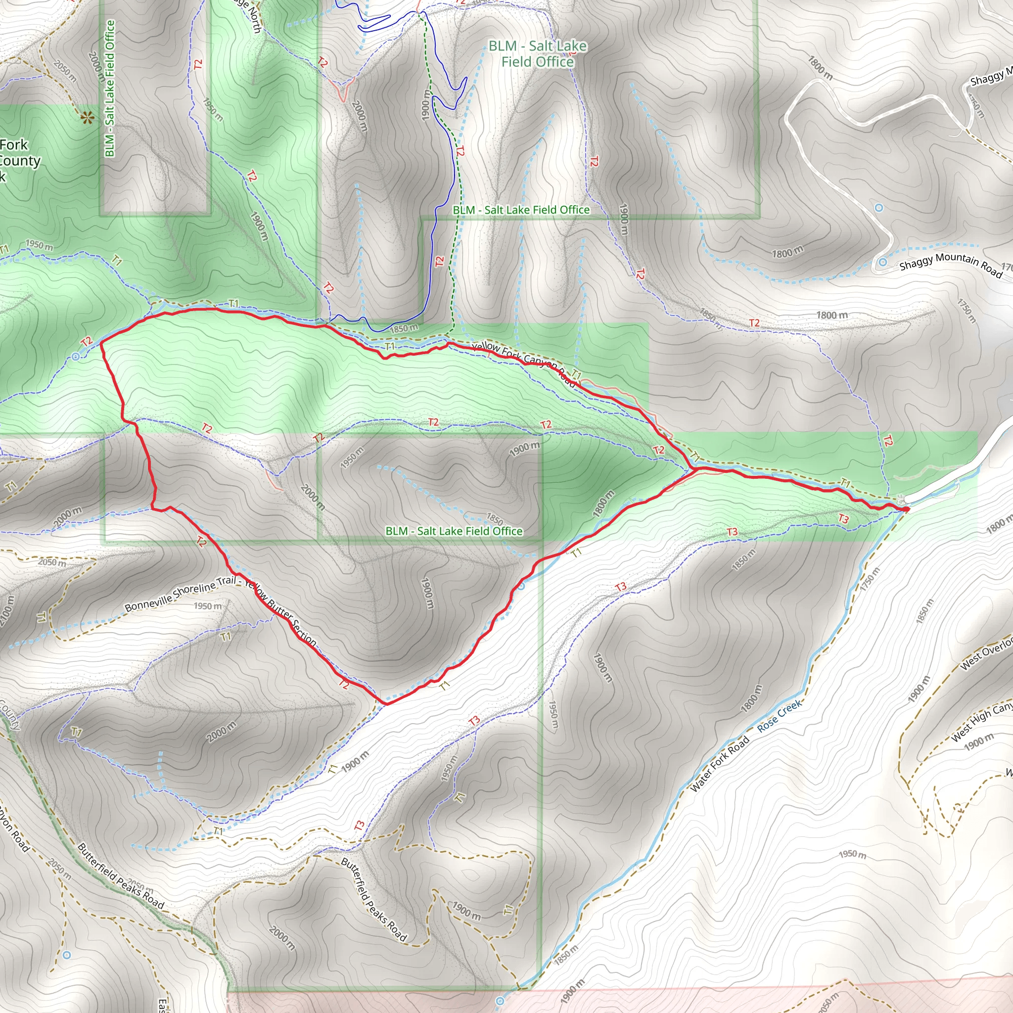
Starting near Salt Lake County, Utah, the Horsin' Around Trail and Yellow Fork Trail form a scenic loop that spans approximately 7 kilometers (4.3 miles) with an elevation gain of around 300 meters (984 feet). This medium-difficulty trail offers a blend of natural beauty, wildlife, and historical significance, making it a rewarding experience for hikers of various skill levels.
Getting There
To reach the trailhead, you can drive or use public transportation. If driving, head towards the Yellow Fork Canyon Trailhead, located near 11300 S Herriman Main St, Herriman, UT 84096. For those using public transport, the nearest bus stop is at Herriman Main St, from where you can either walk or arrange for a short taxi ride to the trailhead.
Trail Overview
The loop begins at the Yellow Fork Canyon Trailhead, where ample parking is available. The trail is well-marked and maintained, making navigation straightforward. For those who prefer digital navigation tools, HiiKER is highly recommended for real-time trail maps and updates.
Key Sections and Landmarks
Initial Ascent: The first section of the trail involves a moderate ascent through a forested area. The path is shaded by a canopy of oak and maple trees, providing a cool and refreshing start. This section covers approximately 1.5 kilometers (0.9 miles) with an elevation gain of about 100 meters (328 feet).
Meadow and Wildlife Viewing: As you continue, the trail opens up into a meadow around the 2.5-kilometer (1.6-mile) mark. This area is ideal for spotting local wildlife such as deer, wild turkeys, and various bird species. The meadow also offers panoramic views of the surrounding mountains.
Historical Significance: Around the 4-kilometer (2.5-mile) point, you'll encounter remnants of old mining operations. This region was historically significant during the late 19th and early 20th centuries when mining was a major industry. Informational plaques provide insights into the history and impact of these operations.
Creek Crossing: The trail then descends towards a small creek, which you will cross via a wooden bridge. This section is particularly picturesque, with the sound of flowing water adding to the serene atmosphere. The creek crossing is located approximately 5 kilometers (3.1 miles) into the hike.
Final Stretch: The last 2 kilometers (1.2 miles) of the trail involve a gentle ascent back towards the trailhead. This section is less shaded but offers stunning views of the valley below. The elevation gain here is around 50 meters (164 feet), making it a manageable end to the hike.
Flora and Fauna
The trail is rich in biodiversity. In spring and summer, wildflowers such as lupine and Indian paintbrush bloom along the path. The forested areas are home to a variety of birds, including woodpeckers and hawks. Keep an eye out for mule deer, which are commonly seen grazing in the meadows.
Preparation Tips
- Footwear: Sturdy hiking boots are recommended due to the varied terrain.
- Water: Carry at least 1.5 liters (50 ounces) of water, especially during warmer months.
- Weather: Check the weather forecast before heading out, as conditions can change rapidly.
- Navigation: Use HiiKER for real-time trail maps and updates.
This trail offers a perfect blend of natural beauty, wildlife, and historical intrigue, making it a must-visit for hikers in the Salt Lake County area.
What to expect?
Activity types
Comments and Reviews
User comments, reviews and discussions about the Horsin' Around Trail and Yellow Fork Trail, Utah.
4.47
average rating out of 5
19 rating(s)
