
Download
3D Flyover
Add to list
More
8.9 km
~3 hrs 3 min
763 m
Out and Back
“Embark on the scenic 9 km Grandeur Peak Trail for rewarding summit views and vibrant wildlife encounters.”
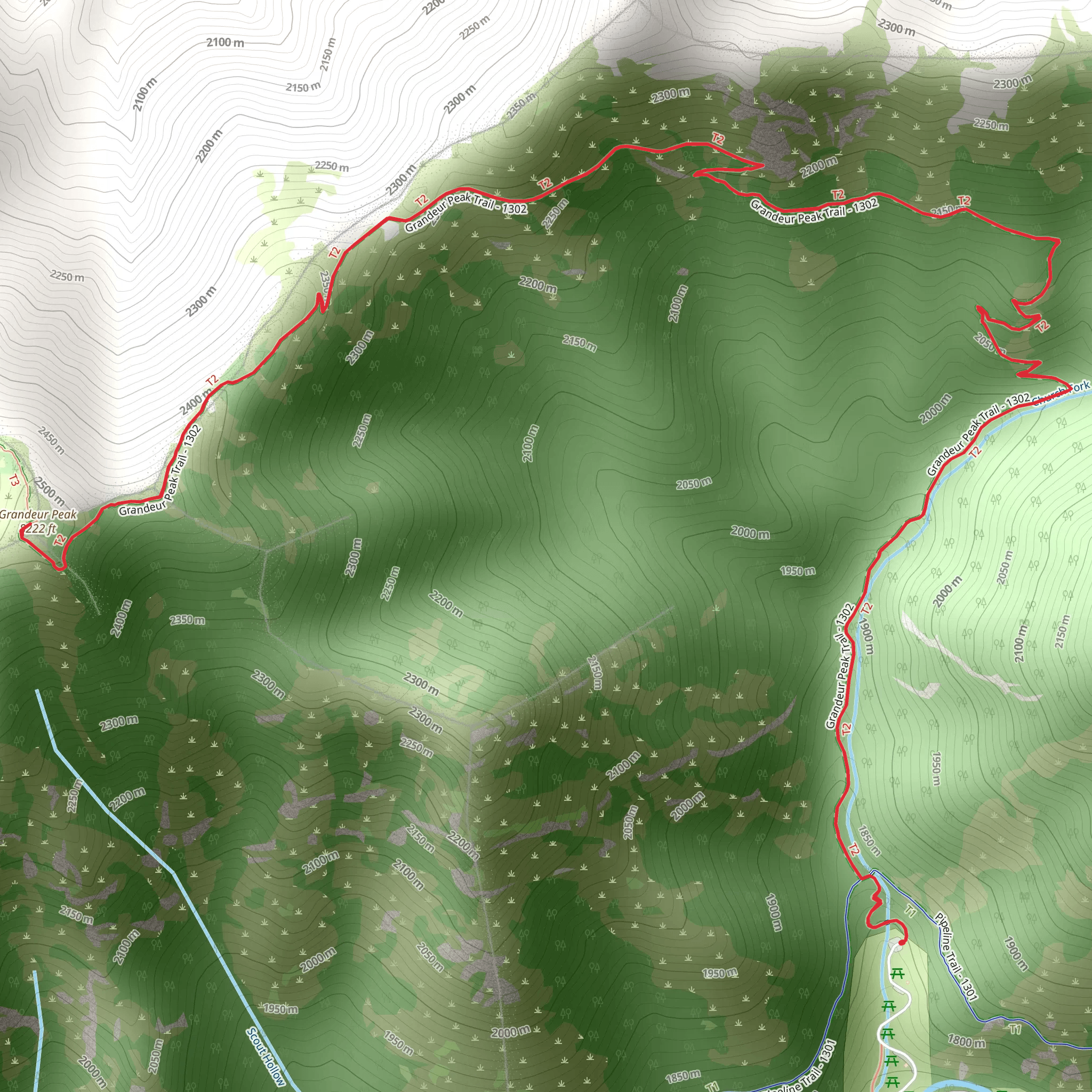
Starting your adventure near Salt Lake County, Utah, the Grandeur Peak Trail offers a rewarding out-and-back hike that spans approximately 9 km (5.6 miles) with an elevation gain of around 700 meters (2,300 feet). This trail is rated as medium difficulty, making it suitable for moderately experienced hikers.
Getting There
To reach the trailhead, you can drive or use public transportation. If driving, head towards the Church Fork Picnic Area in Mill Creek Canyon. The nearest known address is 3800 Mill Creek Canyon Road, Salt Lake City, UT 84109. For those using public transport, take a bus to the Mill Creek Canyon Park and Ride, then arrange for a short taxi or rideshare to the trailhead.
Trail Overview
The trail begins at the Church Fork Picnic Area, where you can find parking and restroom facilities. The initial section of the trail meanders through a shaded forest of oak, maple, and pine trees, providing a cool and serene start to your hike. As you ascend, the trail becomes steeper and rockier, so sturdy hiking boots are recommended.
Key Landmarks and Sections
First Mile (1.6 km): The first mile of the trail is relatively gentle, with an elevation gain of about 150 meters (500 feet). You'll cross a small creek and pass through dense foliage, making this section particularly scenic in the fall when the leaves change color.
Midway Point (2.5 km / 1.5 miles): At approximately 2.5 km (1.5 miles), you'll reach a clearing with a bench, offering a perfect spot to rest and take in the views of the Salt Lake Valley below. This is also a good place to hydrate and have a snack.
Final Ascent (3.5 km / 2.2 miles): The trail becomes more challenging as you approach the final ascent. The terrain is rocky and steep, with an elevation gain of about 300 meters (1,000 feet) in this section alone. Trekking poles can be helpful here for stability.
Flora and Fauna
The Grandeur Peak Trail is home to a variety of wildlife, including mule deer, wild turkeys, and occasionally, black bears. Birdwatchers will enjoy spotting species like the Mountain Bluebird and the Western Tanager. The flora varies with elevation; lower sections are dominated by scrub oak and maple, while higher elevations feature conifers and alpine wildflowers.
Historical Significance
The region around Grandeur Peak has a rich history, with evidence of Native American habitation dating back thousands of years. The area was also explored by early Mormon settlers in the mid-19th century, who used the canyon for logging and grazing.
Summit Views
Reaching the summit of Grandeur Peak is a rewarding experience. At 2,682 meters (8,799 feet) above sea level, the peak offers panoramic views of the Wasatch Range, the Great Salt Lake, and the Salt Lake Valley. On a clear day, you can even see as far as the Oquirrh Mountains to the west.
Navigation and Safety
For navigation, it's advisable to use the HiiKER app, which provides detailed maps and real-time updates. Always check the weather forecast before heading out, as conditions can change rapidly at higher elevations. Carry plenty of water, especially during the summer months, and be prepared for sudden temperature drops as you gain altitude.
Return Journey
The descent follows the same path back to the trailhead. While descending, take care on the rocky sections to avoid slips and falls. The return journey offers a different perspective of the landscape, so take your time to enjoy the views and perhaps spot some wildlife you missed on the way up.
What to expect?
Activity types
Comments and Reviews
User comments, reviews and discussions about the Grandeur Peak Trail, Utah.
4.67
average rating out of 5
15 rating(s)
