Download
Preview
Add to list
More
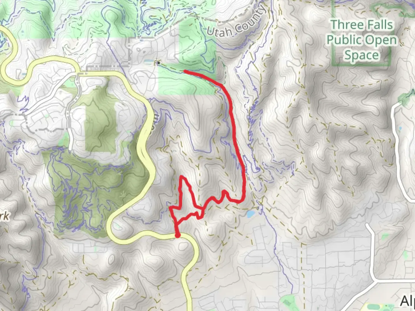
8.8 km
~2 hrs 21 min
359 m
Loop
“The Fango Loop offers a scenic, moderately challenging 9 km hike with stunning views and rich history.”
Starting near Salt Lake County, Utah, the Fango Loop is a captivating 9 km (approximately 5.6 miles) trail that offers a moderate challenge with an elevation gain of around 300 meters (984 feet). This loop trail is perfect for those looking to immerse themselves in the natural beauty of the region while enjoying a manageable hike.### Getting There To reach the trailhead, you can drive or use public transportation. If driving, head towards the nearest known landmark, the Salt Lake City International Airport. From there, it's a short drive to the trailhead. For those using public transport, take a bus or train to Salt Lake City and then a local bus or taxi to the trailhead area.### Trail Overview The Fango Loop begins with a gentle ascent through a mixed forest of pine and aspen trees. The initial 1.5 km (0.9 miles) offers a relatively easy walk, allowing you to acclimate to the terrain. As you progress, the trail becomes steeper, gaining elevation more rapidly over the next 2 km (1.2 miles). This section can be a bit challenging, so take your time and enjoy the surroundings.### Significant Landmarks and Nature Around the 3.5 km (2.2 miles) mark, you'll encounter a stunning viewpoint overlooking the Salt Lake Valley. This is an excellent spot for a break and some photos. Continuing on, the trail meanders through a series of meadows filled with wildflowers in the spring and summer months. Keep an eye out for local wildlife, including deer, elk, and a variety of bird species.### Historical Significance The region around the Fango Loop has a rich history. Native American tribes, including the Ute and Shoshone, once roamed these lands. Evidence of their presence can sometimes be found in the form of petroglyphs and ancient artifacts. Additionally, the area played a role during the westward expansion of the United States, with pioneers and settlers passing through these trails.### Navigation and Safety Given the moderate difficulty of the trail, it's advisable to use a reliable navigation tool like HiiKER to keep track of your progress and ensure you stay on the correct path. The trail is well-marked, but having a digital map can provide extra peace of mind.### Final Stretch The last 2 km (1.2 miles) of the loop bring you back down through a series of switchbacks, eventually leading you back to the trailhead. This descent offers a chance to cool down and reflect on the hike, with more opportunities to spot wildlife and enjoy the serene environment.The Fango Loop is a rewarding hike that combines natural beauty, moderate physical challenge, and a touch of historical intrigue. Whether you're a seasoned hiker or someone looking to explore the outdoors, this trail offers something for everyone.

What to expect?
Activity types
Comments and Reviews
User comments, reviews and discussions about the Fango Loop, Utah.
4.5
average rating out of 5
10 rating(s)