Download
3D Flyover
Add to list
More
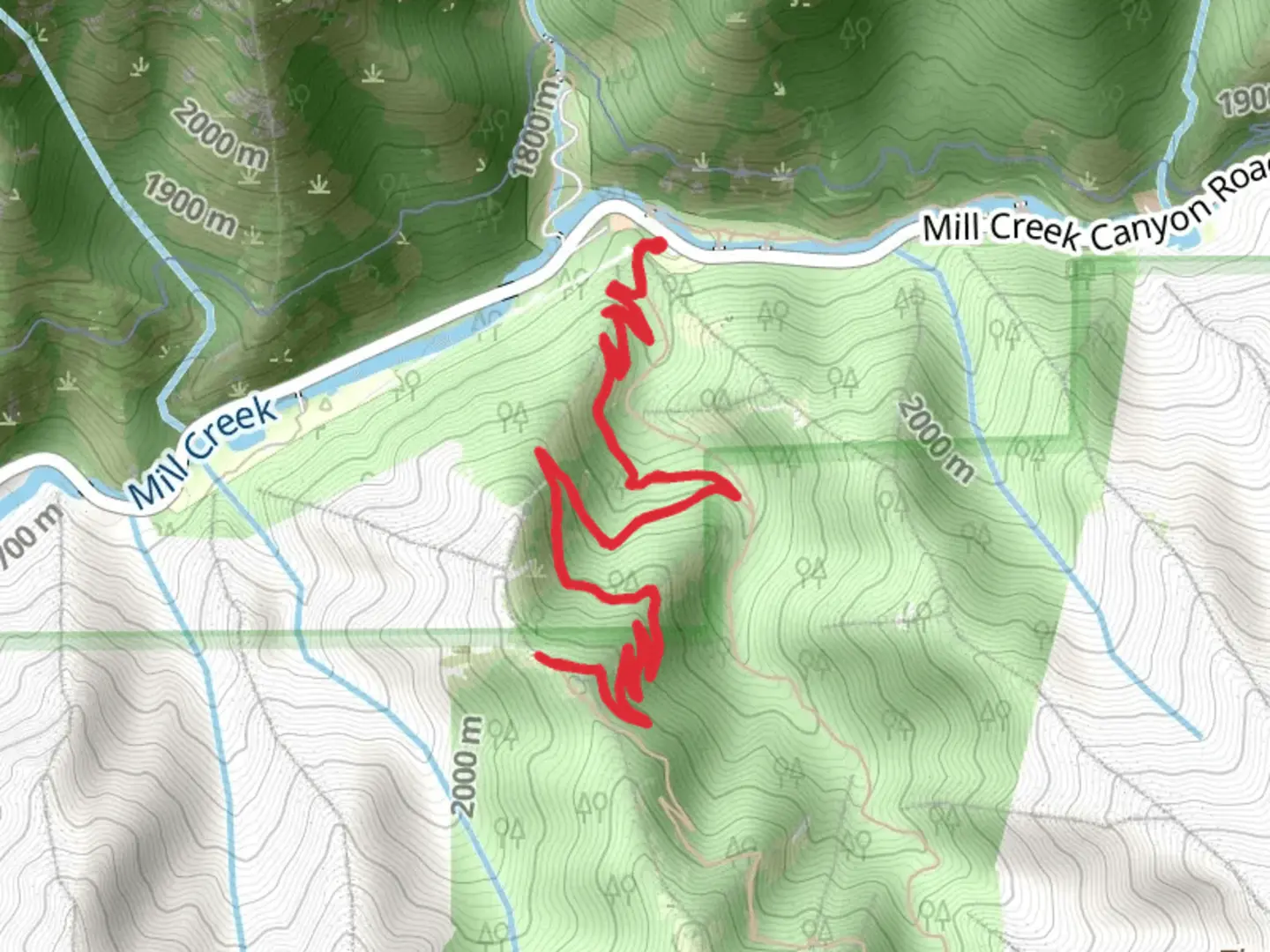
7.7 km
~2 hrs 26 min
540 m
Out and Back
“Experience natural beauty and history on the moderately challenging Desolation Trail to SLC Overlook in Utah.”
Starting near Salt Lake County, Utah, the Desolation Trail and SLC Overlook is an 8 km (5 miles) out-and-back trail with an elevation gain of approximately 500 meters (1,640 feet). This trail is rated as medium difficulty, making it suitable for moderately experienced hikers.
Getting There
To reach the trailhead, you can drive or use public transportation. If driving, head towards Mill Creek Canyon Road, which is the nearest significant landmark. Parking is available near the trailhead, but it can fill up quickly, especially on weekends. For those using public transport, the Utah Transit Authority (UTA) offers bus services that can get you close to the trailhead. Check the UTA website for the latest schedules and routes.
Trail Overview
The trail begins with a steady incline through a dense forest of pine and aspen trees. Early on, you'll encounter a series of switchbacks that help to manage the elevation gain. The first 1.5 km (0.9 miles) of the trail are relatively shaded, providing a cool and comfortable start to your hike.
Significant Landmarks and Nature
At around the 2 km (1.2 miles) mark, you'll reach a small clearing that offers your first glimpse of the Salt Lake Valley. This is a great spot to take a short break and hydrate. Continuing on, the trail becomes steeper and rockier, so be sure to watch your footing.
Wildlife and Flora
The area is home to a variety of wildlife, including deer, squirrels, and a range of bird species. Keep an eye out for wildflowers such as Indian paintbrush and columbine, especially in the spring and early summer months.
Historical Significance
The trail passes through areas that were historically used by Native American tribes for hunting and gathering. Additionally, the region played a role during the early settlement of Utah, with pioneers using nearby routes to traverse the Wasatch Mountains.
Reaching the Overlook
At approximately 4 km (2.5 miles) from the trailhead, you'll reach the SLC Overlook. This vantage point offers panoramic views of the Salt Lake Valley and the surrounding mountains. It's a popular spot for photography, so bring your camera. The overlook is also a good place to rest and enjoy a snack before heading back down.
Navigation and Safety
Given the elevation gain and rocky sections, it's advisable to use a reliable navigation tool like HiiKER to stay on track. The trail is well-marked, but having a digital map can provide extra assurance. Always carry sufficient water, especially during the hotter months, and consider bringing trekking poles for added stability.
Return Journey
The return journey follows the same path back to the trailhead. While descending, take your time to enjoy the changing perspectives and perhaps spot some wildlife you missed on the way up. The descent is generally easier but still requires careful footing, especially on the steeper sections.
This trail offers a rewarding hike with a mix of natural beauty, historical significance, and stunning views, making it a must-visit for those in the Salt Lake County area.

What to expect?
Activity types
Comments and Reviews
User comments, reviews and discussions about the Desolation Trail and SLC Overlook, Utah.
4.69
average rating out of 5
26 rating(s)