Download
3D Preview
Add to list
More
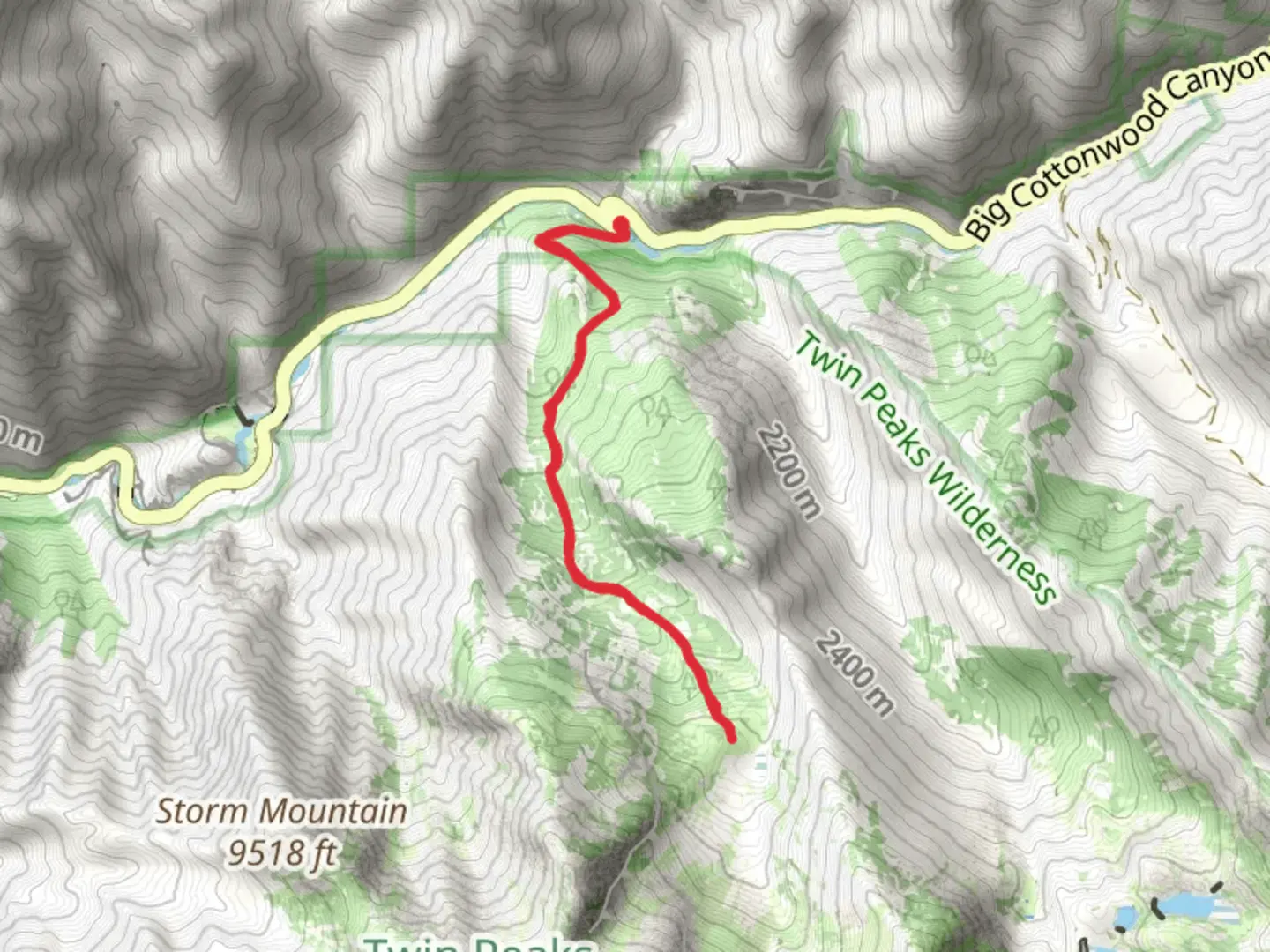
7.2 km
~2 hrs 33 min
677 m
Out and Back
“Embark on a moderately challenging 7-km Broads Fork Trail hike in Utah's stunning Wasatch Mountains.”
Starting your adventure near Salt Lake County, Utah, the Broads Fork Trail offers a captivating journey through the Wasatch Mountains. This out-and-back trail spans approximately 7 kilometers (4.3 miles) with an elevation gain of around 600 meters (1,968 feet), making it a moderately challenging hike suitable for those with some hiking experience.
Getting There
To reach the trailhead, head towards the Mill B South Fork Picnic Area, located off Big Cottonwood Canyon Road (UT-190). If you're driving, there is ample parking available at the picnic area. For those relying on public transport, you can take the UTA bus route 972, which runs along Big Cottonwood Canyon Road. Disembark at the Mill B South Fork stop, and the trailhead is just a short walk away.
Trail Overview
The trail begins at an elevation of approximately 1,920 meters (6,300 feet) and immediately immerses you in a dense forest of aspen and pine trees. The initial section is relatively gentle, allowing you to acclimate to the altitude and enjoy the serene surroundings. About 1 kilometer (0.6 miles) in, you'll encounter a small wooden bridge crossing a babbling brook, a perfect spot for a quick photo or a moment of reflection.
Significant Landmarks and Nature
As you continue, the trail starts to ascend more steeply. Around the 2-kilometer (1.2-mile) mark, you'll reach a clearing that offers your first panoramic view of the surrounding peaks. This is a great place to take a break and hydrate. Keep an eye out for local wildlife such as mule deer and various bird species, including the striking Steller's Jay.
Historical Significance
The Broads Fork area has a rich history tied to the early settlers and miners of the region. In the late 19th century, this area was explored for its mineral wealth, and remnants of old mining operations can still be found if you know where to look. These historical artifacts add an intriguing layer to your hike, connecting you to the past inhabitants of these rugged mountains.
Final Ascent and Views
The final push to the end of the trail is the most strenuous, with a series of switchbacks that will test your endurance. However, the effort is well worth it. At approximately 3.5 kilometers (2.2 miles) from the trailhead, you'll reach the Broads Fork Meadow, a stunning alpine meadow surrounded by towering peaks. This is the turnaround point for the hike, and it offers breathtaking views that make the climb worthwhile.
Navigation and Safety
Given the moderate difficulty of the trail, it's advisable to use a reliable navigation tool like HiiKER to keep track of your progress and ensure you stay on the correct path. The trail is well-marked, but having a digital map can provide extra peace of mind.
Flora and Fauna
Throughout your hike, you'll be treated to a diverse array of flora, including wildflowers in the spring and summer months. The trail is also home to various fauna, so keep your eyes peeled for signs of wildlife. Remember to respect their habitat and maintain a safe distance.
Return Journey
The descent back to the trailhead is much quicker, but still requires caution, especially on the steeper sections. Take your time to enjoy the changing perspectives and perhaps spot some wildlife you missed on the way up.
This hike offers a perfect blend of natural beauty, historical intrigue, and physical challenge, making it a must-do for any hiking enthusiast visiting the Salt Lake County area.

What to expect?
Activity types
Comments and Reviews
User comments, reviews and discussions about the Broads Fork Trail, Utah.
4.53
average rating out of 5
19 rating(s)