
Download
3D Flyover
Add to list
More
5.5 km
~1 hrs 33 min
274 m
Out and Back
“Explore Thor's Lookout Trail for invigorating views, historical landmarks, and diverse wildlife in Iron County, Utah.”
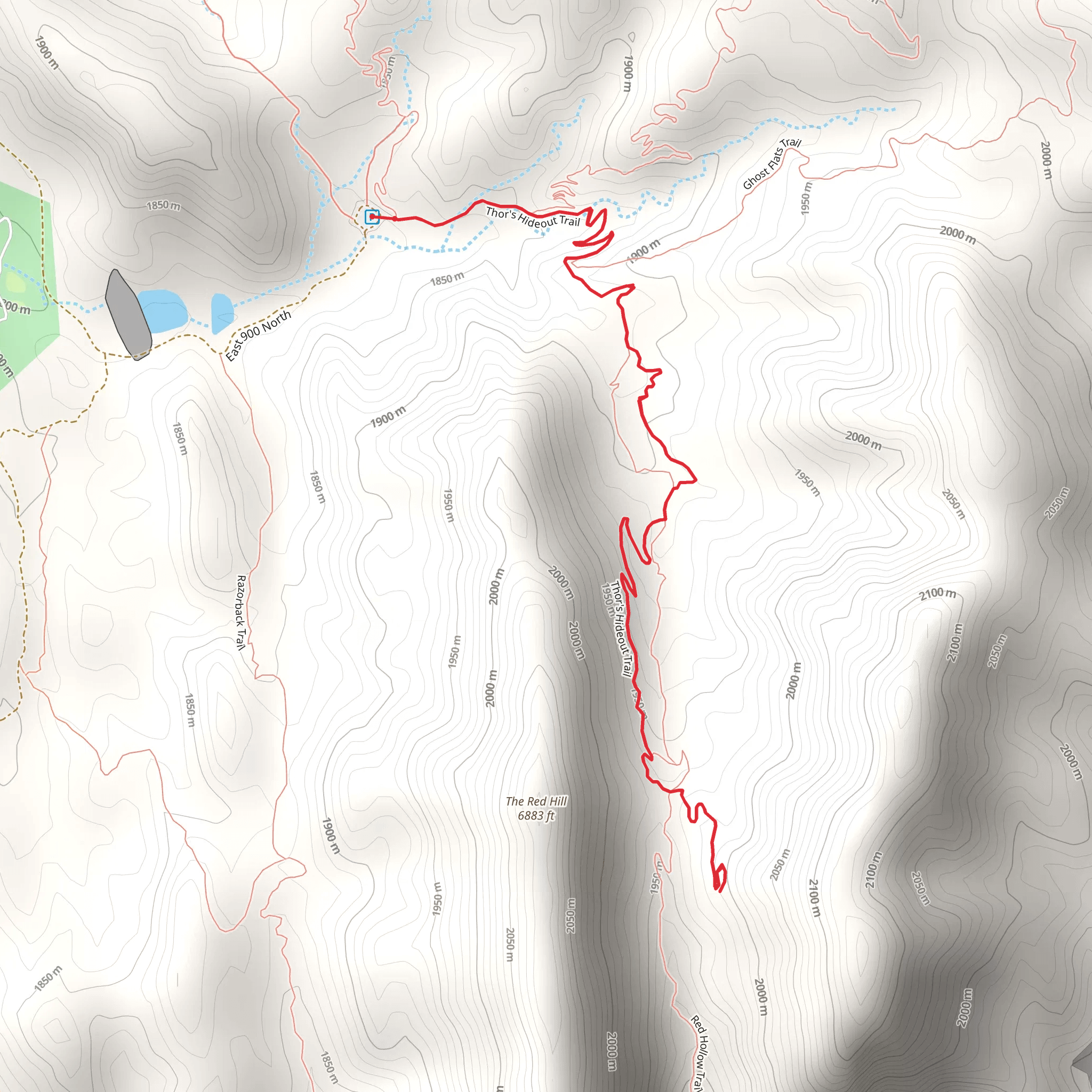
Starting near Iron County, Utah, the Thor's Lookout Trail is an invigorating out-and-back hike that spans approximately 6 kilometers (around 3.7 miles) with an elevation gain of about 200 meters (656 feet). This trail offers a moderate challenge, making it suitable for hikers with some experience.
Getting There
To reach the trailhead, you can drive or use public transportation. If you're driving, head towards Cedar City, Utah, and follow signs to Iron County. The nearest significant landmark is the Cedar City Regional Airport. From there, it's a short drive to the trailhead. For those relying on public transport, buses run regularly to Cedar City, and from there, you can take a local taxi or rideshare service to the trailhead.
Trail Overview
The trail begins with a gentle ascent through a mixed forest of pinyon pines and junipers. The initial 1 kilometer (0.6 miles) is relatively easy, allowing you to warm up and enjoy the serene surroundings. As you continue, the trail becomes steeper, gaining elevation more rapidly.
Significant Landmarks
At around the 2-kilometer (1.2-mile) mark, you'll encounter a striking rock formation known locally as "The Sentinel." This natural feature offers a great spot for a short break and some photos. Continuing on, the trail winds through a series of switchbacks, providing panoramic views of the surrounding valleys and distant mountain ranges.
Flora and Fauna
The area is rich in wildlife, so keep an eye out for mule deer, foxes, and a variety of bird species, including hawks and eagles. The flora is equally diverse, with seasonal wildflowers adding splashes of color to the landscape, particularly in the spring and early summer.
Historical Significance
Iron County has a rich history, with roots tracing back to Native American tribes and early settlers. The trail itself passes near several ancient petroglyphs, which are worth a brief detour. These rock carvings offer a glimpse into the lives of the region's original inhabitants.
Final Stretch
The final kilometer (0.6 miles) to Thor's Lookout is the most challenging, with a steep incline that will test your endurance. However, the effort is well worth it. Upon reaching the lookout, you'll be rewarded with breathtaking views of the surrounding landscape, including Cedar Breaks National Monument in the distance.
Navigation
For navigation, it's highly recommended to use the HiiKER app, which provides detailed maps and real-time updates. This will ensure you stay on track and can fully enjoy the hike without worrying about getting lost.
Return Journey
The return journey follows the same path, allowing you to revisit the landmarks and perhaps notice details you missed on the way up. Make sure to pace yourself and take breaks as needed, especially on the steeper sections.
This trail offers a perfect blend of natural beauty, moderate challenge, and historical intrigue, making it a must-visit for any hiking enthusiast.
What to expect?
Activity types
Comments and Reviews
User comments, reviews and discussions about the Thor's Lookout Trail, Utah.
4.8
average rating out of 5
20 rating(s)
