
Download
3D Flyover
Add to list
More
3.5 km
~52 min
104 m
Out and Back
“Explore the captivating 3-km Lizard Foot trail with scenic vistas, historical sites, and diverse desert wildlife.”
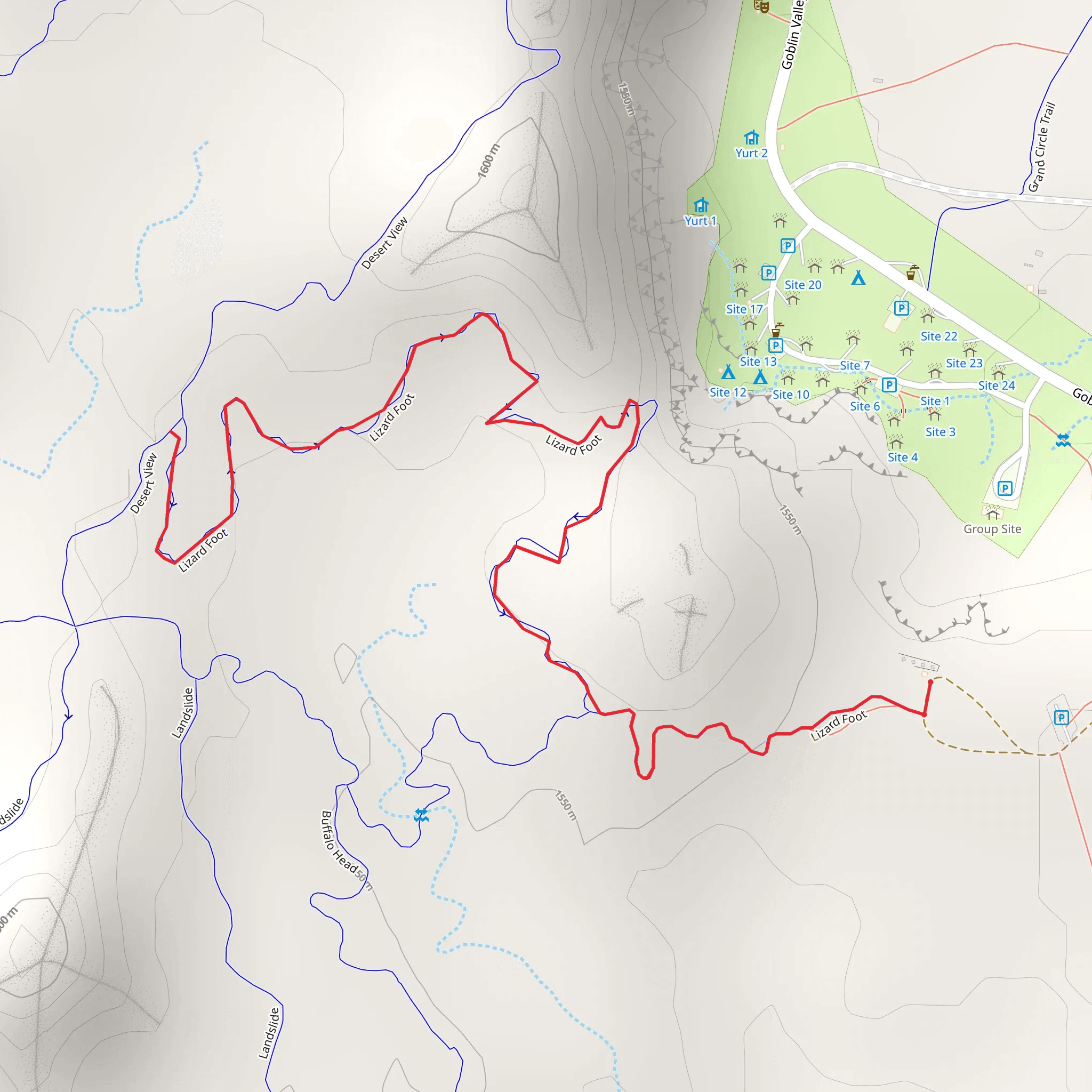
Starting near Emery County, Utah, the Lizard Foot trail is an engaging out-and-back hike that spans approximately 3 kilometers (1.86 miles) with an elevation gain of around 100 meters (328 feet). This trail is rated as medium difficulty, making it suitable for hikers with some experience.
Getting There
To reach the trailhead, you can drive or use public transport. If you're driving, head towards the town of Green River, Utah. From there, take the I-70 westbound and exit at mile marker 147. Follow the signs towards Goblin Valley State Park, and you'll find the trailhead near Temple Mountain Road. For those using public transport, the nearest bus stop is in Green River, and you may need to arrange a taxi or rideshare to the trailhead.
Trail Overview
The trail begins with a gentle ascent, gradually increasing in elevation as you move deeper into the landscape. The initial 0.5 kilometers (0.31 miles) are relatively easy, allowing you to warm up and get accustomed to the terrain. As you progress, the trail becomes steeper, with rocky sections that require careful footing.
Landmarks and Natural Features
Around the 1-kilometer (0.62 miles) mark, you'll encounter a striking rock formation known locally as "The Sentinel." This towering structure offers a great spot for a short break and some photography. Continuing on, the trail winds through a series of narrow canyons, where the walls rise dramatically on either side, creating a sense of seclusion and tranquility.
Flora and Fauna
The Lizard Foot trail is home to a variety of desert flora, including sagebrush, juniper, and various cacti. Keep an eye out for wildlife such as lizards, jackrabbits, and occasionally, desert bighorn sheep. Birdwatchers will also appreciate the presence of hawks and eagles soaring overhead.
Historical Significance
This region holds historical significance due to its proximity to ancient Native American sites. Petroglyphs and pictographs can be found in the surrounding areas, offering a glimpse into the lives of the indigenous peoples who once inhabited this land. While these are not directly on the trail, they are worth exploring if you have extra time.
Navigation and Safety
Given the rocky and sometimes uneven terrain, it's advisable to use a reliable navigation tool like HiiKER to stay on track. The trail is well-marked, but having a digital map can provide extra assurance. Make sure to carry plenty of water, as the desert environment can be extremely dehydrating, especially during the hotter months.
Final Stretch
The final stretch of the trail offers a rewarding view of the surrounding landscape. At the turnaround point, you'll find a natural rock ledge that provides a panoramic view of the valley below. This is an excellent spot to rest and take in the scenery before heading back the way you came.
By preparing adequately and being aware of the trail's features and challenges, you can fully enjoy the unique beauty and historical richness that the Lizard Foot trail has to offer.
What to expect?
Activity types
Comments and Reviews
User comments, reviews and discussions about the Lizard Foot, Utah.
4.67
average rating out of 5
12 rating(s)
