
Download
3D Flyover
Add to list
More
13.1 km
~3 hrs 3 min
267 m
Out and Back
“"Experience the Uinta Highline Trail's stunning landscapes, moderate challenges, and rich history on this 13-kilometer hike."”
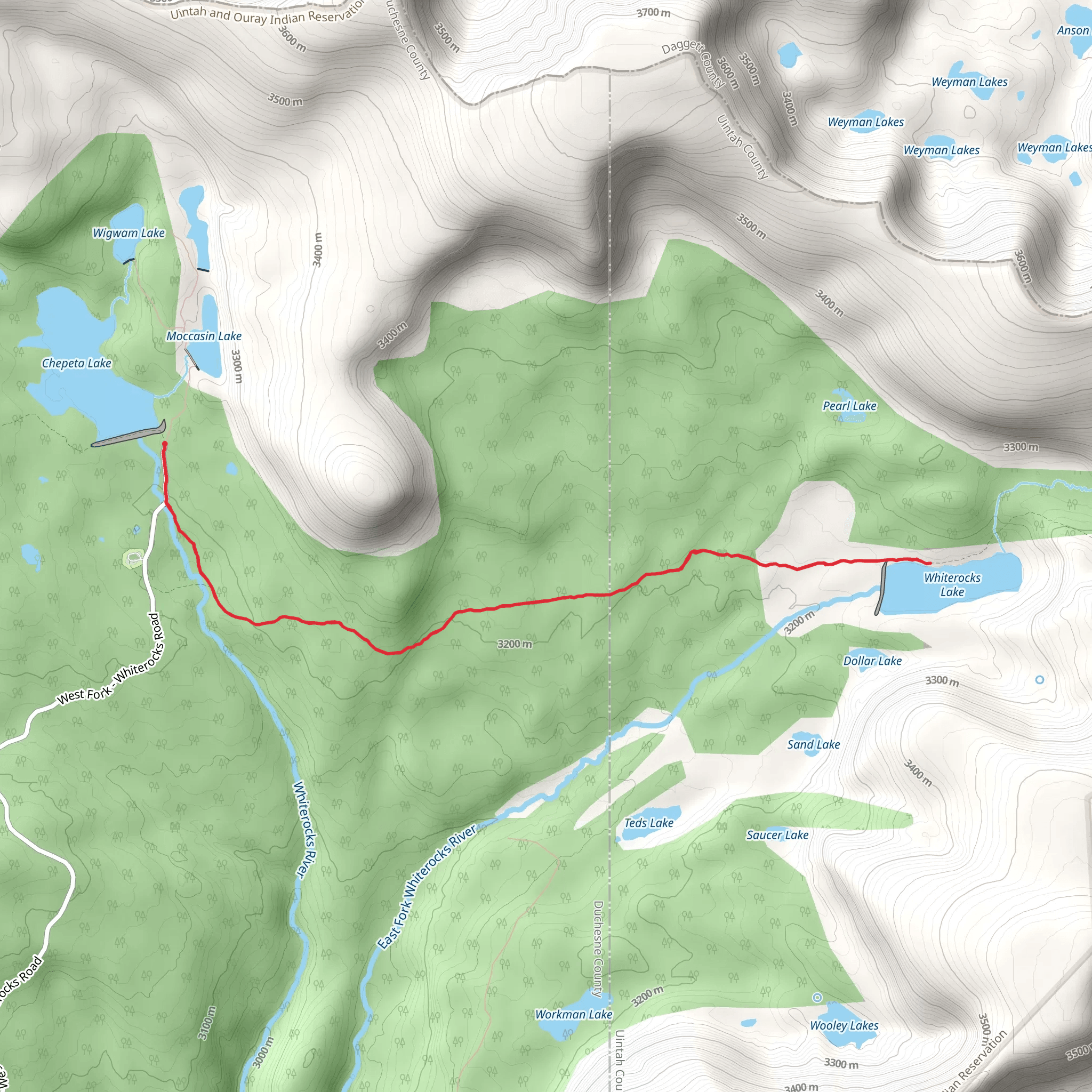
Starting near Duchesne County, Utah, the Whiterocks Lake via Uinta Highline Trail offers a captivating journey through the Uinta Mountains. This out-and-back trail spans approximately 13 kilometers (8 miles) with an elevation gain of around 200 meters (656 feet), making it a moderately challenging hike suitable for those with some hiking experience.
Getting There
To reach the trailhead, you can drive or use public transport. If driving, head towards the Uinta-Wasatch-Cache National Forest, specifically near the Whiterocks River Campground. For those relying on public transport, the nearest significant town is Duchesne, Utah. From Duchesne, you can arrange a taxi or shuttle service to the trailhead.
Trail Overview
The trail begins at the Whiterocks River Campground, a convenient starting point with ample parking. As you set off, you'll immediately be immersed in the dense forest, characterized by towering pines and a rich understory of shrubs and wildflowers. The initial section of the trail is relatively flat, allowing you to ease into the hike.
Key Landmarks and Elevation
At approximately 2 kilometers (1.2 miles) in, you'll encounter a gentle ascent, gaining about 50 meters (164 feet) in elevation. This section offers stunning views of the surrounding peaks and valleys. Keep an eye out for wildlife; deer and elk are commonly spotted here, and if you're lucky, you might even see a moose.
Mid-Trail Highlights
Around the 5-kilometer (3.1-mile) mark, you'll reach a picturesque meadow, an ideal spot for a short break. This meadow is often dotted with colorful wildflowers in the spring and summer months. From here, the trail continues to climb gradually, offering intermittent views of Whiterocks Lake in the distance.
Historical Significance
The Uinta Mountains are rich in history, with evidence of Native American presence dating back thousands of years. The Uinta Highline Trail itself has been used for centuries, initially by indigenous tribes and later by European settlers and explorers. As you hike, consider the historical significance of the land beneath your feet.
Final Stretch to Whiterocks Lake
The final 2 kilometers (1.2 miles) involve a more noticeable ascent, gaining an additional 100 meters (328 feet) in elevation. This section can be a bit more strenuous, but the reward is well worth the effort. As you approach Whiterocks Lake, the trail levels out, and the serene beauty of the lake comes into view. The crystal-clear waters of Whiterocks Lake are surrounded by rugged mountain peaks, creating a breathtaking panorama.
Navigation and Safety
For navigation, it's highly recommended to use the HiiKER app, which provides detailed maps and real-time updates. The trail is well-marked, but having a reliable navigation tool ensures you stay on track. Additionally, be prepared for changing weather conditions, as the Uinta Mountains can experience sudden shifts in weather.
Wildlife and Flora
The area is home to a diverse range of wildlife, including black bears, so carrying bear spray is advisable. The flora is equally impressive, with a variety of coniferous trees, alpine flowers, and shrubs. Birdwatchers will also find plenty to enjoy, with species like the Clark's Nutcracker and Mountain Bluebird frequently spotted.
Return Journey
After spending some time at Whiterocks Lake, retrace your steps back to the trailhead. The descent offers a different perspective of the landscape, and the return journey is generally quicker due to the downhill sections.
This trail offers a perfect blend of natural beauty, moderate challenge, and historical significance, making it a must-visit for any hiking enthusiast.
What to expect?
Activity types
Comments and Reviews
User comments, reviews and discussions about the Whiterocks Lake via Uinta Highline Trail, Utah.
4.86
average rating out of 5
7 rating(s)
