
Download
3D Flyover
Add to list
More
31.4 km
~2 days
1119 m
Out and Back
“A moderately challenging, scenic trail with historical sites, stunning views, and diverse wildlife awaits in Cache County.”
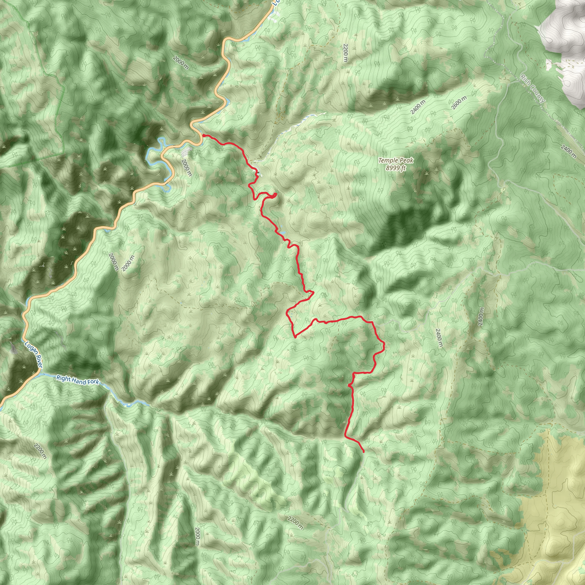
Starting near Cache County, Utah, the Temple Fork and Long Hollow trail spans approximately 31 kilometers (about 19 miles) with an elevation gain of around 1100 meters (3600 feet). This out-and-back trail is rated as medium difficulty, making it suitable for moderately experienced hikers.
Getting There
To reach the trailhead, you can drive or use public transportation. If driving, head towards Logan, Utah, and follow US-89 north until you reach Temple Fork Road. The trailhead is located near the intersection of Temple Fork Road and US-89. For those using public transport, the nearest significant landmark is the Logan Transit District, from where you can catch a local bus or arrange for a taxi to the trailhead.
Trail Overview
The trail begins with a gentle ascent through a lush forest of aspen and pine trees. The first 5 kilometers (3 miles) are relatively easy, with an elevation gain of about 150 meters (500 feet). This section is perfect for warming up and getting accustomed to the terrain.
Historical Significance
Around the 6-kilometer (3.7-mile) mark, you'll come across the remnants of an old sawmill, which dates back to the late 19th century. This sawmill was crucial for the early settlers in the region, providing lumber for building homes and other structures. Take a moment to explore this historical site and imagine the bustling activity that once took place here.
Mid-Trail Highlights
As you continue, the trail becomes steeper, gaining another 300 meters (1000 feet) over the next 5 kilometers (3 miles). This section offers stunning views of the surrounding mountains and valleys. Keep an eye out for wildlife such as deer, elk, and various bird species. The area is also known for its wildflowers, which bloom in abundance during the spring and summer months.
Long Hollow
At around the 16-kilometer (10-mile) mark, you'll reach Long Hollow, a serene and picturesque valley. This is an excellent spot to take a break, have a snack, and enjoy the tranquility of nature. The elevation gain here is about 200 meters (650 feet), making it a relatively flat section compared to the earlier parts of the trail.
Final Ascent
The final stretch of the trail involves a steep ascent of approximately 450 meters (1500 feet) over the last 5 kilometers (3 miles). This section can be challenging, but the panoramic views from the top are well worth the effort. On a clear day, you can see for miles in every direction, taking in the beauty of the Cache National Forest.
Navigation and Safety
Given the trail's length and elevation gain, it's essential to be well-prepared. Make sure to bring plenty of water, snacks, and appropriate clothing for changing weather conditions. Using a navigation tool like HiiKER can help you stay on track and ensure you don't miss any key landmarks or turnoffs.
Return Journey
The return journey follows the same path, allowing you to revisit some of the trail's highlights from a different perspective. The descent can be easier on the legs but requires careful footing, especially on steeper sections.
This trail offers a mix of natural beauty, historical significance, and moderate physical challenge, making it a rewarding experience for those who undertake it.
AI Planner
Days planned around your pace, with somewhere to stay each night.
What to expect?
Comments and Reviews
User comments, reviews and discussions about the Temple Fork and Long Hollow, Utah.
4.76
average rating out of 5
17 rating(s)
