Download
3D Flyover
Add to list
More
27.8 km
~2 days
2077 m
Loop
“Explore the diverse landscapes and rich history of the Highline-Crimson-Beirdneau loop near Tony Grove Lake.”
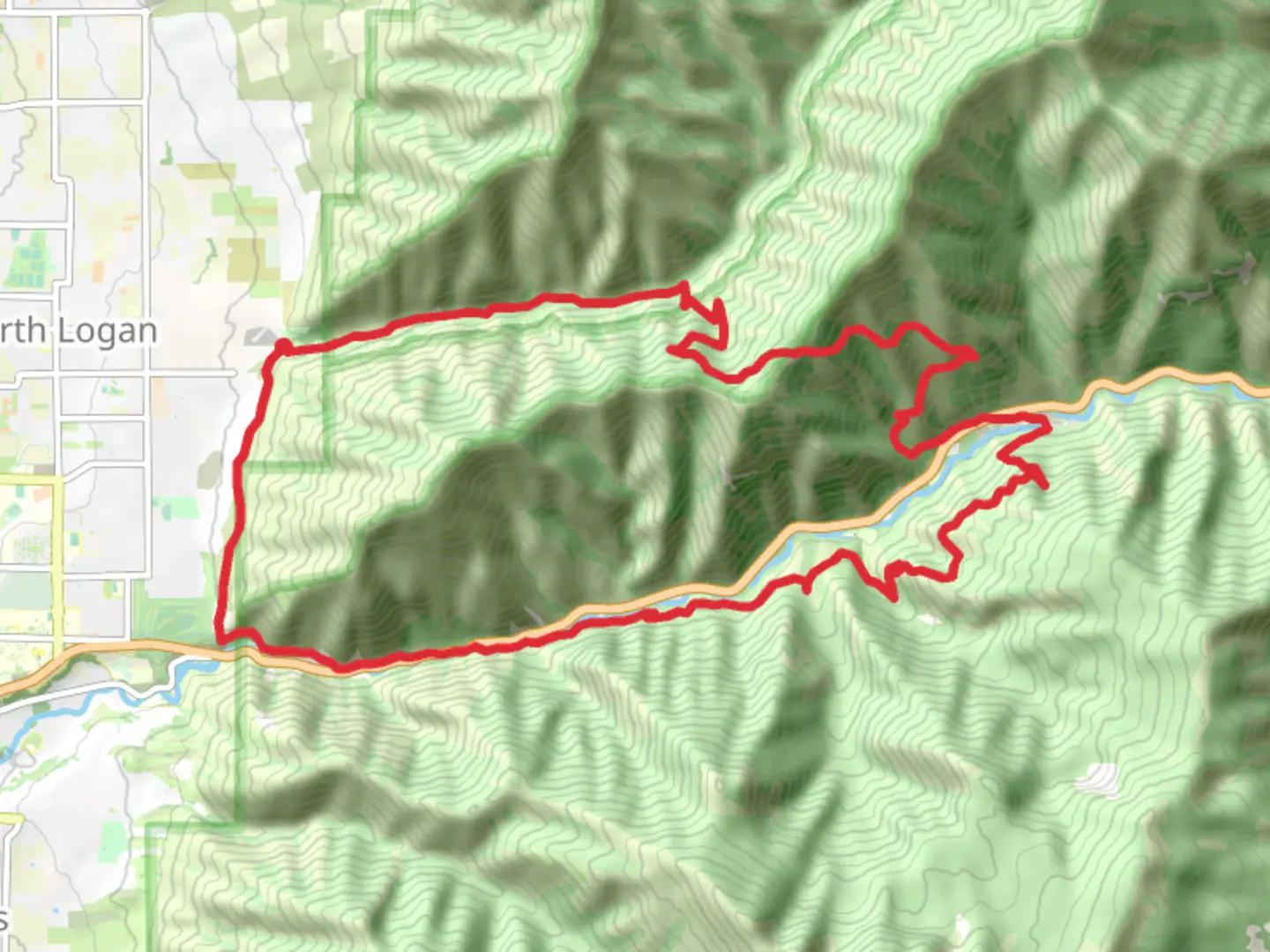
Starting near Cache County, Utah, this loop trail spans approximately 28 kilometers (17.4 miles) with an elevation gain of around 2000 meters (6562 feet). The trailhead is conveniently located near the Tony Grove Lake area, which is accessible by car. If you're using public transport, the nearest significant landmark is Logan, Utah, from where you can take a taxi or rideshare service to the trailhead.
Trail Overview
The Highline Trail, Crimson Trail, and Beirdneau Trail form a loop that offers a diverse hiking experience. The trail is rated as medium difficulty, making it suitable for hikers with some experience. The route takes you through a variety of landscapes, including dense forests, open meadows, and rugged mountain terrain.
Key Sections and Landmarks
Highline Trail
- Starting from the trailhead near Tony Grove Lake, the Highline Trail begins with a gradual ascent. The first 5 kilometers (3.1 miles) offer a steady climb, gaining approximately 300 meters (984 feet) in elevation. This section is characterized by lush forests and occasional clearings that provide stunning views of the surrounding mountains.
- As you continue, you'll reach a series of switchbacks that lead to the ridge. This part of the trail is more exposed, so be prepared for windier conditions. The ridge offers panoramic views of the Bear River Range and the Logan Canyon below.
Crimson Trail
- After about 10 kilometers (6.2 miles) on the Highline Trail, you'll transition to the Crimson Trail. This section is known for its vibrant red rock formations and steep cliffs. The trail here is narrower and more rugged, requiring careful footing.
- Approximately 5 kilometers (3.1 miles) into the Crimson Trail, you'll encounter the "China Wall," a prominent rock formation that resembles a fortress wall. This is a great spot for a break and some photos.
Beirdneau Trail
- The final section of the loop is the Beirdneau Trail, which begins after about 18 kilometers (11.2 miles) into your hike. This trail descends gradually through dense forests and meadows. The descent is more forgiving, allowing you to enjoy the serene surroundings.
- Around 23 kilometers (14.3 miles) into the hike, you'll come across Beirdneau Peak. While not the highest point on the trail, it offers a unique vantage point of the surrounding landscape.
Flora and Fauna
The trail is home to a diverse range of flora and fauna. In the lower elevations, you'll find a mix of coniferous and deciduous trees, including Douglas fir, aspen, and maple. As you ascend, the vegetation becomes sparser, with alpine meadows filled with wildflowers in the summer months.
Wildlife is abundant, with chances to spot mule deer, elk, and even the occasional black bear. Birdwatchers will enjoy sightings of various species, including hawks, eagles, and songbirds.
Historical Significance
The region has a rich history, with evidence of Native American habitation dating back thousands of years. The Bear River Range was also a significant area during the westward expansion of the United States, with early settlers and trappers traversing these mountains. The trails themselves have been used for centuries, initially by indigenous peoples and later by pioneers and explorers.
Navigation and Safety
Given the trail's length and elevation gain, it's crucial to be well-prepared. Ensure you have a reliable navigation tool like HiiKER to track your progress and stay on course. Weather conditions can change rapidly, especially at higher elevations, so pack accordingly with layers, rain gear, and plenty of water.
Getting There
To reach the trailhead, drive to Tony Grove Lake, located about 25 miles (40 kilometers) northeast of Logan, Utah. If you're relying on public transport, Logan is the nearest city with bus services. From Logan, you can arrange for a taxi or rideshare to take you to the trailhead. Parking is available at Tony Grove Lake, but it can fill up quickly during peak seasons, so plan to arrive early.

What to expect?
Activity types
Comments and Reviews
User comments, reviews and discussions about the Highline Trail, Crimson Trail and Beirdneau Trail, Utah.
4.33
average rating out of 5
15 rating(s)