
Download
3D Flyover
Add to list
More
12.9 km
~4 hrs 42 min
1276 m
Out and Back
“Embark on the 13 km Rattlesnake Canyon Trail for breathtaking views, diverse wildlife, and historic charm.”
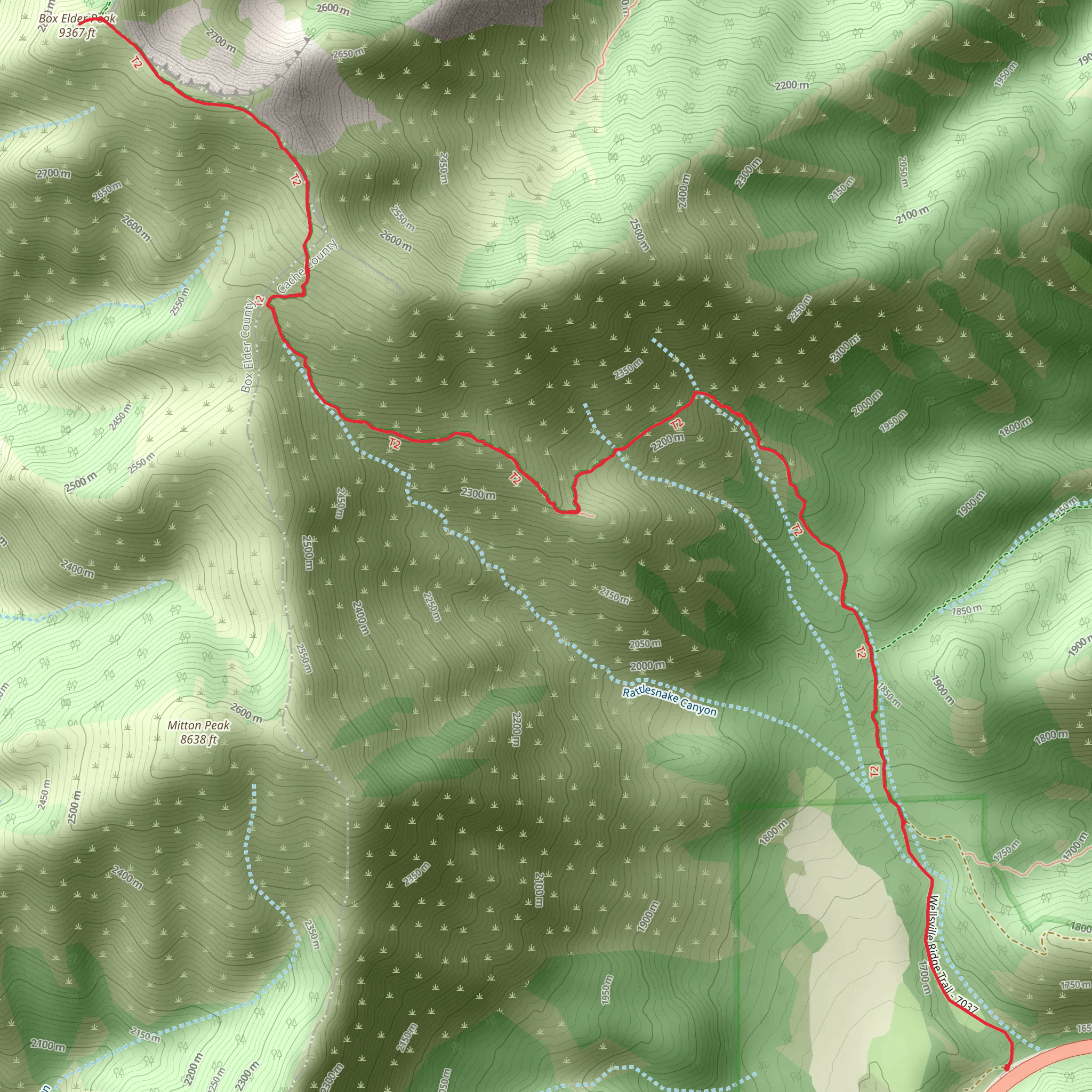
Starting your adventure near Cache County, Utah, the Box Elder Peak via Rattlesnake Canyon Trail is a captivating out-and-back hike that spans approximately 13 kilometers (8 miles) with an elevation gain of around 1200 meters (3937 feet). This trail is rated as medium difficulty, making it suitable for moderately experienced hikers.
Getting There
To reach the trailhead, you can drive or use public transportation. If driving, head towards the nearest significant landmark, which is the town of Logan, Utah. From Logan, take US-89 N and follow signs towards the Rattlesnake Canyon area. The trailhead is located near the end of Rattlesnake Canyon Road. For those using public transport, the Cache Valley Transit District (CVTD) offers bus services to Logan, from where you can arrange a taxi or rideshare to the trailhead.
Trail Overview
The trail begins with a gentle ascent through a lush forested area, offering a mix of pine and aspen trees. As you progress, the trail becomes steeper, and the terrain shifts to rocky outcrops and open meadows. At approximately 3 kilometers (1.9 miles) in, you'll encounter a small creek, which is a good spot to refill your water bottles if you have a filtration system.
Significant Landmarks and Nature
Around the 5-kilometer (3.1-mile) mark, you'll reach a scenic overlook that provides stunning views of the Cache Valley and the surrounding mountains. This is a great spot for a short break and some photography. Continuing on, the trail becomes more rugged and steep, with switchbacks that lead you up to the ridge.
Wildlife and Flora
The area is rich in wildlife, including deer, elk, and occasionally black bears. Birdwatchers will also enjoy spotting various species such as hawks, eagles, and songbirds. The flora is equally diverse, with wildflowers blooming in the spring and summer months, adding vibrant colors to the landscape.
Final Ascent
The final 2 kilometers (1.2 miles) to the summit of Box Elder Peak are the most challenging, with a steep incline and loose rocks. However, the effort is well worth it. Upon reaching the summit, you'll be rewarded with panoramic views of the Wasatch Range and the Great Salt Lake in the distance.
Historical Significance
The region around Box Elder Peak has historical significance dating back to the early settlers and Native American tribes who used these trails for hunting and trading. The area is also known for its geological features, including ancient rock formations that tell the story of the Earth's history.
Navigation
For navigation, it's highly recommended to use the HiiKER app, which provides detailed maps and real-time updates on trail conditions. This will ensure you stay on the right path and can safely enjoy your hike.
Prepare adequately with water, snacks, and appropriate gear, and always check the weather forecast before heading out. Happy hiking!
What to expect?
Activity types
Comments and Reviews
User comments, reviews and discussions about the Box Elder Peak via Rattlesnake Canyon Trail, Utah.
4.65
average rating out of 5
20 rating(s)
