Pontsticill Reservoir & Trig 617m - Upper Limits UK
Download
Preview
Add to list
More
15.7 km
~4 hrs 45 min
411 m
Loop
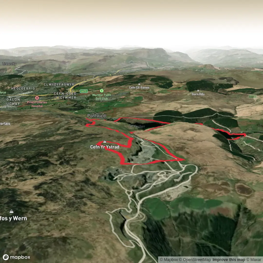
We started this one from the Car Park at Pontsticill reservoir. Its free but does not have any facilities.
From here we managed to pick up the fishermans path through the wood and along the bank of the reservoir heading generally North, though did need to pop out onto the road at the far end before crossing the bridge that splits Pontsticill from Pentwyn Reservoir.
After passing Dolygaer, we then picked up the bridleway alongside the railway line. Just after the sailing club we continued on the bridleway up through the woods and out onto the open access land to pick up the byway from Cwm Criban.
We followed this NE up to the Quarries. Althouh there are fantastic views from here, the ground doesnt allow you to see Talybont or Llangors Lake.
Next we took the path SE leading up to the first small pond and on to the corner of yhe boundary fence before heading south up onto the 617m Trig.
The views from here were stunning and all of the high peaks right across the whole of the Bannau Brycheiniog - Brecon Beacons - National Park could be seen. A great place for a spot of lunch.
After leaving the Trig we headed north to drop onto the 600m ring contour before beginning our descent in a south westerly direction to again meet the byway which we crossed to the byway down to the road.
Its now a road section back up over the dam and on to the car park. I may recce this section separately in the future to see if there is another fishermans path that leads back to the car park to avoid the road. Nevertheless this is a stunning route and one we will definitely do a variation on with the main group in the future.
Here is the route fly through: Pontsticill Reservoir & Cefn yr Ystrad Trig 617m! https://www.relive.com/view/vKv2dg9KZ46


Comments and Reviews
User comments, reviews and discussions about the Pontsticill Reservoir & Trig 617m - Upper Limits UK, Wales.
average rating out of 5
0 rating(s)