Download
3D Flyover
Add to list
More
Trail length
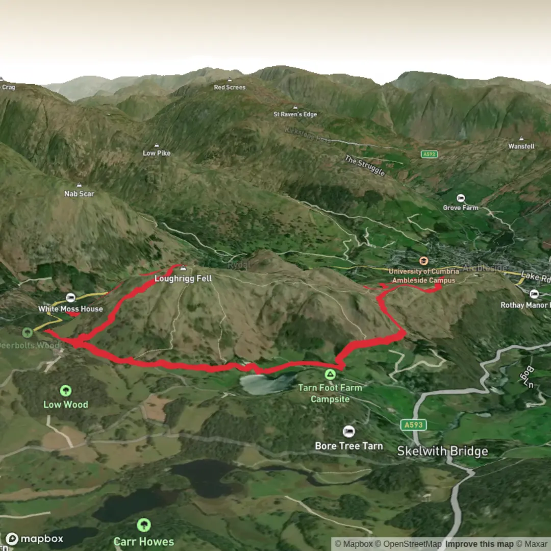
15.4 km
Time
~4 hrs 6 min
Elevation Gain
619 m
Hike Type
Loop
Challenging loop from Westmorland and Furness covering about 9.5 miles with roughly 2,060 ft of ascent and 2,220 ft of descent. Expect sustained climbs and steep sections that reward you with wide views over the surrounding fells and valleys. The route explores quieter paths away from crowds, returning close to the starting point. Best suited to experienced hikers with good fitness and proper gear.
Created by
Johnny71

What to expect?
waterfalls
kid-friendly
forest
wildflowers
dog-friendly
mountain-views
lakes
caves
Surfaces
Unknown
Asphalt
Compacted Gravel
Gravel
Grass
Unpaved
Ground
Dirt
Fine Gravel
Comments and Reviews
User comments, reviews and discussions about the Loughrigg from Ambleside, England.
5.0
average rating out of 5
1 rating(s)