Download
Preview
Add to list
More
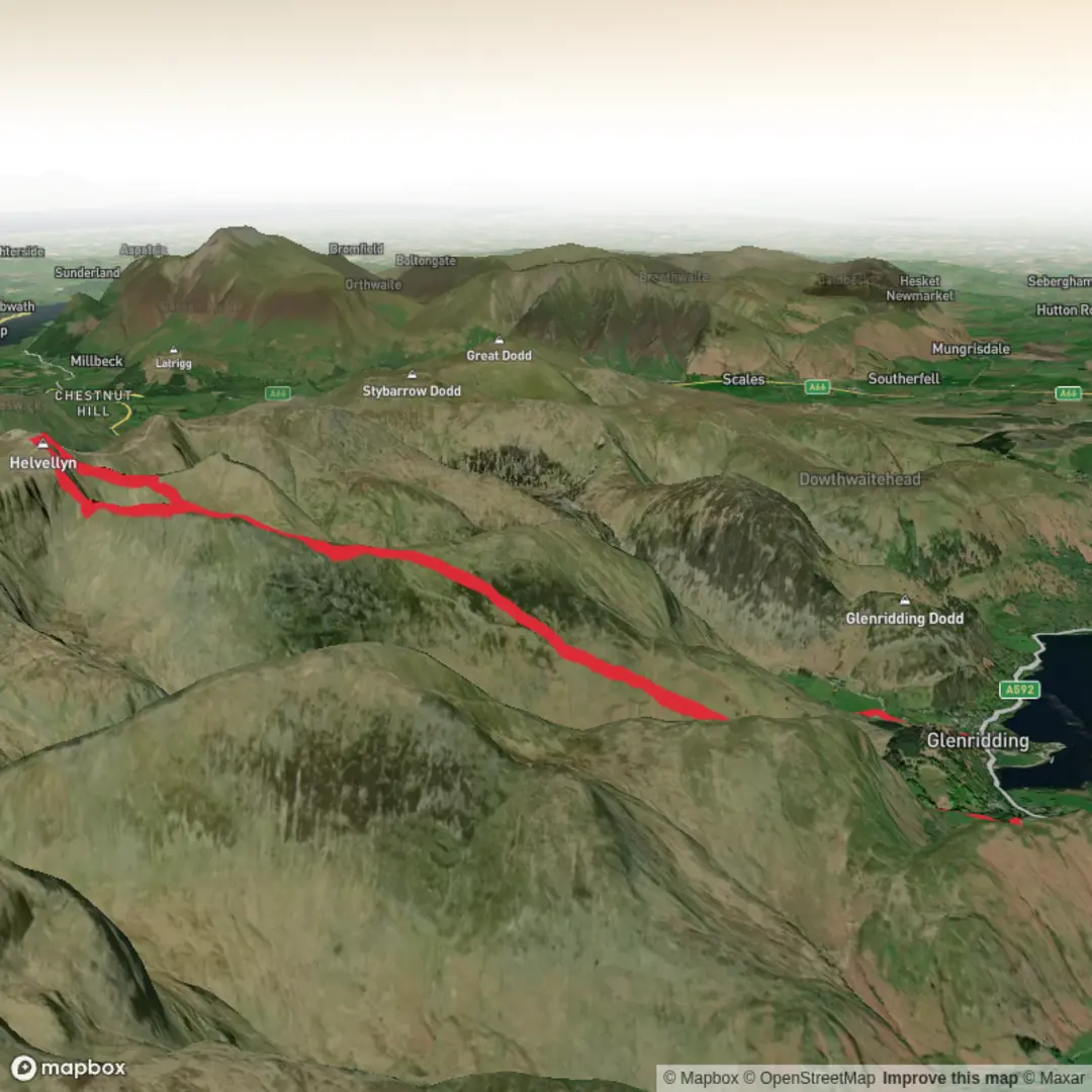
Trail length
12.3 km
Time
~3 hrs 53 min
Elevation Gain
854 m
Hike Type
Loop
Challenging 12.3 km route near 54.53587, -2.94436 with steep climbs and descents, gaining about 854 m and losing around 921 m over roughly 4 hours. The path explores rugged Cumbrian countryside with a mix of open fell and valley sections, offering wide views of surrounding hills. Expect uneven, sometimes boggy terrain and sustained gradients, making this suitable for fit, experienced hikers prepared for changing weather.

Created by
Anngoneill

Comments and Reviews
User comments, reviews and discussions about the Helvllyn ridge, England.
average rating out of 5
0 rating(s)