Download
3D Preview
Add to list
More
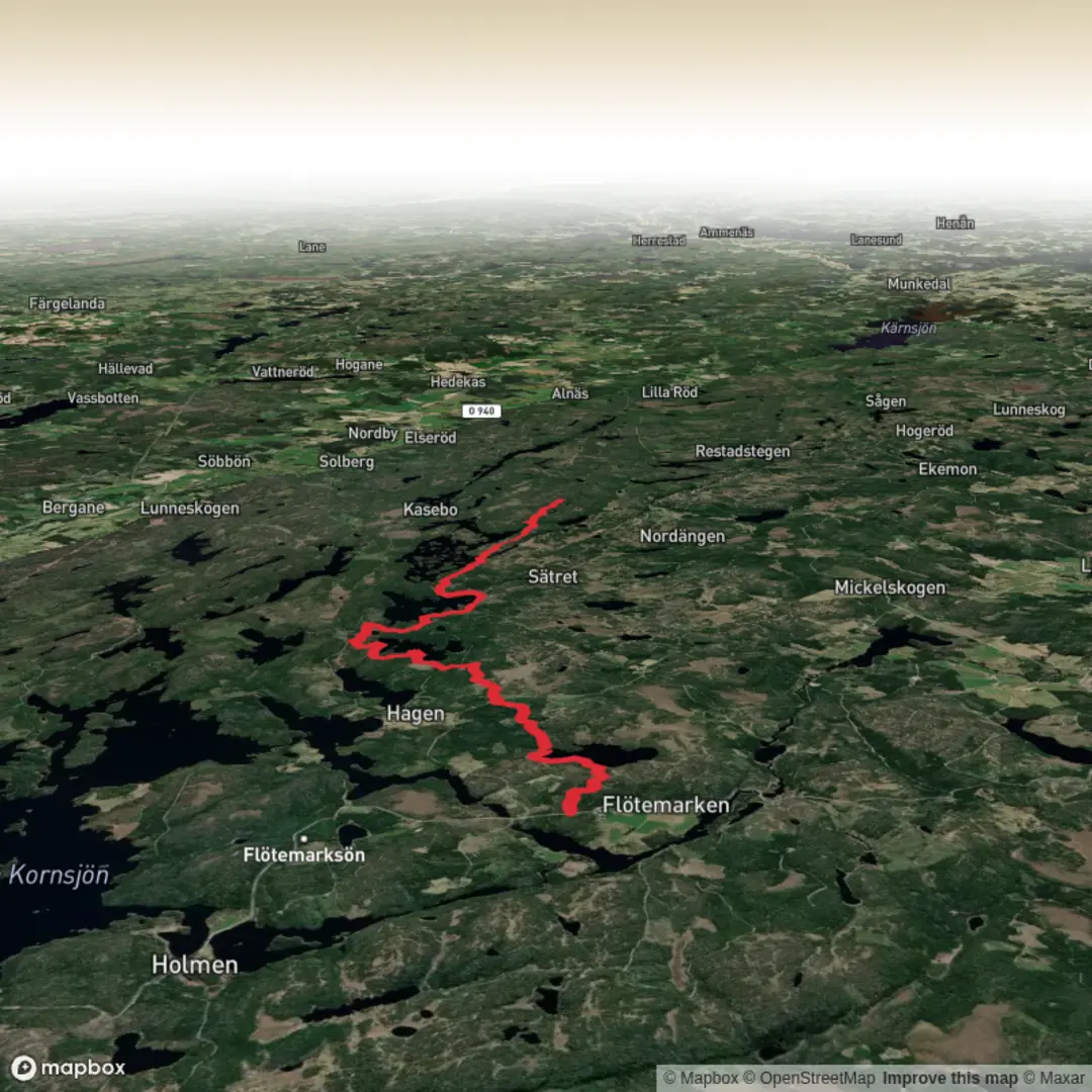
Trail length
12.6 km
Time
~2 hrs 47 min
Elevation Gain
157 m
Hike Type
Point-to-Point
This easy 12.6 km day hike runs for about 2 hours 50 minutes between coordinates near 58.79, 11.67 and 58.72, 11.71, likely following the Bohuslän coast of western Sweden. With gentle elevation gain of about 157 m and 166 m of descent, the route is mostly flat with a few mild slopes, suitable for most hikers. Expect coastal scenery, scattered forests, and open rock or farmland, making it a relaxed but rewarding outing.

Created by
Run Hike Sleep Repeat

What to expect?
lakes
forest
wildflowers
Surfaces
Ground
Compacted Gravel
Gravel
Unknown
Comments and Reviews
User comments, reviews and discussions about the Bohusleden Trail stage 8, Sweden.
average rating out of 5
0 rating(s)