Download
3D Preview
Add to list
More
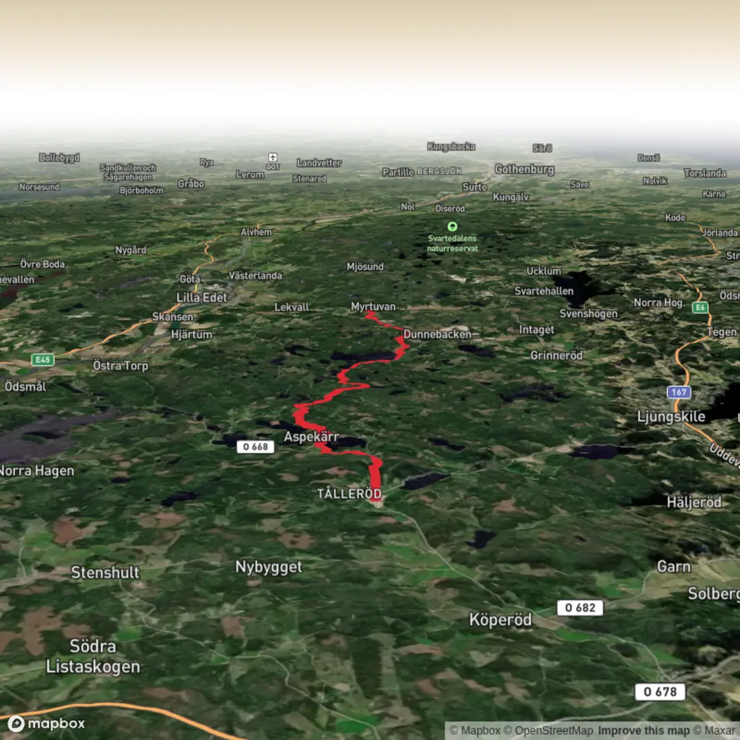
Trail length
19.2 km
Time
~4 hrs 22 min
Elevation Gain
324 m
Hike Type
Point-to-Point
An easy 19.2 km day hike in Västra Götalands län, starting near 58.272828, 12.00697 and ending at 58.148133, 12.038506. The route has gentle but steady climbs with about 326 m of elevation gain and 373 m of loss, offering varied scenery typical of West Sweden—mixed forest, open farmland, and scattered lakes or streams. Suitable for most hikers with basic fitness, it’s a longer outing but on generally manageable terrain.

Created by
Run Hike Sleep Repeat

Surfaces
Unknown
Ground
Gravel
Compacted Gravel
Asphalt
Comments and Reviews
User comments, reviews and discussions about the Bohusleden Trail stage 17, Sweden.
average rating out of 5
0 rating(s)