Download
3D Preview
Add to list
More
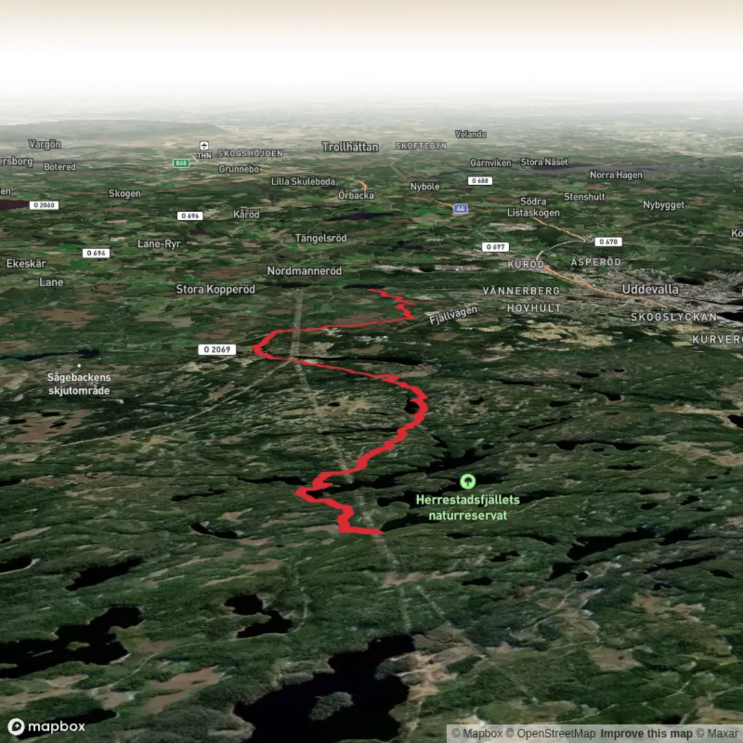
Trail length
13.1 km
Time
~2 hrs 46 min
Elevation Gain
88 m
Hike Type
Point-to-Point
This easy 13.1 km route in Västra Götaland County takes about 2¾ hours, starting near 58.426525, 11.844436 and ending at 58.384636, 11.967494. With roughly 93 m of elevation gain and 185 m of descent, it’s mostly gentle walking with a net downhill. Expect a relaxed countryside feel typical of coastal western Sweden, with varied forest and open landscapes ideal for casual hikers and those looking for a longer but not demanding outing.

Created by
Run Hike Sleep Repeat

What to expect?
lakes
scenic-views
mountain-views
Surfaces
Compacted Gravel
Dirt
Ground
Unknown
Gravel
Fine Gravel
Grass
Comments and Reviews
User comments, reviews and discussions about the Bohusleden Trail stage 14 Northbound, Sweden.
average rating out of 5
0 rating(s)