Download
3D Preview
Add to list
More
Trail length
14.9 km
Time
~3 hrs 24 min
Elevation Gain
258 m
Hike Type
Point-to-Point
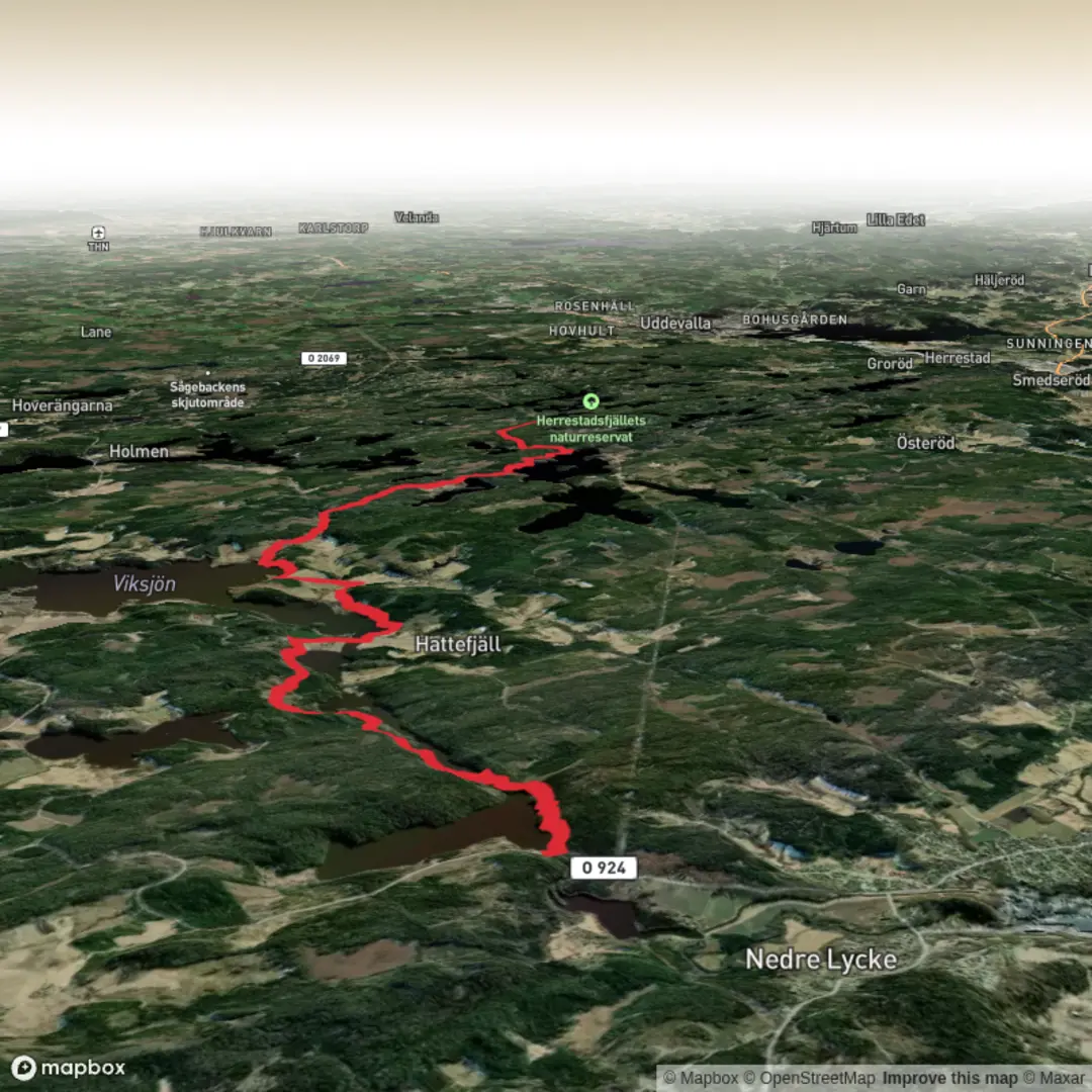
An easy 14.9 km point‑to‑point hike in Västra Götalands län, starting near 58.490801, 11.7237 and ending close to 58.426525, 11.844436. With about 259 m of elevation gain and 255 m of descent, it offers gentle hills and varied forest and countryside scenery. Plan around 3.5 hours of walking. Suitable for most hikers looking for a relaxed day trip with coastal province views and gradual climbs rather than challenging terrain.

Created by
Run Hike Sleep Repeat

What to expect?
lakes
mountain-views
forest
Surfaces
Ground
Gravel
Unknown
Compacted Gravel
Asphalt
Grass
Comments and Reviews
User comments, reviews and discussions about the Bohusleden Trail stage 13, Sweden.
average rating out of 5
0 rating(s)