Download
3D Preview
Add to list
More
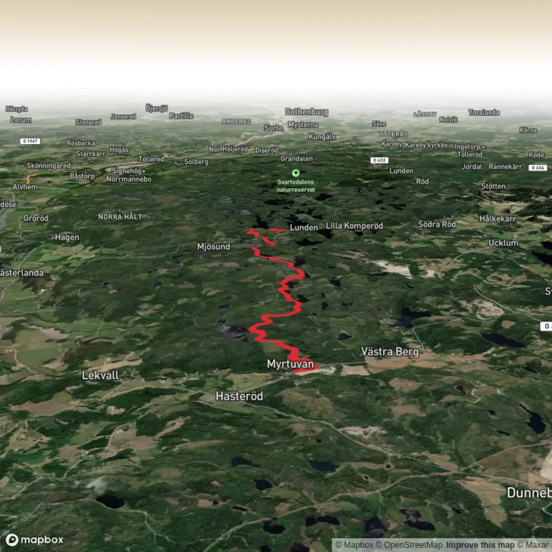
Trail length
11.9 km
Time
~2 hrs 43 min
Elevation Gain
204 m
Hike Type
Point-to-Point
This medium-difficulty day hike covers about 11.9 km in just under 3 hours, starting near 58.148133, 12.038506 and ending at 58.076028, 12.032154. With around 204 m of elevation gain and 232 m of loss, the route offers varied terrain and gentle ups and downs. It’s suitable for reasonably fit hikers looking for a longer outing, with enough elevation to keep it interesting without being too demanding.

Created by
Run Hike Sleep Repeat

What to expect?
lakes
Surfaces
Unknown
Ground
Asphalt
Unpaved
Comments and Reviews
User comments, reviews and discussions about the Bohusleden stage 18, Sweden.
average rating out of 5
0 rating(s)