Download
3D Preview
Add to list
More
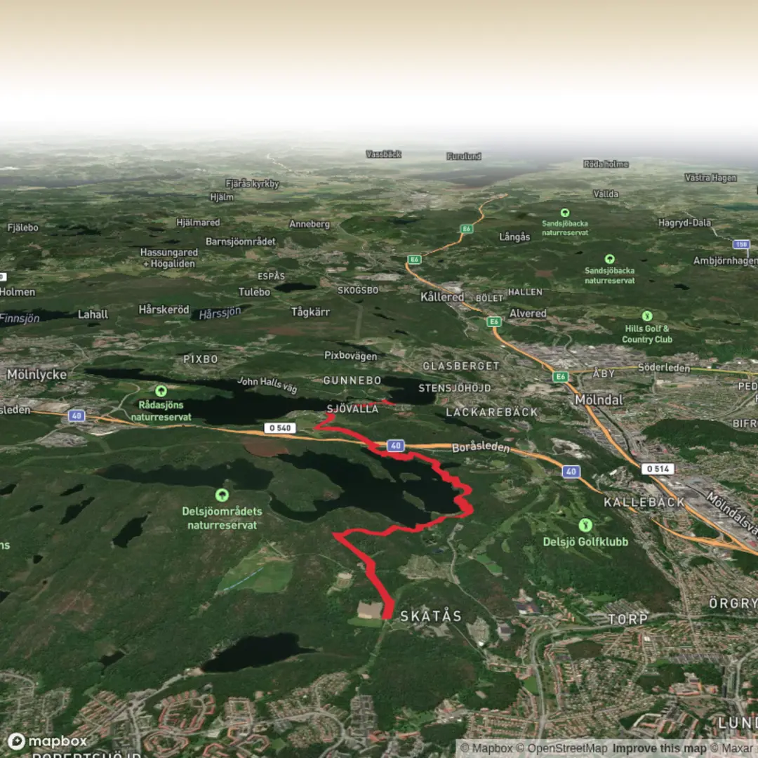
Trail length
6.9 km
Time
~1 hrs 36 min
Elevation Gain
131 m
Hike Type
Point-to-Point
This easy custom route covers about 6.9 km in roughly 1 hour 40 minutes, with gentle elevation changes of +133 m and −167 m. It starts near 57.703241, 12.039036 and finishes at 57.662525, 12.050315, making it a good point‑to‑point walk. The modest climbs and descents suit most hikers, offering a relaxed outing with time to enjoy local scenery, nearby residential areas, and patches of green typical of western Sweden.

Created by
Run Hike Sleep Repeat

Surfaces
Fine Gravel
Asphalt
Compacted Gravel
Unknown
Concrete
Ground
Unpaved
Cobblestone
Comments and Reviews
User comments, reviews and discussions about the bohusleden 26, Sweden.
average rating out of 5
0 rating(s)