Download
3D Flyover
Add to list
More
41.1 km
~2 days
339 m
Multi-Day
“Embark on the Good Water Loop, a 25.5-mile journey of lakeside splendor and rich Texas history, suited for seasoned hikers.”
The Good Water Loop is a scenic trail that encircles the Lake Georgetown and spans approximately 41 kilometers (25.5 miles), with an elevation gain of around 300 meters (984 feet). This loop trail is located near Williamson County, Texas, and is known for its beautiful lakeside views, rocky outcrops, and a variety of flora and fauna. The trail is rated as medium difficulty, making it accessible to hikers with some experience.
Getting to the Trailhead
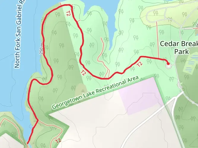
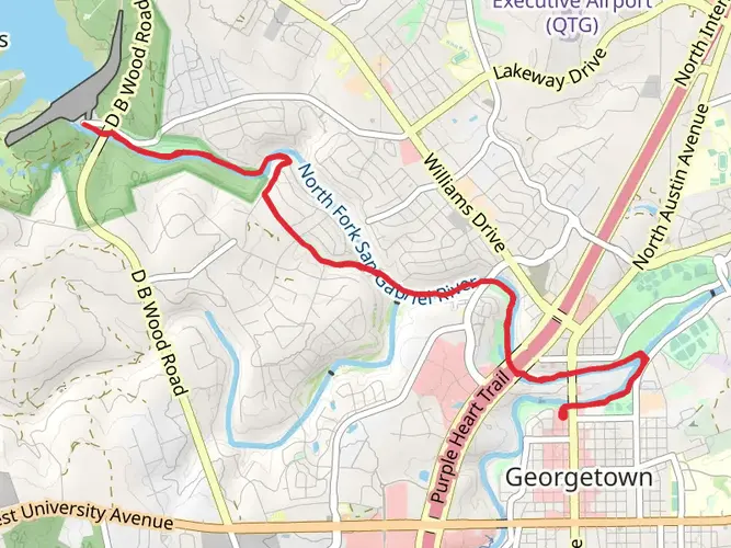
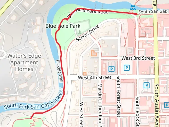
To reach the trailhead, you can drive to Cedar Breaks Park, which is one of the main access points. The park is situated off of DB Wood Road, just north of Georgetown. If you're using public transportation, you can take a bus to the nearest town, Georgetown, and then take a taxi or a ride-share service to Cedar Breaks Park.
Trail Experience
As you begin your hike from the Cedar Breaks Park trailhead, you'll be greeted with views of the serene Lake Georgetown. The trail meanders along the shoreline, offering continuous opportunities to enjoy the water vistas. The path is well-marked, but carrying a navigation tool like HiiKER can be helpful for staying on track and monitoring your progress.
Historical Significance
The region around Lake Georgetown has a rich history, with the lake itself being a reservoir on the San Gabriel River, created in 1979. The area was historically inhabited by Native American tribes, and later by European settlers who established the town of Georgetown.
Landmarks and Wildlife
Approximately 10 kilometers (6.2 miles) into the hike, you'll come across Crockett Gardens and Falls, an oasis with a spring-fed waterfall and the remnants of an old homestead. This is a great spot to rest and enjoy the natural beauty.
The trail continues to wind through cedar and oak forests, which are home to a variety of wildlife. Keep an eye out for white-tailed deer, armadillos, and numerous bird species, including the occasional bald eagle.
Terrain and Elevation
The terrain along the Good Water Loop is diverse, with rocky sections, open meadows, and forested areas. The elevation gain is gradual, but there are a few steep sections that will require some effort. The highest point of the trail offers panoramic views of the lake and the surrounding Texas Hill Country.
Preparing for the Hike
Before setting out, ensure you have enough water, as the Texas heat can be intense, especially in the summer months. There are a few primitive campsites along the trail if you plan to break the hike into a multi-day adventure. It's also advisable to wear sturdy hiking boots due to the rocky terrain.
Seasonal Considerations
The best times to hike the Good Water Loop are in the spring and fall when the temperatures are milder. Spring brings an abundance of wildflowers, while fall offers cooler weather and changing foliage. Summer hikes are possible but start early to avoid the midday heat.
Remember to check the weather forecast and trail conditions before your hike, as the trail can become muddy after heavy rains. Always practice Leave No Trace principles to preserve the beauty and integrity of the trail for future hikers.

What to expect?
Activity types
Frequently asked questions
How long does it take to hike the Good Water Loop around Lake Georgetown?
The Good Water Loop is 41.05 km, or about 25.5 miles, so most hikers treat it as a long full-day effort or an overnight trip. Strong day hikers often finish in 8 to 12 hours depending on pace, heat, and stops, while backpackers commonly split it into two days around Lake Georgetown.
Where can you park to start the Good Water Loop in Georgetown, Texas?
Common access points for the Good Water Loop include Cedar Breaks Park, Tejas Camp, Russell Park, Overlook Park, the Nature Center, and the Stilling Basin on Booty’s Road. Cedar Breaks Park is one of the main trailheads on the south side of Lake Georgetown, about 4 miles west of Georgetown, with direct access to the loop.
Is the Good Water Loop dog friendly, and are dogs allowed on the trail?
Dogs are allowed on the Good Water Loop, but park rules at Lake Georgetown require pets to be kept on a leash no longer than 6 feet. That makes the route workable for trail dogs used to rocky terrain and warm Central Texas conditions, especially on a 41 km loop with exposed sections around the lake.
Can you camp on the Good Water Loop, or is it only a day hike?
The Good Water Loop works for both day hiking and overnight trips. Lake Georgetown has primitive camping options connected to the trail, including sites at places such as Russell Park and Tejas Camp, and Russell Park is open year-round with primitive campsites plus nearby drinking water and flush toilets.
How hard is the Good Water Loop, and is it suitable for beginners?
The route covers 41.05 km with 339 m of elevation gain, so the climbing is moderate, but the overall distance makes it a substantial outing. It is best described as approachable for fit beginners when broken into an overnight trip, while a same-day loop is more demanding because of the mileage, rocky footing, and Texas heat.
What are the main landmarks and views on the Good Water Loop?
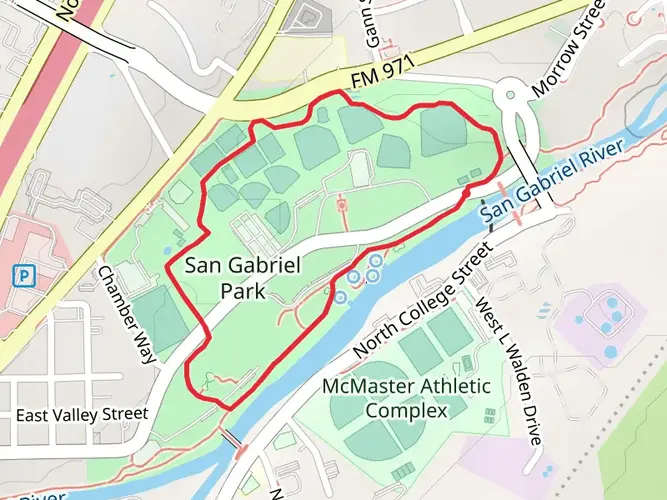
The Good Water Loop circles Lake Georgetown and follows the shoreline for much of the route, with repeated lake views, limestone bluffs, rocky outcrops, and stretches along the San Gabriel River corridor. Named access points and landmarks around the loop include Cedar Breaks Park, Jim Hogg Park, Russell Park, Tejas Camp, Overlook Park, and the dam area.
What is the best time of year to hike the Good Water Loop in Williamson County?
The best seasons for the Good Water Loop are generally fall through spring, when temperatures around Georgetown are more manageable for a 41 km hike. Summer is still possible, but exposed lakeside sections and Central Texas heat can make the loop much tougher, especially on a full circuit with limited shade in places.
Comments and Reviews
User comments, reviews and discussions about the Good Water Loop, Texas.
4.36
average rating out of 5
11 rating(s)