
Download
3D Flyover
Add to list
More
5.8 km
~1 hrs 28 min
197 m
Loop
“Explore diverse landscapes, wildlife, and historical ruins on the 6 km Joshua Creek Loop.”
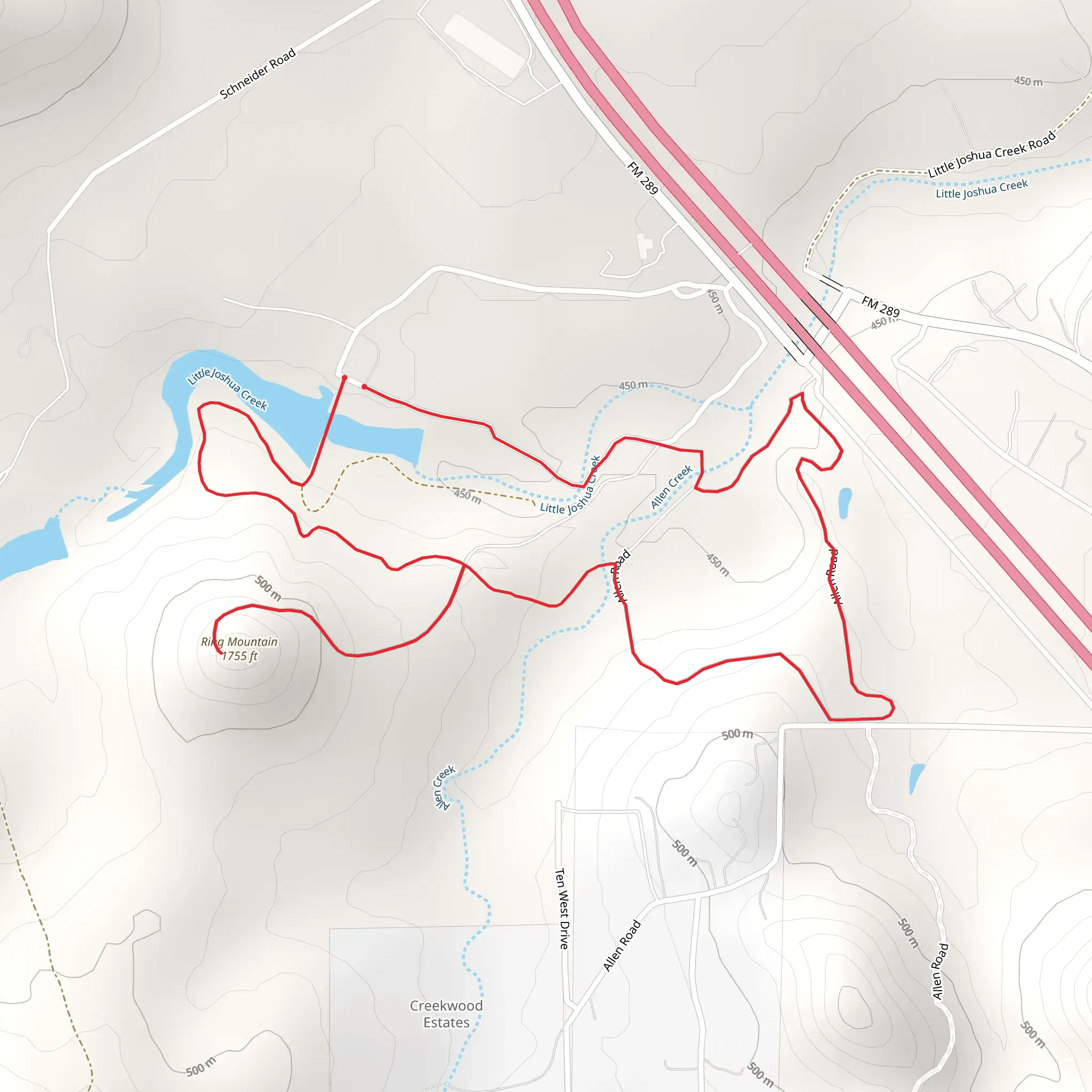
Starting near Kendall County, Texas, the Joshua Creek, Ragsdale, and Ring Mountain Loop is a 6 km (approximately 3.7 miles) loop trail with an elevation gain of around 100 meters (328 feet). This medium-difficulty trail offers a diverse hiking experience, blending natural beauty with historical significance.
Getting There
To reach the trailhead, you can drive or use public transport. If driving, head towards the nearest significant landmark, Joshua Springs Park and Preserve, located at 716 FM 289, Comfort, TX 78013. From there, follow the signs to the trailhead. For those using public transport, the nearest bus stop is in Comfort, Texas, from where you can take a taxi or rideshare service to the park.
Trail Overview
The loop begins with a gentle ascent, offering a gradual introduction to the terrain. The first section of the trail meanders through a mix of oak and juniper woodlands, providing ample shade and a serene atmosphere. Keep an eye out for local wildlife such as white-tailed deer, armadillos, and a variety of bird species, including the vibrant painted bunting.
Key Landmarks and Points of Interest
- Joshua Creek: About 1.5 km (0.9 miles) into the hike, you'll encounter Joshua Creek. This picturesque creek is a great spot for a short break. The clear, flowing water is home to small fish and amphibians, making it a delightful spot for nature observation.
- Ragsdale Homestead Ruins: Approximately 3 km (1.8 miles) into the loop, you'll come across the remnants of the Ragsdale Homestead. These ruins offer a glimpse into the area's history, dating back to the late 19th century. Interpretive signs provide information about the homestead's significance and the lives of its former inhabitants.
- Ring Mountain Summit: The trail's highest point, Ring Mountain, is reached around the 4.5 km (2.8 miles) mark. The summit offers panoramic views of the surrounding Texas Hill Country. The elevation gain here is about 100 meters (328 feet), making it a moderate climb. On clear days, you can see for miles, with vistas that include rolling hills and distant ranchlands.
Navigation and Safety
For navigation, it's recommended to use the HiiKER app, which provides detailed maps and real-time GPS tracking. The trail is well-marked, but having a reliable navigation tool ensures you stay on course.
Flora and Fauna
The trail is rich in native flora, including Texas bluebonnets in the spring and various wildflowers throughout the year. The diverse plant life supports a healthy ecosystem, attracting butterflies, bees, and other pollinators.
Historical Significance
The area around Kendall County has a rich history, with Native American tribes such as the Comanche and Lipan Apache originally inhabiting the region. The Ragsdale Homestead is a testament to the early European settlers who farmed and ranched in the area. Exploring these ruins provides a tangible connection to the past and an appreciation for the resilience of early pioneers.
Final Stretch
The final section of the loop descends gently back towards the trailhead, passing through open meadows and offering one last chance to spot wildlife. The trail concludes back at Joshua Springs Park and Preserve, where you can relax and enjoy the park's amenities, including picnic areas and restrooms.
This trail offers a well-rounded hiking experience, combining natural beauty, wildlife, and historical intrigue, making it a rewarding adventure for hikers of all levels.
What to expect?
Activity types
Comments and Reviews
User comments, reviews and discussions about the Joshua Creek, Ragsdale and Ring Mountain Loop, Texas.
4.35
average rating out of 5
23 rating(s)
