Download
3D Flyover
Add to list
More
208.1 km
~7 days
193 m
Multi-Day
“Embark on a scenic journey through rural Texas, exploring history and nature on the Northeast Texas Trail.”
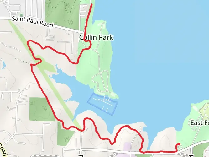
Spanning approximately 130 miles (208 kilometers) and with a minimal elevation gain of around 328 feet (100 meters), the Northeast Texas Trail is a unique point-to-point route that offers a diverse experience for hikers, cyclists, and nature enthusiasts. The trail begins near the vicinity of Farmersville in Collin County, Texas, and stretches all the way to New Boston, Bowie County.
Getting to the Trailhead
To reach the starting point of the Northeast Texas Trail, hikers can drive to Farmersville, which is accessible via Highway 380 if coming from the Dallas area. For those relying on public transportation, options may be limited due to the rural nature of the trail's endpoints, but regional bus services or shuttles might be available to the nearby towns from where you can arrange a taxi or a ride-share to the trailhead.
Trail Experience
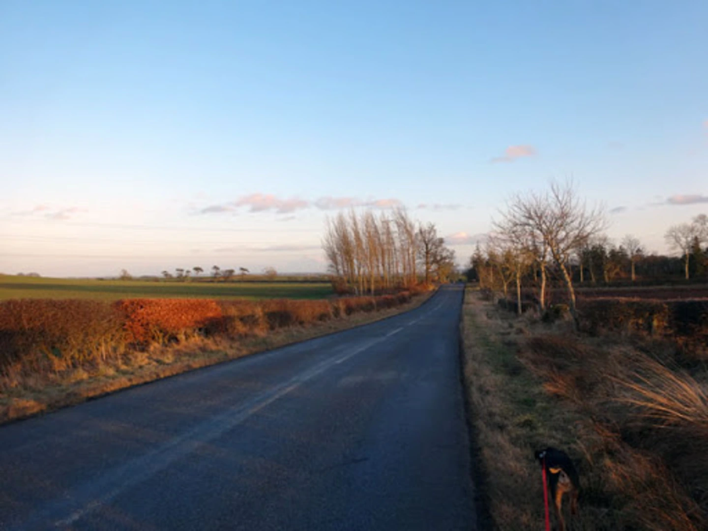
The trail itself is a repurposed railway, part of the Rails-to-Trails Conservancy project, which means the path is relatively flat and wide, making it suitable for a variety of users. The surface varies from asphalt to crushed stone and natural earth, with some sections potentially muddy after rain.
As you embark on your journey, you'll traverse through a mix of landscapes including farmland, prairies, and woodlands. The trail is rich in biodiversity, and it's not uncommon to spot white-tailed deer, armadillos, and a variety of bird species, including hawks and songbirds.
Cultural and Historical Significance
The Northeast Texas Trail passes through several small towns and communities, each with its own unique charm and history. The trail itself is a monument to the region's past, following the former rail lines that once connected these rural areas. Along the way, you'll encounter remnants of the railroad era, including old depots and railroad bridges that have been repurposed for trail use.
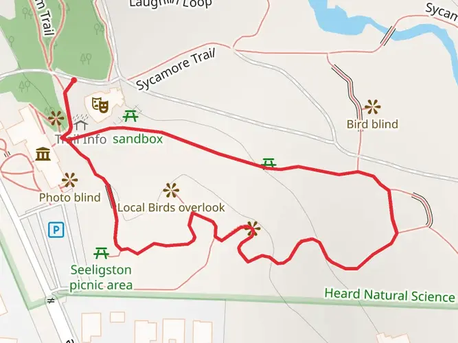
Landmarks and Points of Interest
One of the notable landmarks along the trail is the historic Onion Shed in Farmersville, which is a symbol of the town's agricultural heritage. As you continue, the trail takes you through the quaint town of Paris, Texas, where you can find the Eiffel Tower replica adorned with a cowboy hat, a whimsical nod to the city's namesake.
Navigation and Planning
For navigation along the Northeast Texas Trail, HiiKER is an excellent resource for trail maps and planning your hike. It's advisable to download the trail map on your device for offline use, as some sections of the trail may have limited cell phone reception.
Preparation and Safety
Given the trail's length, it's important to plan for multiple days of hiking if you intend to complete the entire route. Ensure you have adequate water and provisions, as services along the trail can be sparse. It's also wise to check the weather forecast and trail conditions before setting out, especially after heavy rains that could affect trail surfaces.
Accommodations and Amenities
For those looking to extend their hike over several days, camping options are available, and some towns along the route offer lodging and dining. It's recommended to research and book accommodations in advance, particularly during peak seasons or local events.
Environmental Considerations
Hikers are encouraged to practice Leave No Trace principles to preserve the trail's natural beauty and minimize their impact on the environment. This includes packing out all trash, respecting wildlife, and staying on designated paths to protect the surrounding habitats.
Whether you're looking for a multi-day adventure or a leisurely day hike, the Northeast Texas Trail offers a unique glimpse into the heart of rural Texas, its communities, and the natural splendor of the region.

What to expect?
Activity types
Frequently asked questions
How long does it take to hike the Northeast Texas Trail end to end?
The Northeast Texas Trail is 208.07 km, or about 130 miles, from the Farmersville area to New Boston. Because the grade is very gentle and total elevation gain is only about 193 m, strong multi-day hikers often break it into roughly 6 to 10 days, depending on daily mileage, weather, and surface conditions.
Where do you park to start the Northeast Texas Trail in Farmersville?
A main starting point for the Northeast Texas Trail in Farmersville is the Audie Murphy Trailhead at Hill and Main near the Onion Shed area. Official parking information also lists day parking at the J. W. Spain Athletic Sports Complex, with the Farmersville trailhead marked as mile 0 on the route.
Is the Northeast Texas Trail dog friendly for hikers?
The Northeast Texas Trail allows dogs, but they must be on a leash no longer than 10 feet. Trail rules also require pet waste to be picked up and disposed of, so it is a dog-friendly route as long as those rules are followed.
Can you camp on the Northeast Texas Trail during a multi-day hike?
Camping is not allowed just anywhere on the Northeast Texas Trail corridor. Trail rules permit camping only in designated camping areas, so overnight plans need to be built around approved campsites and nearby towns along the 130-mile route.
What is the terrain like on the Northeast Texas Trail?
The Northeast Texas Trail is a rail-trail, so the route is mostly flat and easy by Texas long-distance standards, with only about 193 m of total climbing over 208.07 km. Surfaces vary by section and can include crushed stone, dirt, and some improved town segments, with muddy patches possible after rain.
Which towns does the Northeast Texas Trail pass through?
The Northeast Texas Trail runs across northeast Texas from Farmersville to New Boston and is commonly divided into sections between towns including Merit, Celeste, Wolfe City, Ladonia, Pecan Gap, Ben Franklin, Roxton, Paris, Reno, Blossom, Detroit, Clarksville, Annona, Avery, and DeKalb. That makes it practical to plan shorter day hikes or resupply-focused multi-day trips.
Is the Northeast Texas Trail suitable for beginner long-distance hikers?
Yes. The Northeast Texas Trail is rated easy, and its railroad heritage keeps grades mild for most of the 208.07 km route. The main challenge is not steep climbing but the sheer distance, exposure, and changing surface conditions across a long point-to-point trail.
Comments and Reviews
User comments, reviews and discussions about the Northeast Texas Trail, Texas.
4.86
average rating out of 5
14 rating(s)