Download
3D Flyover
Add to list
More
10.1 km
~2 hrs 32 min
305 m
Loop
“Explore the scenic Black Oak Ridge Trail in Tennessee with its moderate hike and rich history.”
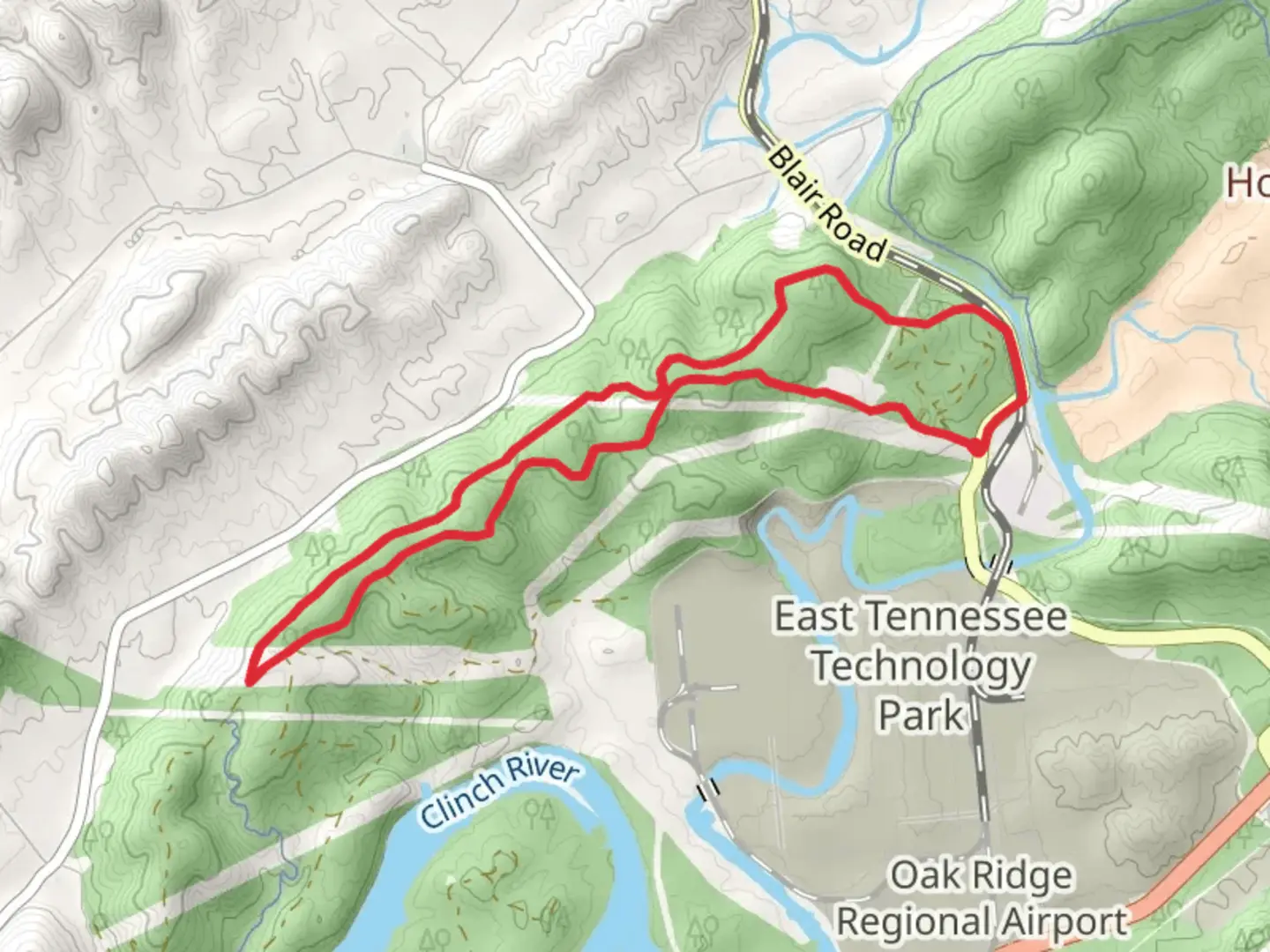
Starting near Roane County, Tennessee, the Black Oak Ridge Conservation Easement Walk is a loop trail that spans approximately 10 kilometers (6.2 miles) with an elevation gain of around 300 meters (984 feet). This trail is rated as medium difficulty, making it suitable for moderately experienced hikers.
Getting There
To reach the trailhead, you can drive or use public transportation. If driving, head towards Roane County, Tennessee, and look for signs directing you to the Black Oak Ridge Conservation Easement area. The nearest significant landmark is the Oak Ridge National Laboratory, located at 1 Bethel Valley Rd, Oak Ridge, TN 37830. For those using public transport, the closest major bus stop is in Oak Ridge, from where you can take a taxi or rideshare service to the trailhead.
Trail Navigation
For navigation, it's highly recommended to use the HiiKER app, which provides detailed maps and real-time updates. The trail is well-marked, but having a reliable navigation tool will enhance your experience and ensure you stay on track.
Trail Highlights
The trail begins with a gentle ascent through a mixed hardwood forest, featuring a variety of oak species, including the trail's namesake, the Black Oak. At around the 2-kilometer (1.2-mile) mark, you'll encounter a small creek that you can cross via a wooden footbridge. This area is particularly scenic in the spring when wildflowers like trilliums and violets are in bloom.
Wildlife and Nature
As you continue, keep an eye out for local wildlife. White-tailed deer are commonly seen, and birdwatchers will appreciate the variety of species, including woodpeckers, owls, and songbirds. The trail also passes through several meadows, which are excellent spots for observing butterflies and other pollinators.
Historical Significance
The region has a rich history, particularly related to the Manhattan Project during World War II. The nearby Oak Ridge National Laboratory was a key site for the development of nuclear technology. While the trail itself doesn't pass through any historical sites, the surrounding area is steeped in history, adding an extra layer of interest to your hike.
Midpoint and Elevation Gain
Around the 5-kilometer (3.1-mile) mark, you'll reach the highest point of the trail, offering panoramic views of the surrounding landscape. This is a great spot to take a break and enjoy a snack while taking in the scenery. The elevation gain to this point is approximately 150 meters (492 feet), making it a moderate climb.
Return Loop
The descent begins gradually, winding through more dense forest and eventually leading you back to the starting point. The final 2 kilometers (1.2 miles) are relatively flat, allowing for a leisurely end to your hike.
Practical Tips
- Wear sturdy hiking boots, as the trail can be rocky and uneven in places.
- Bring plenty of water, especially during the warmer months.
- Check the weather forecast before you go, as the trail can become slippery after rain.
- Use the HiiKER app for real-time navigation and updates.
This trail offers a balanced mix of natural beauty, moderate physical challenge, and historical context, making it a rewarding experience for those who undertake it.

What to expect?
Activity types
Comments and Reviews
User comments, reviews and discussions about the Black Oak Ridge Conservation Easement Walk, Tennessee.
4.64
average rating out of 5
28 rating(s)