
Download
3D Flyover
Add to list
More
9.3 km
~2 hrs 6 min
142 m
Loop
“A gentle woodland wander with a dramatic waterfall, sandstone arch, and just enough slippery spice.”
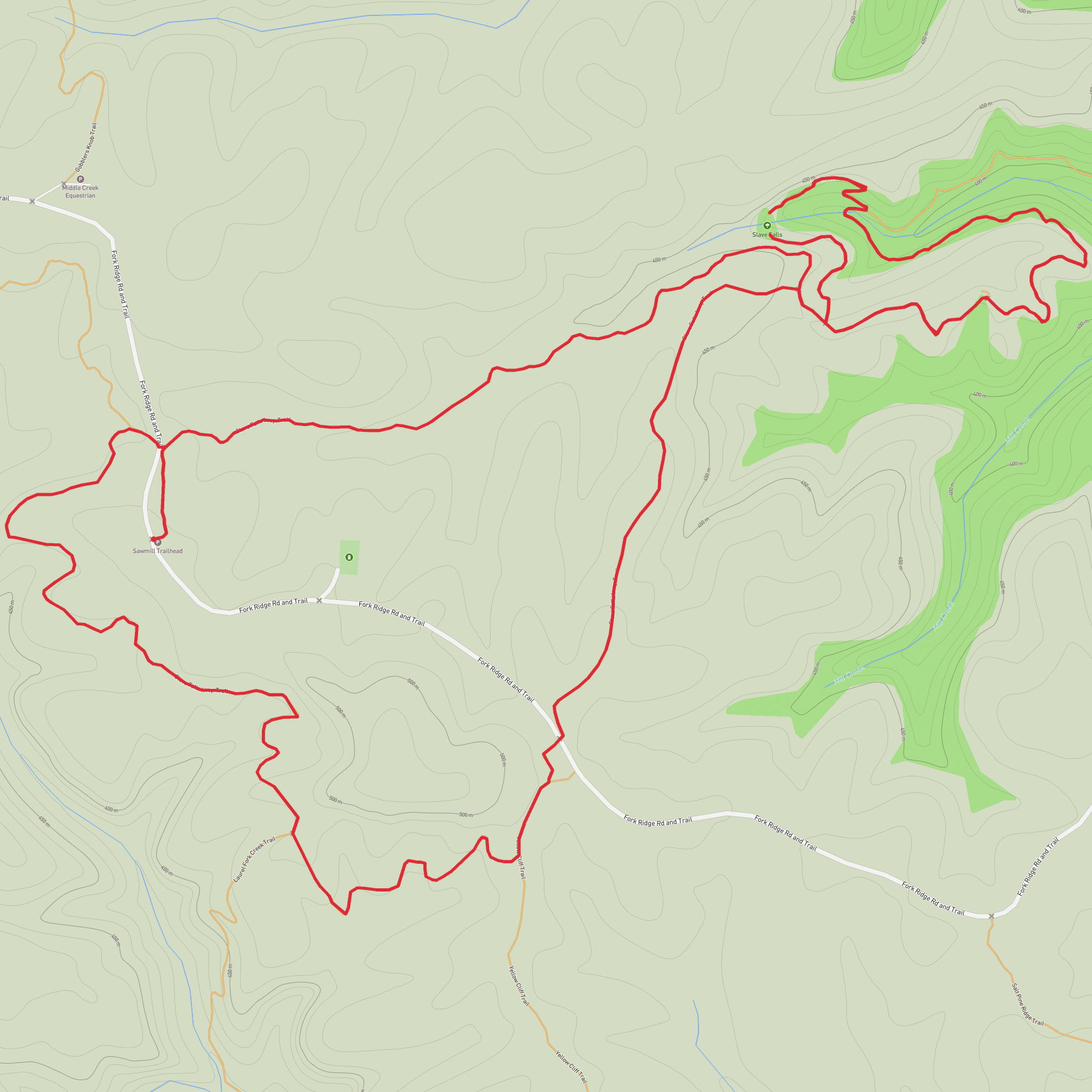
This easy loop in Big South Fork National River & Recreation Area packs a lot into roughly 9 km / 5.6 miles, though many hikers also complete a shorter version from Sawmill Trailhead at about 5.1 km / 3.2 miles round trip. The route is best known for two standout features: Slave Falls, a tall plunge waterfall dropping beside a huge rock shelter, and Needle Arch, a narrow sandstone opening perched along the gorge edge. The terrain is generally gentle by plateau standards, with only around 100 m / 330 ft of elevation gain overall, but there are still short ups and downs, roots, rock, and potentially slick sections after rain. The hike is usually rated easy because the grades are modest and the landmarks come quickly, but wet leaves, muddy patches, and uneven footing can make it feel a little more demanding than the numbers suggest. (npshistory.com)
The hike starts near Sawmill Trailhead on Fork Ridge Road, off Divide Road near Sharp Place in Pickett County, Tennessee, within Big South Fork National River & Recreation Area. That is the clearest significant landmark for navigation and trip planning, and it is the recognized access point for both Slave Falls and Needle Arch. From the parking area, a short connector leads to the Slave Falls Loop Trail. If you are driving, the usual approach is from TN 154 / Pickett Park Highway near Sharp Place, then onto Divide Road and Fork Ridge Road to the Sawmill parking area. Parking is generally straightforward, but services at the trailhead are limited, so it is wise to arrive with water, snacks, and a downloaded route in HiiKER. (nps.gov)
Public transport is extremely limited here. There is no practical regular transit service to the trailhead itself, so most hikers should plan on arriving by private car. The nearest communities commonly used as staging points are Jamestown, Tennessee and Oneida, Tennessee, but from either town you should expect to drive the final stretch on rural roads into the park. (nps.gov)
What the route is like
From Sawmill Trailhead, the opening section is easy to follow and mostly wooded, with the path moving through classic Cumberland Plateau forest. The walking is pleasant and shaded, and the trail wastes little time before introducing the area’s defining geology: sandstone bluffs, overhangs, and deeply cut hollows. If you are doing the shorter out-and-back variation, the main landmarks come within the first 1.6 to 2 km / 1 to 1.2 miles. If you continue the broader loop, the mileage stretches closer to your stated 9 km / 5.6 miles and adds more forest walking and additional rockhouse scenery. (backyardknoxville.com)
Slave Falls is the emotional centerpiece of the hike. The waterfall is commonly described at around 18 to 24 m / 60 to 80 ft high depending on source and flow conditions, and it spills beside or in front of a very large rock shelter that gives the area a dramatic amphitheater feel. In wetter periods, the falls are much more impressive; in dry spells, the flow can be reduced, but the setting remains striking because of the cliffline and shelter. The trail passes behind or beside the falls area under the shelter, which is one of the most memorable parts of the walk. Expect damp ground, spray, and slick rock nearby. (nps.gov)
A short spur leads to Needle Arch, which is smaller than the waterfall but geologically just as interesting. It is a slender sandstone arch formed by erosion in the resistant caprock of the plateau. This is the kind of feature that rewards slowing down: the opening itself is narrow, but the surrounding cliff edge, weathered stone, and forest backdrop make it feel more substantial than a quick glance suggests. Because arches in this region often sit near drop-offs
Surfaces
Dirt
Unknown
Ground
Comments and Reviews
User comments, reviews and discussions about the Slave Falls and Needle Arch via Slave Falls Loop Trail, Tennessee.
average rating out of 5
0 rating(s)
