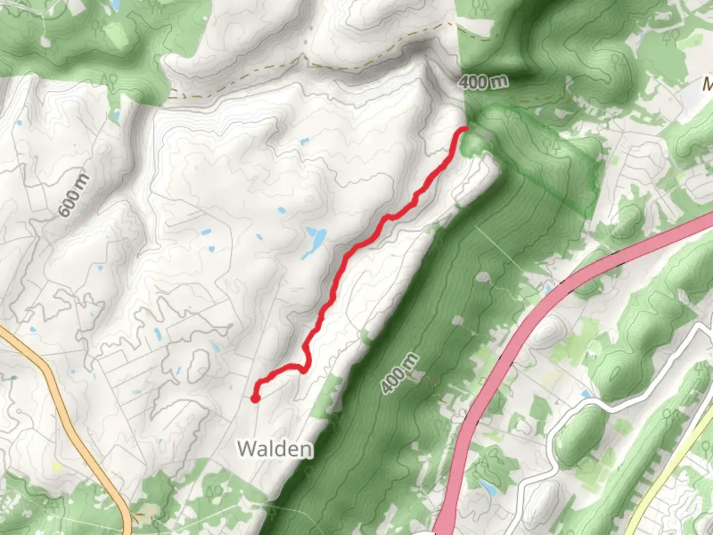
Little Falling Water Creek and Mabbit Springs - Falling Water Connector
Download
Preview
Add to list
More
7.0 km
~1 hrs 49 min
253 m
Out and Back
“Explore a scenic 7 km trail near Hamilton County, featuring waterfalls, wildlife, and historical significance.”
Starting near Hamilton County, Tennessee, this 7 km (approximately 4.3 miles) out-and-back trail offers a moderate challenge with an elevation gain of around 200 meters (656 feet). The trailhead is conveniently accessible by car, with parking available nearby. For those relying on public transport, the closest significant landmark is the Signal Mountain area, from where you can take a short taxi or rideshare to the trailhead.
Trail Overview
The trail begins with a gentle ascent through a lush forest, characterized by a mix of hardwoods and pines. Early on, you'll encounter Little Falling Water Creek, a serene waterway that meanders through the landscape. The sound of flowing water accompanies you for the first kilometer (0.6 miles), providing a tranquil start to your hike.
Key Landmarks and Features
Little Falling Water Creek
At approximately 1.5 km (0.9 miles) into the hike, you'll reach a picturesque spot along Little Falling Water Creek. Here, the creek cascades over a series of small rocks, creating a series of gentle waterfalls. This is an excellent spot for a short break and some photography.
Mabbit Springs
Continuing along the trail, you'll come across Mabbit Springs around the 3 km (1.9 miles) mark. The springs are a natural water source, and the area is often frequented by local wildlife, including deer and various bird species. The clear, cool water is a refreshing sight and a good place to refill water bottles if you have a filtration system.
Elevation and Terrain
The trail's elevation gain is gradual but steady. The first half of the trail features a mix of dirt paths and rocky sections, requiring sturdy footwear. As you approach the 4 km (2.5 miles) point, the trail becomes steeper, leading up to the Falling Water Connector. This section offers a more challenging climb but rewards hikers with stunning views of the surrounding landscape.
Historical Significance
The region around Hamilton County has a rich history, with Native American tribes such as the Cherokee having inhabited the area for centuries. The trail itself passes through lands that were once part of their hunting grounds. Additionally, the area played a role during the Civil War, with several skirmishes occurring nearby. Hikers may notice remnants of old trails and pathways that date back to these historical periods.
Navigation and Safety
For navigation, it's recommended to use the HiiKER app, which provides detailed maps and real-time updates. The trail is well-marked, but having a reliable navigation tool ensures you stay on course, especially in the more remote sections.
Wildlife and Flora
The trail is home to a diverse range of flora and fauna. In the spring and summer months, wildflowers such as trillium and lady's slipper orchids bloom along the path. Birdwatchers will enjoy spotting species like the Eastern Bluebird and Red-tailed Hawk. Be mindful of local wildlife, including snakes and black bears, and always follow Leave No Trace principles to preserve the natural beauty of the area.
Getting There
If driving, head towards Signal Mountain, Tennessee, and follow local signage to the trailhead. For those using public transport, the nearest bus stop is in Signal Mountain, from where a short taxi or rideshare will get you to the start of the trail. Ensure you have all necessary supplies, including water, snacks, and appropriate clothing, before setting out.
This trail offers a blend of natural beauty, moderate physical challenge, and historical intrigue, making it a rewarding experience for hikers of all levels.

What to expect?
Activity types
Comments and Reviews
User comments, reviews and discussions about the Little Falling Water Creek and Mabbit Springs - Falling Water Connector, Tennessee.
4.54
average rating out of 5
35 rating(s)