
Download
3D Flyover
Add to list
More
42.1 km
~2 days
1585 m
Loop
“Explore the Boyd Branch, Savage Creek, and Collins River Loop for a scenic and historical hiking adventure.”
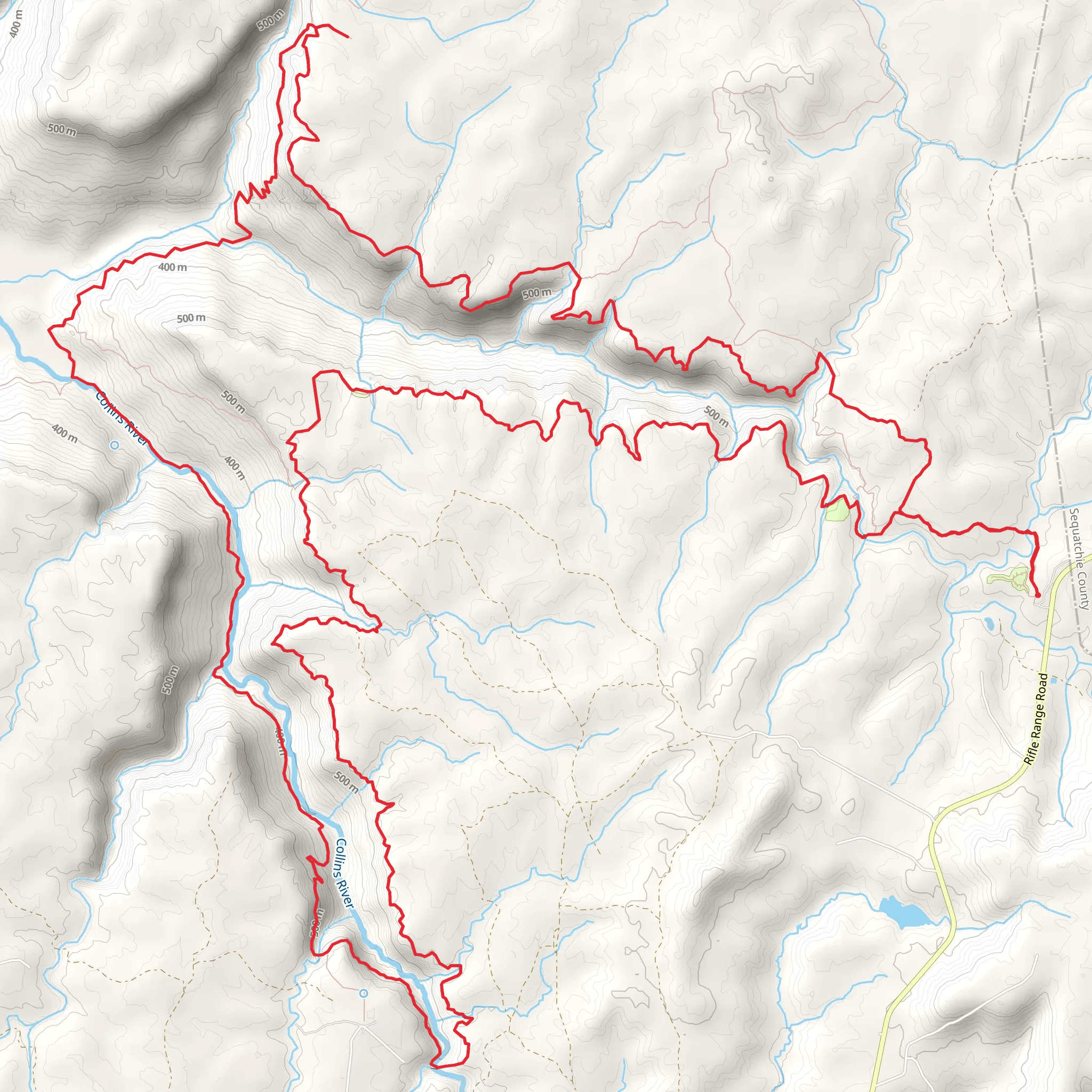
Nestled in the heart of Grundy County, Tennessee, the Boyd Branch, Savage Creek, and Collins River Loop offers an invigorating hiking experience with a blend of natural beauty and historical intrigue. This 42 km (approximately 26 miles) loop trail features an elevation gain of around 1500 meters (about 4921 feet), making it a moderately challenging adventure for hikers.
Getting There
To reach the trailhead, head towards Grundy County, Tennessee. If you're driving, you can park near the Savage Gulf State Natural Area, which is a well-known landmark in the region. For those relying on public transport, the nearest major city is Chattanooga, from where you can take a bus or arrange a shuttle service to the trailhead area. Ensure you check the latest schedules and availability for public transport options.
Trail Highlights
Boyd Branch
Starting your journey, the Boyd Branch section of the trail introduces you to the lush, dense forests typical of the Cumberland Plateau. As you traverse this part, expect to encounter a variety of hardwood trees, including oak and hickory, which provide a vibrant canopy overhead. This section is relatively gentle, allowing you to ease into the hike while enjoying the serene sounds of the forest.
Savage Creek
As you progress, the trail leads you to Savage Creek, where the terrain becomes more rugged. Here, the elevation gain becomes more noticeable, with steep inclines that challenge your endurance. The creek itself is a picturesque spot, with clear waters cascading over rocks, creating small waterfalls that are perfect for a refreshing break. Keep an eye out for local wildlife, such as white-tailed deer and various bird species, which are commonly seen in this area.
Collins River
The final section of the loop takes you along the Collins River. This part of the trail is known for its stunning river views and the opportunity to spot aquatic wildlife. The riverbanks are lined with wildflowers in the spring and summer, adding a splash of color to your hike. The Collins River area also has historical significance, as it was once a vital waterway for Native American tribes and early settlers in the region.
Navigation and Safety
Given the trail's moderate difficulty, it's essential to be well-prepared. Use the HiiKER app for accurate navigation and to stay on track, as some sections can be less clearly marked. The trail can be muddy and slippery, especially after rain, so sturdy hiking boots with good grip are recommended. Carry enough water and snacks, as there are limited facilities along the route.
Historical Significance
The region surrounding the Boyd Branch, Savage Creek, and Collins River Loop is steeped in history. The Cumberland Plateau was historically inhabited by Native American tribes, and remnants of their presence can still be found in the form of ancient artifacts and burial mounds. Additionally, the area played a role in the early settlement of Tennessee, with settlers utilizing the natural resources and waterways for transportation and sustenance.
Embarking on this loop trail offers not only a physical challenge but also a journey through the rich natural and cultural history of Tennessee's Cumberland Plateau.
AI Planner
Days planned around your pace, with somewhere to stay each night.
What to expect?
Activity types
Comments and Reviews
User comments, reviews and discussions about the Boyd Branch, Savage Creek and Collins River Loop, Tennessee.
average rating out of 5
0 rating(s)
