
Download
3D Flyover
Add to list
More
15.5 km
~4 hrs 21 min
760 m
Point to Point
“A steady Jura climb from La Cure rewards prepared hikers with forests, pastures, and far-reaching horizons.”
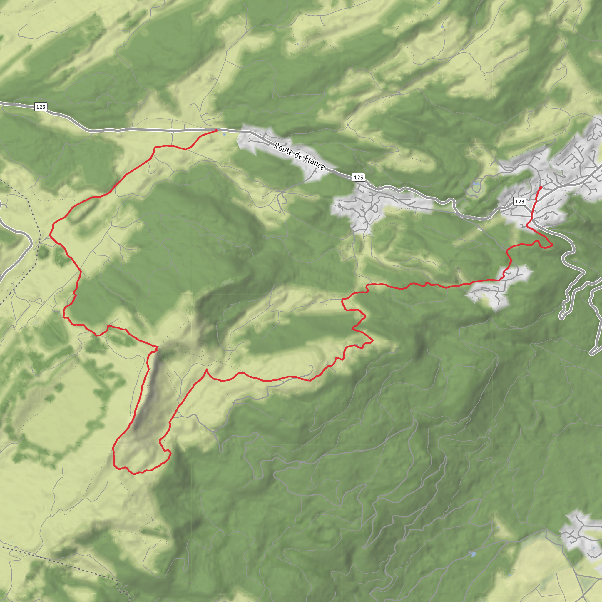
This roughly 15 km (9.3 mile) section of the E2 in Switzerland is best thought of as a solid half-day to full-day outing with a sustained climb of about 800 m (2,625 ft), so it suits hikers who are comfortable with steady uphill walking rather than technical mountain terrain. With a medium difficulty feel, the challenge usually comes from the cumulative ascent, changing gradients, and the need to pace energy carefully on longer rises rather than from exposure or scrambling. Because the Swiss portion of the E2 is short and links into the wider E2/GR5 corridor, the route sits within a landscape shaped by cross-border travel, old pastoral movement, and long-established walking infrastructure. The E2 itself is one of Europe’s long-distance paths, and in Switzerland it connects into the Jura-side continuation toward Nyon from the La Cure area. (longdistancepaths.eu)
The start is most commonly associated with the La Cure border area, a well-known village and crossing point on the French-Swiss frontier above Lake Geneva, and that is the nearest significant landmark identifiable for the Swiss E2 segment from the available route information. The broader Swiss section is signposted between La Cure and Nyon, placing the hike in the Jura landscape rather than the high Alps. (en.wikipedia.org)
What to expect on the route
Expect a route that alternates between forest tracks, pasture-edge paths, and open stretches with wider views when the trees break. In the Jura, climbs often build gradually before steepening in shorter ramps, so the 800 m (2,625 ft) of ascent can feel more demanding than the distance alone suggests. A 15 km (9.3 mile) day here often means a mix of compact village approaches, agricultural land, and wooded ridgelines, with underfoot conditions changing quickly after rain. Dirt paths and grassy sections can become slick, while stony farm tracks can feel hard underfoot on descents. (longdistancepaths.eu)
Navigation is usually helped by Switzerland’s dense waymarked hiking network, but junction-rich terrain means it is still worth checking the route carefully in HiiKER before setting out, especially where local paths intersect long-distance trail markings. The SwissTopo mapping available through HiiKER is particularly useful in this kind of rolling upland terrain, where multiple tracks may run parallel through woodland or pasture. (support.hiiker.app)
Landmarks, scenery, and natural character
This part of western Switzerland is defined by the Jura Mountains: rounded ridges, limestone uplands, meadows, conifer stands, and occasional broad viewpoints toward Lake Geneva and, in clear weather, the distant Alps. Rather than dramatic glacial scenery at every turn, the appeal is in the contrast between quiet forest, open grazing land, and long horizon lines. Traditional farm clearings and pasture mosaics are a strong part of the landscape character. (hiiker.app)
Wildlife is typically that of the Jura foothills and uplands. Hikers should keep an eye out for raptors overhead, smaller woodland birds, and signs of mammals along quieter stretches, especially early or late in the day. In pasture areas, livestock is often more relevant than wild animals from a practical standpoint: give cattle space, keep to the marked line of travel, and be prepared to pass through gates or along fenced grazing land. Seasonal insects can also be noticeable in warm weather, particularly near damp meadows and forest margins.
Historical significance of the region
The historical interest here comes less from a single monument and more from the setting. La Cure and the surrounding Jura frontier have long been part of a borderland between France and Switzerland, where trade, customs, and local movement shaped village life. The E2’s passage through this area reflects a much older pattern of crossing uplands by established routes linking communities on either side of the frontier. The wider E2 is part of the European long-distance path network created to connect countries through continuous walking routes, giving this short Swiss section an outsized cultural importance despite its limited length within Switzerland. (en.wikipedia.org)
Planning, timing, and preparation
For most hikers, allow roughly 4.5 to 6.5 hours of moving time for 15 km (9.3 miles) with 800 m (2,625 ft) of ascent, depending on fitness, trail conditions, and how often you stop for views or navigation checks. The climb is enough to make water, weather layers, and pacing
Surfaces
Unknown
Dirt
Gravel
Ground
Paved
Asphalt
Unpaved
Grass
Comments and Reviews
User comments, reviews and discussions about the E2 - Switzerland, Switzerland.
average rating out of 5
0 rating(s)
