
Download
3D Flyover
Add to list
More
481.9 km
21 days
7179 m
Multi Day
“A serene pilgrim’s thread through rivers, lakes, abbeys, and towns, with occasional tougher stretches.”
This long, mostly gentle pilgrimage route follows the Swiss and Austrian chapter of the wider Columban Way, tracing the remembered path of St. Columbanus and his companion St. Gall across river valleys, lakeshores, market towns, abbey landscapes, and the northeastern edge of the Alps. The Switzerland–Austria section is generally described at about 481 km/299 miles, though some Swiss route material rounds the national section to roughly 500 km/311 miles depending on variants and stage choices. Total ascent is often estimated around 7,300 m/23,950 ft, which is modest for a route of this length and helps explain why it is often rated on the easier side overall. (thecolumbanway.org)
The route is not a wilderness thru-hike in the classic mountain sense. It is better understood as a cultural long-distance walk: long days are possible, surfaces are mixed, and the challenge comes more from consistency, weather, and time on feet than from technical terrain. Much of the walking uses well-developed paths and local hiking infrastructure, with several sections following rivers or lake edges and others linking towns by country lanes, promenades, and rolling farmland. Swiss route notes also indicate that some stages can be shortened by bus or train, which is useful for planning if you want to reduce mileage or avoid less attractive road sections. (kolumbansweg.ch)
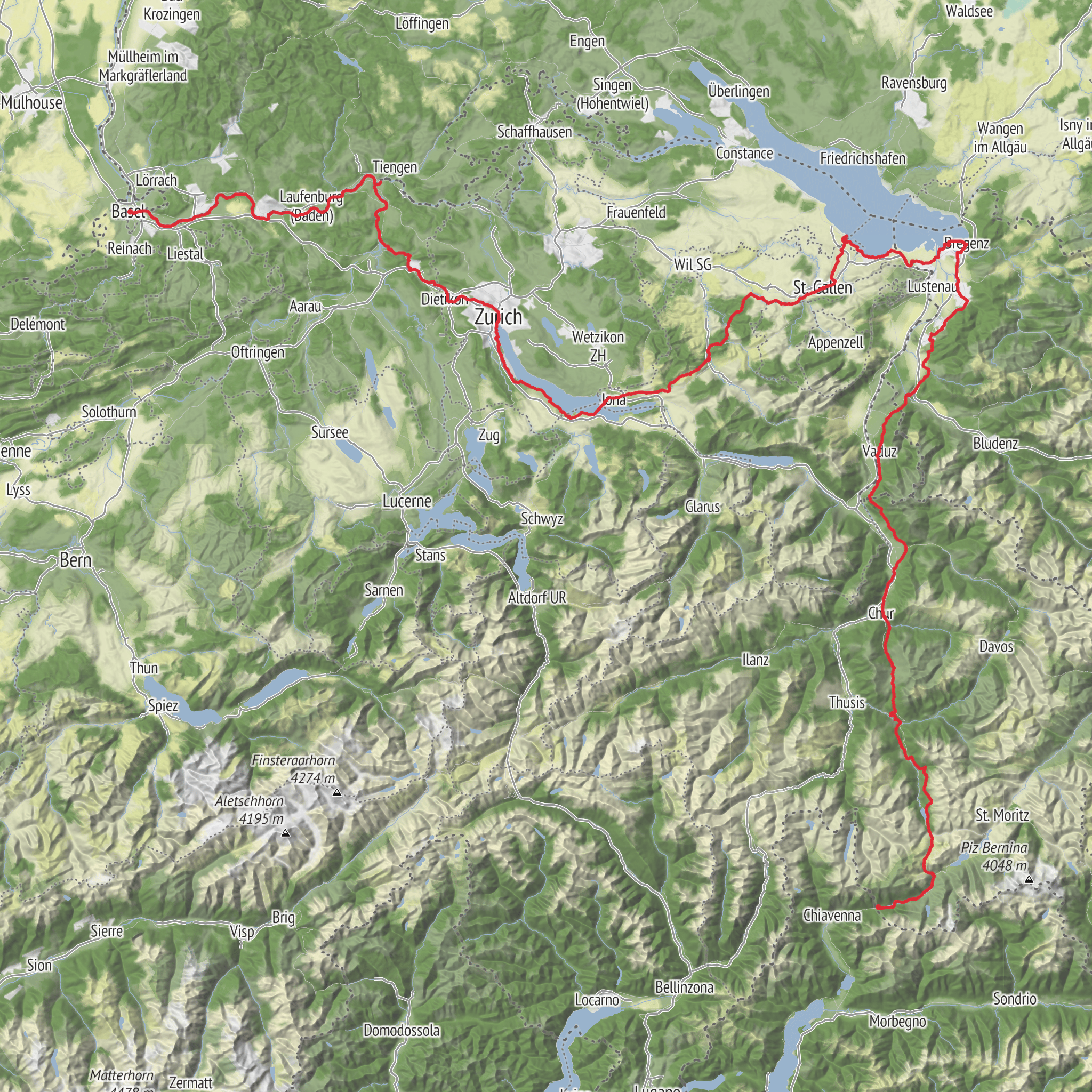
The usual Swiss-Austrian line of travel begins in Basel, near Basel SBB railway station and the historic city center, then works east and southeast through the Rhine corridor, Baden, Zürich, the Lake Zürich region, onward toward Wattwil, St. Gallen, Arbon, Rorschach, and finally Bregenz on Lake Constance in Austria. Basel tourism describes the opening stage as starting in Basel and continuing up the Rhine toward Rheinfelden and Fricktal, while Swiss Columban route material identifies Basel as the practical western gateway for this section. (basel.com)
What the walking feels like
For much of the first half, expect lowland and lakeside walking rather than alpine exposure. The opening stretch out of Basel is notably easy, with one published stage to Möhlin measuring about 19.5 km/12.1 miles and only around 60 m/197 ft of ascent. Farther east, the route through the Zürich region remains moderate: Baden–Zürich is listed at 27 km/16.8 miles with about 300 m/984 ft of elevation difference, Zürich–Wädenswil at about 25 km/15.5 miles with roughly 360 m/1,181 ft, and Wädenswil–Rapperswil at about 15 km/9.3 miles with little net elevation change. (basel.com)
That said, “easy” does not mean uniformly soft underfoot. Some of the least strenuous elevation days can still feel tiring because of pavement and urban fringe walking. The Zürich–Wädenswil stage is specifically noted for having a large amount of asphalt and a fairly long roadside section, although there are attractive lakeside stretches and possible alternatives to reduce the least pleasant parts. (kolumbansweg.ch)
The route becomes more varied after the Lake Zürich area. If you take the Rapperswil variant, the stage from Rapperswil to Wattwil is one of the more demanding days, around 27 km/16.8 miles with approximately 915 m/3,002 ft of ascent and 710 m/2,329 ft of descent. This is still non-technical hiking, but it is a meaningful jump in effort compared with the flatter river and lakeshore sections. (kolumbansweg.ch)
Near St. Gallen and onward to Lake Constance, the route returns to gentler terrain. The Gallus Way from Arbon to St. Gallen, closely tied to the Columban story, is a good indicator of the landscape here: 16 km/9.9 miles, about 520
AI Planner
Days planned around your pace, with somewhere to stay each night.
Surfaces
Unknown
Asphalt
Gravel
Ground
Dirt
Cobblestone
Unpaved
Concrete
Grass
Paved
Wood
Sand
Comments and Reviews
User comments, reviews and discussions about the The Columban Way in Switzerland Austria, Switzerland.
average rating out of 5
0 rating(s)



