
Download
3D Flyover
Add to list
More
477.5 km
22 days
10003 m
Multi Day
“From lakeside calm to Alpine drama and sunlit plains, this pilgrimage rewards resilient, well-prepared walkers.”
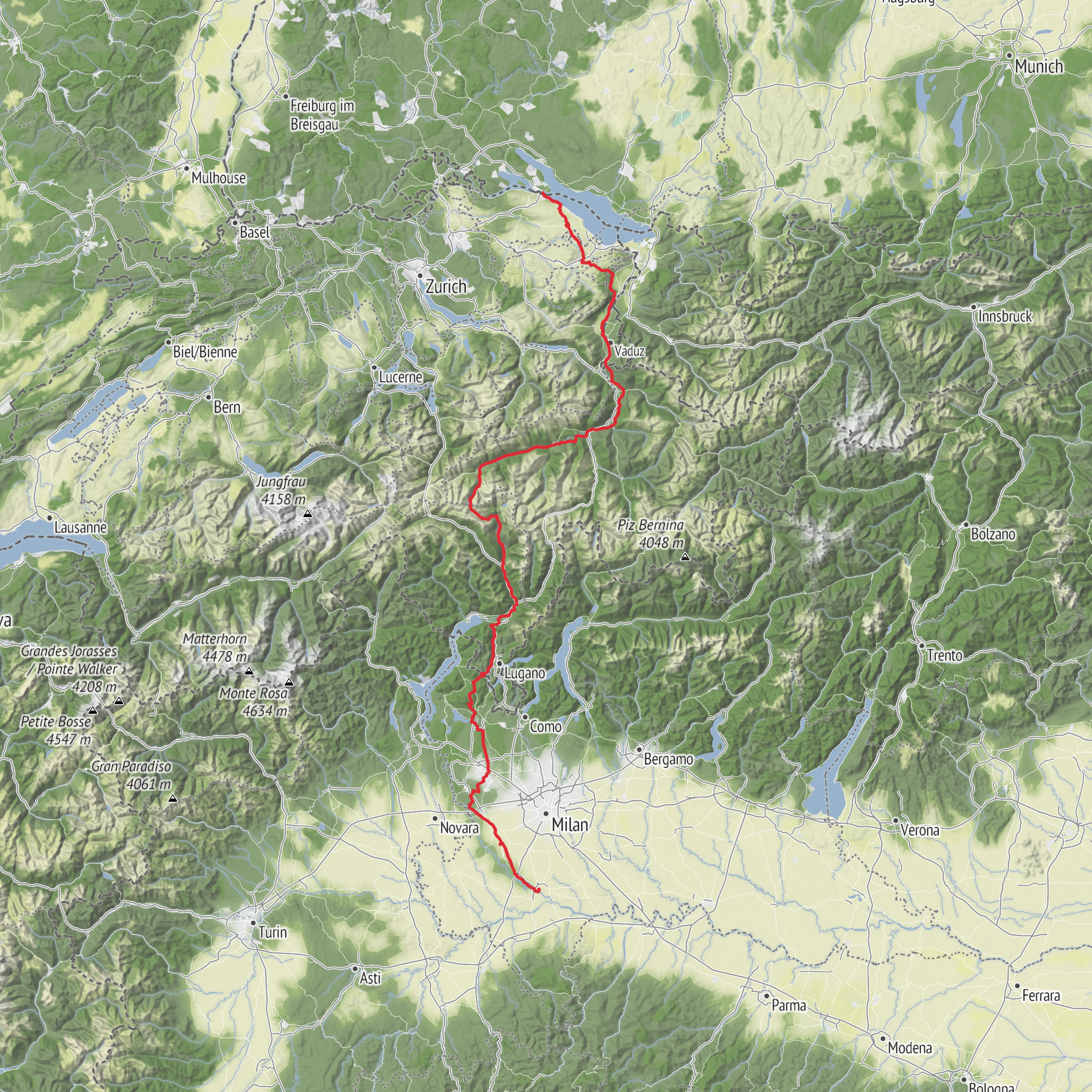
This long pilgrimage route runs about 477 km / 296 miles, linking Konstanz Minster (Konstanzer Münster), Münsterplatz in Konstanz, Germany, with Basilica of San Pietro in Ciel d’Oro, Piazza San Pietro in Ciel d’Oro, Pavia, Italy. The official Swiss overview lists it at 476.1 km / 295.8 miles, with the route crossing the Lukmanier Pass and continuing south to Pavia, where it joins the Via Francigena toward Rome. The high point is just under 1,978 m / 6,490 ft, and the route is generally rated medium, though that label hides a very real endurance challenge because the distance is long and the terrain changes dramatically from lakeshore paths to Alpine crossings and lower-elevation river plains. (sportanlagenchur.ch)
What makes this route distinctive is its progression through several landscapes and cultural zones in one continuous walk. It begins around Lake Constance, follows the Rhine corridor, climbs through Graubünden toward the Alpine watershed, crosses the Lukmanier Pass, then drops into the Italian-speaking south before continuing through Varese, the Olona Valley, and the Ticino Park toward Pavia. The Swiss route description notes that much of the trail is on mountain, woodland, and meadow paths, with some paved urban stretches, and the Italian section is tied to an old Roman-Longobard line of travel that historically connected central Europe with the Po Valley. (viafrancisca.ch)
What to expect on the route
The first days are usually the gentlest psychologically, because the walking starts in a settled landscape with frequent services, rail access, and clear cultural landmarks. Around Konstanz, expect a historic urban start, lake views, and a gradual transition into river and valley walking rather than an immediate mountain test. This is a good place to settle into a rhythm before the route becomes more committing. (sportanlagenchur.ch)
As the trail heads deeper into Switzerland, the route becomes more varied and more physically demanding. You move through a sequence of river valleys and upland terrain, with the sense of scale increasing as the Alps draw closer. The route’s official overview identifies the Lukmanier Pass crossing as the key mountain section, and this is where weather, exposure, and seasonal timing matter most. Even though the pass is relatively low by Alpine standards at about 1,915 m / 6,283 ft, it is still a serious mountain environment where conditions can change quickly. The official route notes that from November through April, snow can affect the Disentis–Lukmanier Pass–Olivone stages, and public transport may be the safer option in that period. (sportanlagenchur.ch)
South of the pass, the character changes again. The route descends toward the Brenno and then the Ticino watershed, and the climate gradually feels more Mediterranean. This is often where hikers notice the route becoming less about mountain effort and more about sustained daily mileage, heat management, and foot care. In Italy, some sections are easier underfoot, but long flat or rolling days can still be tiring, especially after the cumulative fatigue of the Alpine stages. (viafrancisca.ch)
Distance, climbing, and daily planning
With roughly 477 km / 296 miles and around 10,000 m / 32,800 ft of ascent as you’ve listed, this is best planned as a multi-week hike rather than a quick through-walk. The official route overview gives a similar total distance and shows substantial cumulative ascent and descent, reinforcing that this is a route of persistence more than technical difficulty. (sportanlagenchur.ch)
A strong walker might divide it into something like 20 to 25 days, averaging about 19 to 24 km / 12 to 15 miles per day. A more relaxed pilgrimage pace could stretch it to 4 weeks or more, which gives more room for weather delays, rest days, and time in historic towns. The mountain stages deserve shorter planning windows than the lowland sections, even when the raw distance looks manageable.
The hardest part for many hikers is not steepness alone but the combination of: - repeated long days, - changing surfaces, - weather exposure near the pass, - and the transition from cool Alpine conditions to warmer lowland walking.
Because the route is long and crosses multiple transport networks, it is practical to break it into sections if needed. The official route information also notes that stage towns are reachable by public transport, which is useful
Surfaces
Unknown
Asphalt
Gravel
Dirt
Cobblestone
Ground
Unpaved
Concrete
Paved
Wood
Grass
Comments and Reviews
User comments, reviews and discussions about the Via Francisca, Switzerland.
average rating out of 5
0 rating(s)

