Download
3D Flyover
Add to list
More
17.9 km
~5 hrs 31 min
1168 m
Multi-Day
“Explore Tenerife's Mount Guajara Loop, a scenic hike with breathtaking vistas, unique flora, and historical intrigue.”
Nestled in the stunning landscape of Tenerife, the Mount Guajara Loop offers a captivating journey through the rugged beauty of the Canary Islands. This 18 km (approximately 11 miles) trail, with an elevation gain of around 1100 meters (3600 feet), begins near the charming town of Granadilla de Abona, Spain. The loop is classified as medium difficulty, making it suitable for hikers with a moderate level of fitness and experience.
Getting There
To reach the trailhead, travelers can opt for public transport or drive. If using public transport, buses from major towns like Santa Cruz de Tenerife or Los Cristianos can take you to Granadilla de Abona. From there, a short taxi ride or local bus can bring you closer to the starting point. For those driving, the trailhead is accessible via the TF-21 road, which offers scenic views as it winds through the island's volcanic landscape.
Trail Highlights
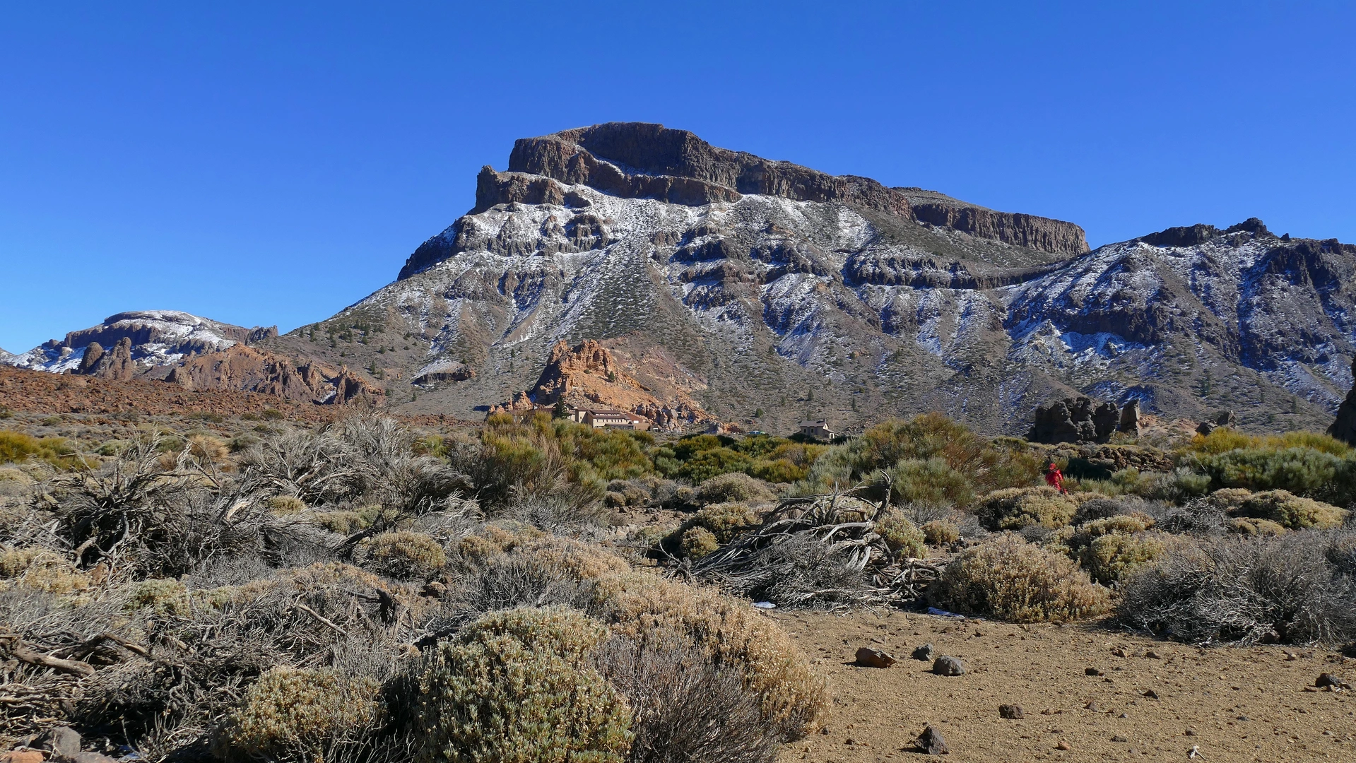
As you embark on the Mount Guajara Loop, you'll be greeted by the dramatic vistas of Teide National Park. The trail meanders through a diverse range of terrains, from rocky paths to lush pine forests. Early in the hike, you'll encounter the striking Roques de García, a series of unique rock formations that stand as sentinels against the backdrop of Mount Teide, Spain's highest peak.
Flora and Fauna
The trail is a haven for nature enthusiasts, with a rich tapestry of flora and fauna. Keep an eye out for the endemic Canary Island pine trees, which provide shade and a refreshing scent. The area is also home to a variety of bird species, including the blue chaffinch and the Tenerife goldcrest. In spring, the landscape bursts into color with wildflowers, including the vibrant Teide violet.
Historical Significance
Mount Guajara itself holds historical significance, as it was once a site for astronomical observations. In the late 19th century, the British astronomer Charles Piazzi Smyth conducted studies here, drawn by the clear skies and high altitude. Remnants of his stone hut can still be found near the summit, offering a glimpse into the scientific heritage of the region.
Navigational Tips
The trail is well-marked, but it's advisable to use a reliable navigation tool like HiiKER to ensure you stay on track. The ascent to the summit of Mount Guajara is the most challenging part of the hike, with steep sections that require careful footing. Once at the top, you'll be rewarded with panoramic views of the surrounding landscape, including the majestic Mount Teide and the vast expanse of the Atlantic Ocean.
Final Stretch
As you descend, the trail loops back towards the starting point, offering a different perspective of the terrain. The descent is gentler, allowing you to soak in the serene beauty of the island. The entire loop typically takes around 6 to 8 hours to complete, depending on your pace and the time spent enjoying the views.
The Mount Guajara Loop is a remarkable journey through one of Tenerife's most captivating landscapes, offering a blend of natural beauty, historical intrigue, and a rewarding hiking experience.

Comments and Reviews
User comments, reviews and discussions about the Mount Guajara Loop, Spain.
average rating out of 5
0 rating(s)