
Download
3D Flyover
Add to list
More
20.6 km
~7 hrs 25 min
1986 m
Out and Back
“A vast, lung-testing climb through pine and scrub to Mulhacén’s roof, rewarding strong, weather-wise hikers.”
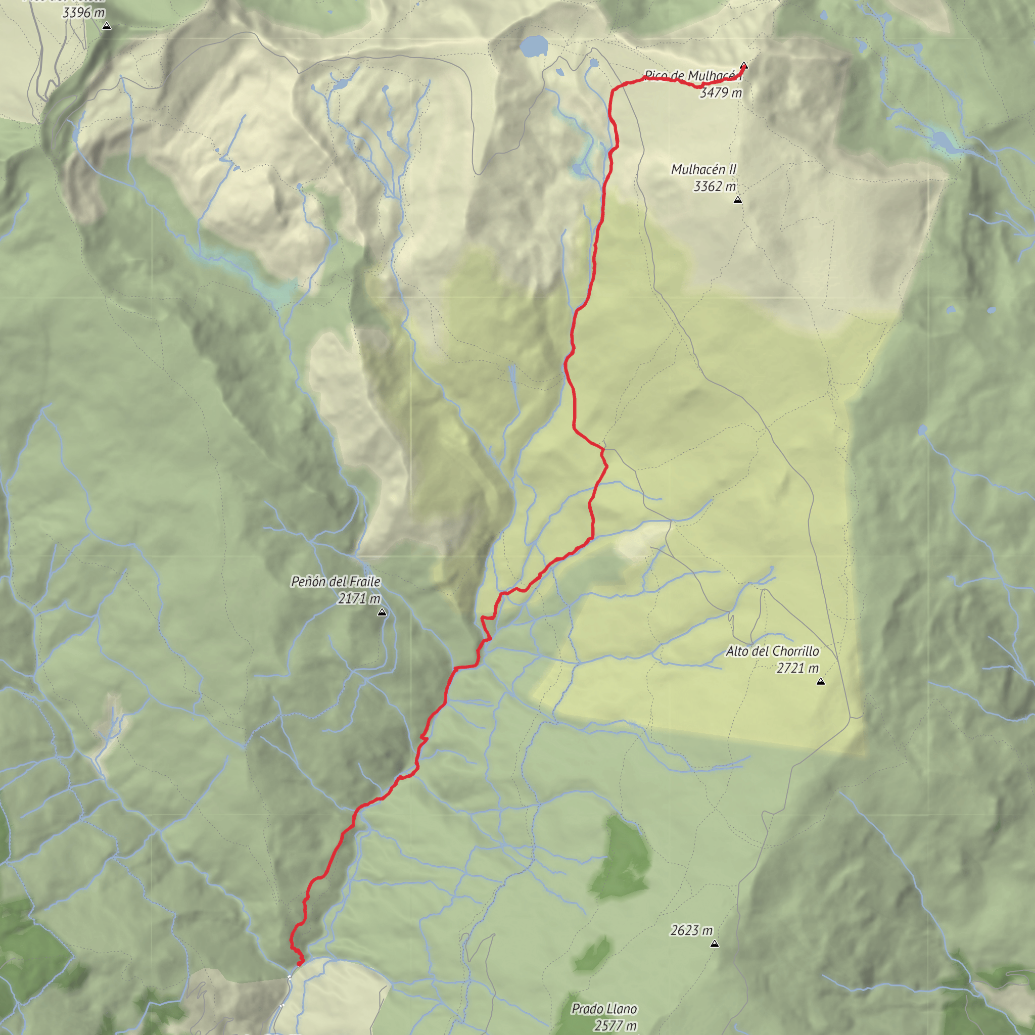
This is a big, high-mountain day in the Sierra Nevada of Andalusia, climbing toward Mulhacén, the highest peak on the Iberian Peninsula at about 3,482 m / 11,424 ft. Even if the line of travel is not especially technical in dry summer conditions, the combination of roughly 21 km / 13 miles and around 2,000 m / 6,560 ft of ascent makes it a genuinely difficult outing that demands strong fitness, steady pacing, and respect for fast-changing mountain weather. The usual southern approach links the Hoya del Portillo parking and control area above Capileira with Refugio Poqueira, then continues up the broad southern shoulder of the mountain toward the summit. Hoya del Portillo sits at about 2,150 m / 7,054 ft, while Refugio Poqueira is around 2,500 m / 8,202 ft. The official Hoya del Portillo to refuge section is about 8 km / 5 miles with roughly 450 m / 1,476 ft of gain, and the refuge-to-summit section is about 7.1 km / 4.4 miles with around 1,100 m / 3,609 ft of ascent one way, so a full out-and-back day from the roadhead lands in the range you provided. (miteco.gob.es)
The hike begins near the Hoya del Portillo Area de Estancia y Control, the main high trail access point above Capileira, Granada, Spain, reached by continuing out of Capileira on the old Sierra Nevada road GR-411 for about 11 km / 6.8 miles from the village center. That is the nearest clear landmark and practical start point for most hikers using this route. (juntadeandalucia.es)
The first stretch is often the most deceptive. You start high, but not high enough to avoid a long day, and the trail wastes little time reminding you that this is a serious mountain environment. From the information point at Hoya del Portillo, the route heads into a Scots pine forest, then emerges onto a firebreak near the line toward Puerto Molina, a notable viewpoint over the Poqueira basin. From there, the route trends along a track and then into more open terrain, where the landscape begins to feel broader, drier, and more alpine. (miteco.gob.es)
What the route feels like
From Hoya del Portillo to Refugio Poqueira, the walking is usually straightforward in clear weather, but it is still mountain walking at altitude. The grade is moderate overall, and this section is often used as the most accessible approach to the refuge. The terrain transitions from pine woodland into piornal scrubland, with increasingly open views into the head of the Barranco del Poqueira and toward the highest summits of the range. The refuge is visible for much of the approach, which helps with orientation in good visibility. (miteco.gob.es)
Once at Refugio Poqueira, the character changes. The refuge is a major landmark on the south side of the massif and sits in the Hoya de Peñón Negro above the confluence of the Río Mulhacén and Río Seco. From here, the route to Mulhacén follows the broad southern line, heading toward El Chorrillo at around 2,700 m / 8,858 ft, then continuing via the Loma del Tanto and Loma del Mulhacén toward Mulhacén II / Mulhacén Chico before the final rise to the main summit. This upper mountain is expansive rather than enclosed: long slopes, old track lines, broad ridges, and a summit approach that can feel much farther than it looks. (refugiopoqueira.com)
The climb above the refuge is not usually steep in one continuous push; instead, it is a long, cumulative ascent where the altitude and exposure do most of the work. The old track makes wide bends, and many hikers use established shortcuts and footpaths where appropriate, but route discipline matters. In cloud, wind, or lingering snow, this broad terrain can become much more committing than the map suggests. For navigation, plan the route carefully in HiiKER before setting out.
Surfaces
Dirt
Unknown
Concrete
Comments and Reviews
User comments, reviews and discussions about the Mulhacén via Refugio Poqueira, Spain.
average rating out of 5
0 rating(s)
