
Download
3D Flyover
Add to list
More
23.8 km
~6 hrs 57 min
1315 m
Out and Back
“A stark, sun-washed climb to Mulhacén unfolds above Capileira, with vast horizons and serious mountain feel.”
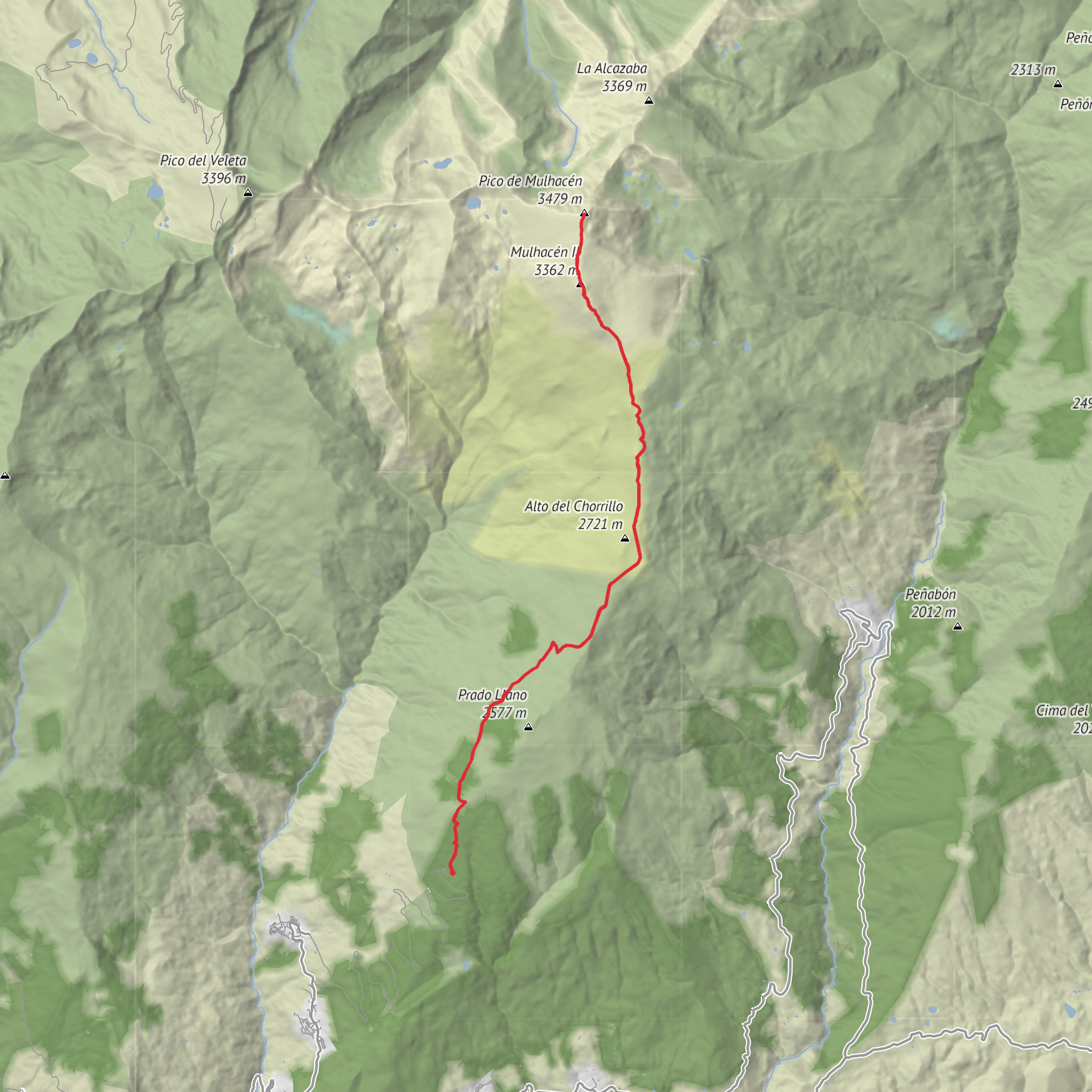
This high-mountain route climbs to Mulhacén, the highest peak in mainland Spain and the Iberian Peninsula at 3,479 m / 11,414 ft, in the Sierra Nevada of Andalusia. A hike of about 24 km / 14.9 miles with roughly 1,300 m / 4,265 ft of ascent usually points to the classic out-and-back from Hoya del Portillo, the small high trailhead above Capileira, Granada, in Sierra Nevada National Park. That starting point is the most practical fit for the distance and elevation you’ve given, and it is commonly used for a non-technical ascent in snow-free conditions. (wikiloc.com)
The trail begins in open mountain terrain rather than forested valley walking, so the day feels alpine almost immediately. From Hoya del Portillo, at around 2,145 m / 7,037 ft, the route heads upward on broad tracks and clear mountain paths toward Alto del Chorrillo, then continues onto the long upper slopes of Mulhacén. Because you start high, the climb is more manageable than some other approaches, but it is still a serious mountain day due to altitude, exposure, weather, and the length of the return. (wikiloc.com)
Getting to the start
By car, most hikers approach from Capileira, one of the best-known villages in La Alpujarra. From the village, a mountain road climbs to Hoya del Portillo, which serves as the nearest significant trailhead landmark for this route. Road conditions can vary, so checking local access conditions before setting out is sensible, especially outside the dry season. Capileira is one of the recognized southern access points for Mulhacén and the Poqueira area. (summitpost.org)
By public transport, the simplest connection is usually to travel first to Granada, then take a bus to Capileira. Current listings show direct Granada–Capileira bus service operated several times daily, with a journey of roughly 2 hours 15 minutes to 2 hours 35 minutes. From Capileira, reaching Hoya del Portillo generally requires a taxi or pre-arranged transfer, since the trailhead sits well above the village. (rome2rio.com)
The route is often rated medium, but that deserves context. Under dry summer conditions, the path is generally straightforward to follow and not technically difficult. What raises the challenge is the combination of sustained ascent, thin air above 3,000 m / 9,843 ft, strong sun, wind exposure, and the possibility of rapid weather changes. If snow, ice, or poor visibility are present, the seriousness increases sharply and the route can move beyond a casual medium-grade outing. Using HiiKER for route planning, elevation profiling, and timing is a good way to judge whether the day matches your fitness and mountain experience.
What the climb feels like
The first section is usually a steady warm-up rather than an immediate steep grind. You gain height on wide, often dusty mountain tracks with long views opening behind you toward the Alpujarra. The gradient is moderate enough to settle into a rhythm, but the altitude means even easy-looking terrain can feel more demanding than expected. Around the approach to Alto del Chorrillo, many hikers notice the landscape becoming broader, barer, and more windswept, with the sense that you are now fully in the high Sierra. (wikiloc.com)
Beyond that point, the route trends onto the upper mountain where the summit cone becomes the main objective. The path is usually clear in good conditions, but the terrain is open and can feel deceptively simple. Distances between landmarks can seem longer than they appear, and the final push often feels tougher than the map suggests because you are already high and exposed. Expect the last few kilometres to be the most tiring part of the ascent, especially if wind is blowing across the ridge or if afternoon cloud starts to build.
From the summit, the panorama is one of the great rewards of hiking in southern Spain. On a clear day, you can look across the Sierra Nevada’s chain of high peaks and down toward the Alpujarra, and in especially clear conditions visibility can extend astonishingly far. Because the summit is broad and exposed, it is not always a place to linger for long; wind chill can be severe even on warm days.
Landmarks, terrain, and natural character
One of the defining features of this hike is the transition from Mediterranean mountain country into a stark, high-elevation landscape that feels almost austere. Lower down, the slopes around Capileira and the Poqueira side of the range are tied to the historic acequia irrigation culture of La Alpujarra
Surfaces
Unknown
Dirt
Gravel
Comments and Reviews
User comments, reviews and discussions about the Mulhacén Peak, Spain.
average rating out of 5
0 rating(s)
