Download
3D Flyover
Add to list
More
55.0 km
~3 days
1780 m
Multi-Day
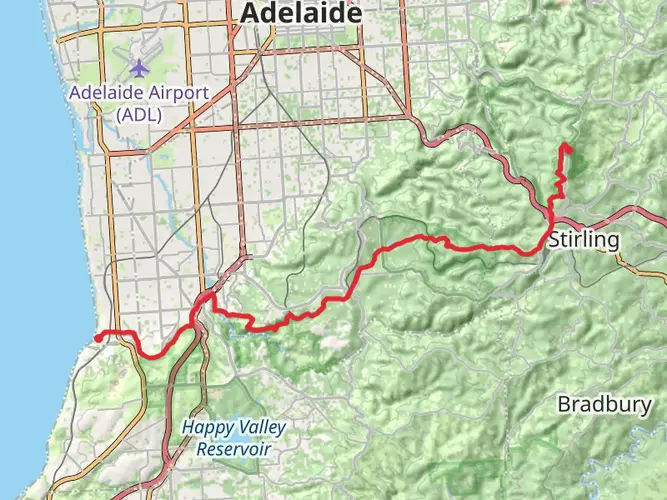
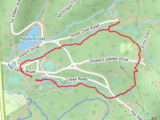
The Yurrebilla Trail is a 55.0 km trail that starts in Belair, Mitcham, South Australia. Based on our data, the hike is graded as Medium. For information on how we grade trails, please read measuring the difficulty of a hiking trail on hiiker. Also, check our latest community posts for trail updates. This hike can be completed in approx 3 days. Caution is advised on trail times as this depends on multiple variables. For more info read about how we calculate hike time.

What to expect?
Activity types
Frequently asked questions
How long does it take to hike the Yurrebilla Trail in South Australia?
The Yurrebilla Trail is about 55.0 km long with roughly 1,780 m of climbing, so most hikers treat it as a 2-day walk or break it into shorter day sections. Strong hikers can cover it faster, but the repeated climbs through the Mount Lofty Ranges make it more demanding than the distance alone suggests.
Where does the Yurrebilla Trail start and finish?
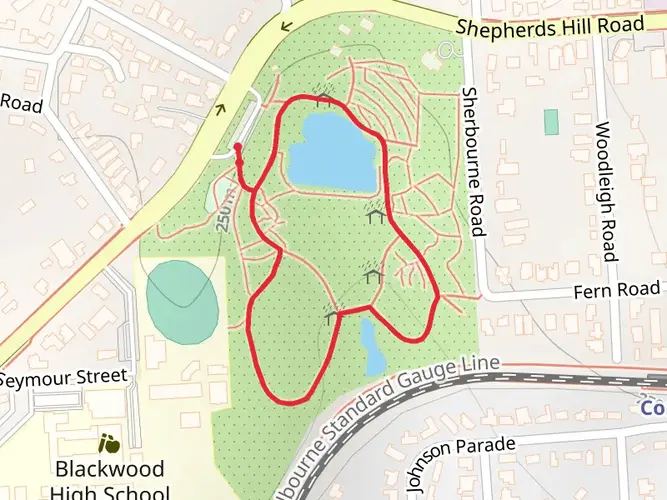
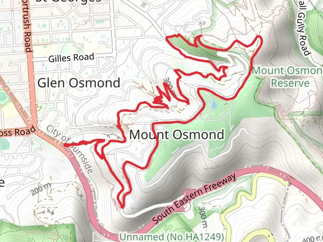
The Yurrebilla Trail runs through the Adelaide Hills from Belair National Park to the Black Hill area on the edge of Norton Summit. It links a chain of parks in the Mount Lofty Ranges, including Belair, Brownhill Creek, Cleland, Morialta, Black Hill, Anstey Hill, and Horsnell Gully, so it can be walked in either direction.
Is the Yurrebilla Trail hard, and is it suitable for beginner hikers?
The Yurrebilla Trail is generally rated medium, but 55.0 km and 1,780 m of elevation gain still make it a solid multi-day challenge. It is better suited to hikers with some fitness and experience on uneven bush tracks, especially because the route includes long climbs, descents, and rugged park sections rather than flat rail-trail walking.
Can you do the Yurrebilla Trail as day hikes instead of one multi-day walk?
Yes. The Yurrebilla Trail is commonly split into day walks because it crosses several separate conservation parks and reserves around Adelaide rather than one remote backcountry corridor. That layout makes it practical to tackle sections around Belair, Cleland, Morialta, Black Hill, Anstey Hill, and Horsnell Gully on different days.
Can you get to the Yurrebilla Trail by public transport from Adelaide?
Yes, public transport works well for the Belair end of the Yurrebilla Trail. Belair Railway Station is served by the Adelaide Metro Belair line from Adelaide Railway Station, which makes the southern end easier to reach without a car; the eastern end near Norton Summit and Black Hill is less straightforward and usually needs extra planning.
Is the Yurrebilla Trail dog friendly all the way?
No. The Yurrebilla Trail passes through several parks with different dog rules, so it is not a simple end-to-end dog-friendly walk. Dogs are allowed in Belair National Park on a lead up to 2 meters and only on designated walking trails, but in Morialta dogs are limited to the recreation zone and are not allowed through most of the conservation park sections used by the full trail.
What are the main highlights on the Yurrebilla Trail?
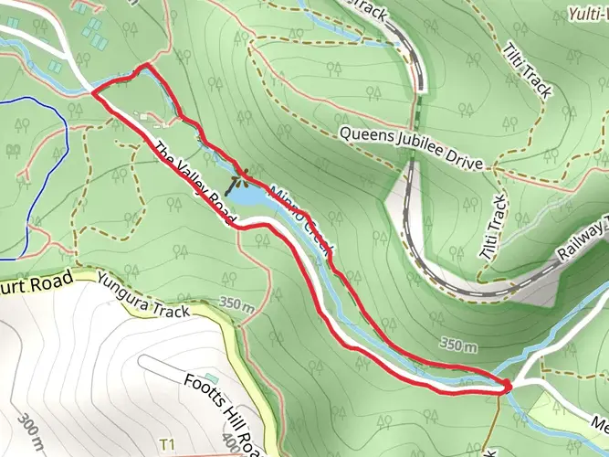
The Yurrebilla Trail is known for linking some of the best-known bushwalking country close to Adelaide, including Belair National Park, Cleland, Morialta, Black Hill, Anstey Hill, and Horsnell Gully. Along the way the route combines ridgelines, gullies, native woodland, and city-and-plains viewpoints, with Morialta’s gorge country and the Black Hill section standing out as major highlights.
Comments and Reviews
User comments, reviews and discussions about the Yurrebilla Trail, South Australia.
4.5
average rating out of 5
10 rating(s)