Download
3D Flyover
Add to list
More
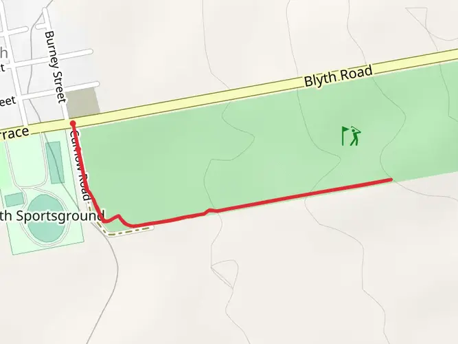
32.8 km
~7 hrs 1 min
285 m
Multi-Day
The The Riesling Trail is a 32.8 km trail that starts in Auburn, Clare and Gilbert Valleys, South Australia. Based on our data, the hike is graded as Easy. For information on how we grade trails, please read measuring the difficulty of a hiking trail on hiiker. Also, check our latest community posts for trail updates. This hike can be completed in approx 7 hrs 2 mins. Caution is advised on trail times as this depends on multiple variables. For more info read about how we calculate hike time.

What to expect?
Activity types
Frequently asked questions
How long does it take to walk The Riesling Trail in Clare Valley?
The Riesling Trail is 32.76 km long with only 285 m of elevation gain, so it is usually treated as an easy full-day walk or a relaxed multi-day outing. Many walkers break it into shorter sections between Auburn, Watervale, Sevenhill, Clare, and Barinia rather than covering the whole route in one push.
Is The Riesling Trail an easy hike or ride for beginners?
The Riesling Trail is generally considered easy. It follows a former railway corridor through the Clare and Gilbert Valleys, which gives it a gentle gradient and a formed surface, and it is widely used by walkers, recreational cyclists, wheelchairs, and prams as well as more experienced riders.
Where can you park for The Riesling Trail in South Australia?
Parking is available at several access points along The Riesling Trail, including Clare, Sevenhill, Watervale, Auburn, and Barinia. Common facilities mentioned along the route include Auburn Memorial Park, Watervale Oval, the Sevenhill Cricket Ground area near Richardson’s Reserve, and the Clare Skate Park precinct, which makes section hikes straightforward.
Is The Riesling Trail dog friendly?
Dogs are allowed on The Riesling Trail, but they need to be kept under control. The trail is also promoted locally as pet friendly, although some nearby businesses and cellar doors have their own rules, so dog access can vary once leaving the rail trail itself.
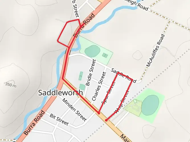
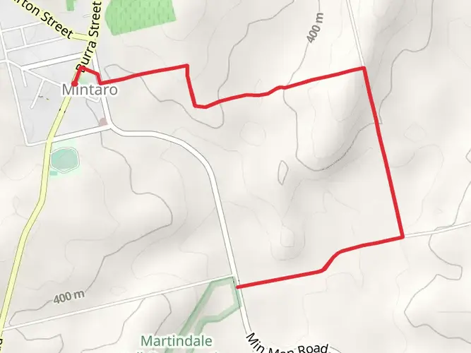
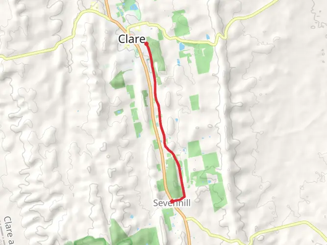
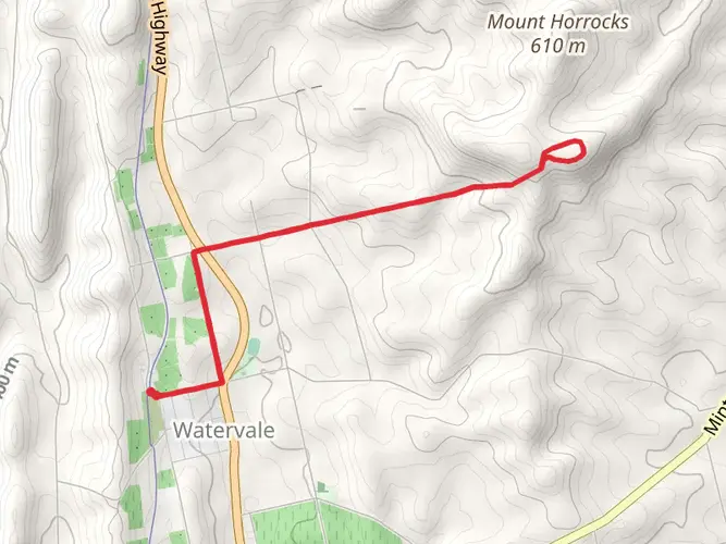
What towns and landmarks does The Riesling Trail pass through?
The Riesling Trail runs through the Clare Valley from Auburn north through Watervale, Sevenhill, and Clare, continuing on to Barinia. Along the way it passes vineyards, cellar doors, the former Clare railway station area, and the Penwortham district near the trail’s high point after Watervale.
Is The Riesling Trail suitable for families and kids?
Yes. The Riesling Trail’s easy rating, modest 285 m of climbing over 32.76 km, and former-railway alignment make it one of the more family-friendly long trails in South Australia. Shorter sections such as Clare to Sevenhill are especially popular because they let families enjoy the route without committing to the full distance.
What is the surface like on The Riesling Trail?
The Riesling Trail has a formed, well-maintained gravel surface built on an old railway line. That makes it smoother and more predictable than a typical bush track, and it is one reason the route is commonly used for walking, cycling, wheelchairs, and pushers as well as longer end-to-end outings.
Comments and Reviews
User comments, reviews and discussions about the The Riesling Trail, South Australia.
3.0
average rating out of 5
1 rating(s)