Search a hike or location

search
GET PRO+
Share:

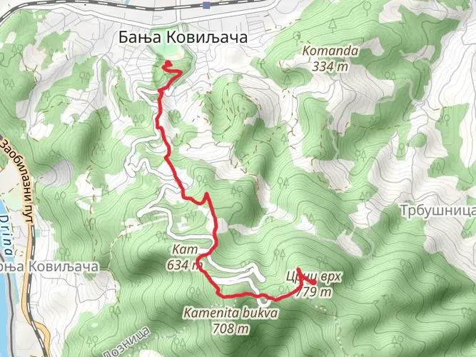
An image depicting the trail Hike from Banja Koviljača and its surrounding area.
star (0) · Medium

Hike from Banja Koviljača

Macva Administrative, Serbia

arrow_circle_down

Download

play_arrow

3D Flyover

bookmark_border

Add to list


Trail length

6.2 km

Time

~2 hrs 21 min

Elevation Gain

673 m

Hike Type

Point to Point

Burmazovic avatar
Created by Burmazovic

What to expect?

Historic Landmarks
Mountain Views
Forest
Scenic Views

Comments and Reviews

User comments, reviews and discussions about the Hike from Banja Koviljača, Serbia.

star

average rating out of 5

0 rating(s)


Choose which optional cookies and similar technologies HiiKER can use on this device. Privacy & cookie policy