
Harperring Reservoir, East Cairn Hill, North Esk Reservoir and Baddinsgill Reservoir Loop
Download
3D Flyover
Add to list
More
27.4 km
~6 hrs 30 min
615 m
Loop
“A sweeping Pentland circuit of reservoirs, cairns, and boggy moorland rewards strong walkers with big skies.”
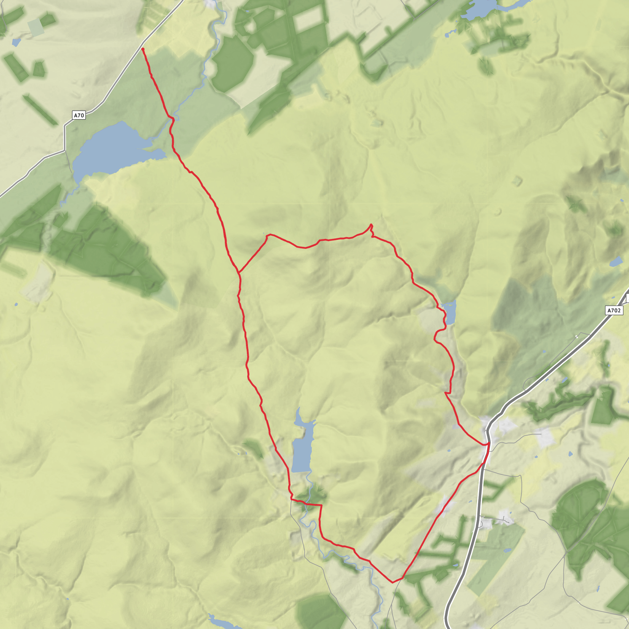
This is a long, exposed Pentland Hills circuit of about 27 km / 16.8 miles with roughly 600 m / 1,970 ft of ascent, linking four reservoirs with a broad hill crossing over East Cairn Hill. Although often rated medium, it feels closer to a strong medium or moderate-hard day because of the distance, the open moorland terrain, and the likelihood of wet, rough, or boggy sections around the cols and reservoir approaches. Expect a full day out with a mix of estate tracks, hill paths, old drove-road lines, grassy trods, and some softer ground underfoot. (visitwestlothian.co.uk)
The route sits in the Pentland Hills Regional Park on the north-west side of the range, starting near Harperrig Reservoir car park, Harperrig Reservoir, near Kirknewton, West Lothian, EH27 8DH. That is the clearest practical start point for this loop and the nearest known access landmark for navigation. Harperrig Reservoir itself lies about 5 miles / 8 km from Kirknewton and around 12 miles / 19 km from Edinburgh. (pentlandhills.org)
By car, Harperrig Reservoir car park is the straightforward access point, reached from the A70 on the north-west side of the Pentlands. Parking can be limited in busy periods, so an early start is sensible. By public transport, access is less convenient: the Pentland Hills authority notes there are no bus services along the A70 north-west side of the Regional Park and no train services directly into the Regional Park, so most hikers using public transport will need a taxi connection from nearby settlements such as Kirknewton or Livingston after rail or bus travel. (pentlandhills.org)
The opening section is gentler than the middle of the day suggests. From the Harperrig side, the route works its way past the reservoir margins and onto the old hill access lines leading toward Cauldstane Slap, the well-known saddle between East Cairn Hill and West Cairn Hill. The climb builds gradually at first, then becomes more sustained as you leave the lower reservoir basin and gain the open shoulder of East Cairn Hill. The Pentland Path and old drove-road alignments help shape this part of the walk, but it is still a place where visibility can change the feel of the route dramatically. In clear weather, the ascent feels spacious and obvious; in mist, the broad moor can feel much more committing, so carrying HiiKER for route guidance is wise. (visitwestlothian.co.uk)
Terrain and route character
East Cairn Hill is the high point and the psychological midpoint of the loop. The climb is not especially technical, but it is long enough to demand pacing, and the upper slopes can be rocky in places near the southern summit area. Walkhighlands notes rougher, heathery ground and boggier cols on this side of the Pentlands, especially around the descent toward Cauldstane Slap, and that matches the general character of this hill group: broad, rounded uplands with wet hollows between them. (walkhighlands.co.uk)
From the summit area, the route opens out into one of the best viewpoints in the western Pentlands. You can expect wide views over Harperrig Reservoir, across West Lothian, and on a clear day toward Fife and the Forth. Near the summit area there is also a substantial ancient cairn, separate from the unmarked highest ground, which is one of the most notable landmarks on the hill. (visitwestlothian.co.uk)
After East Cairn Hill, the loop trends south and east toward North Esk Reservoir, then swings back by Baddinsgill Reservoir before returning across the old moorland crossing toward Harperrig. This middle and later part of the day is where the route earns its distance: the hills are not alpine-steep, but the repeated
AI Planner
Days planned around your pace, with somewhere to stay each night.
Surfaces
Dirt
Unknown
Grass
Gravel
Asphalt
Ground
Comments and Reviews
User comments, reviews and discussions about the Harperring Reservoir, East Cairn Hill, North Esk Reservoir and Baddinsgill Reservoir Loop, Scotland.
average rating out of 5
0 rating(s)

