Download
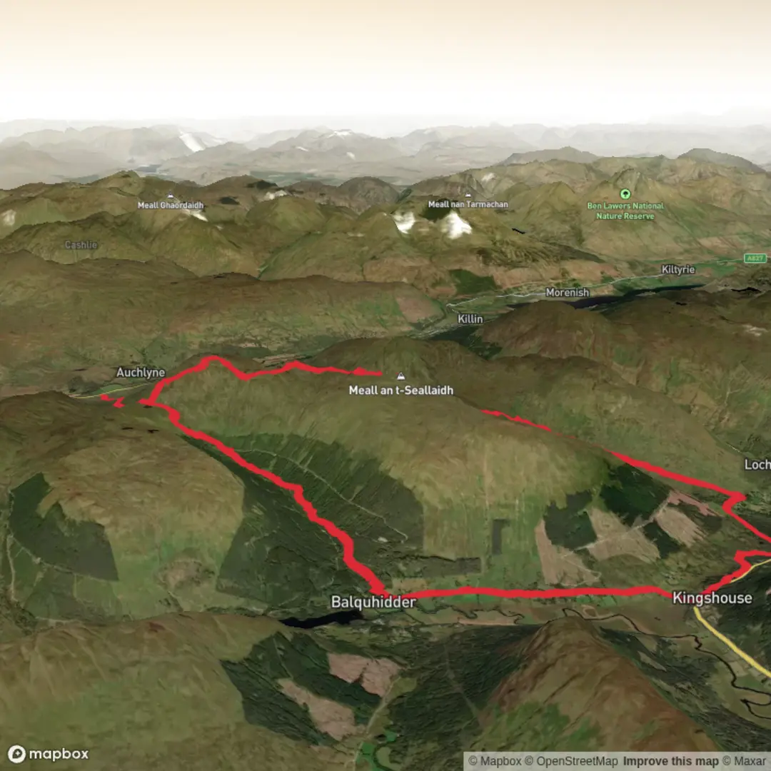
3D Flyover
Add to list
More
22.1 km
~5 hrs 58 min
934 m
Loop
“A long, airy Highland ridge rewards steady, well-prepared walkers with sweeping loch views and wild solitude.”
This is a big Highland circuit with a remote feel, linking Meall an Fhiodhain and Meall an t-Seallaidh on a long, airy ridge above the Braes of Balquhidder. At around 22 km / 13.7 miles with roughly 1,000 m / 3,280 ft of ascent, it sits well beyond a casual hillwalk even if the overall rating is described as medium. The day is long, the ground can be rough and pathless in places, and the weather can make the route feel much more serious than the numbers suggest. The landscape is classic Southern Highlands: broad grassy ridges, peatier sections lower down, steep flanks dropping into glens, and wide views over Loch Earn, Loch Voil, and the surrounding hill country. Meall an t-Seallaidh itself reaches 852 m / 2,795 ft and is well known for its outlook, rising north of Balquhidder between Kirkton Glen and Glen Kendrum. (walkhighlands.co.uk)
The start is most sensibly described as being near Lochearnhead and the Glen Ogle / old railway corridor, on the north side of the Balquhidder hills rather than at a built trailhead with full facilities. Sources for nearby routes place the access either from Lochearnhead or from approaches above Balquhidder / Kirkton Glen, and the long ridge between Meall an Fhiodhain and Meall an t-Seallaidh is a recognised line of travel in this group. (walkhighlands.co.uk)
Early on, expect estate tracks or old rail-path style access to make the first few kilometres relatively straightforward. That easier beginning should not be mistaken for the character of the whole route. Once the route leaves the lower glen and climbs onto open hillside, the gradient steepens and the terrain becomes much more committing. On a loop of this length, the first major climb usually does most of the day’s height gain in one sustained push, and that is where pacing matters. In dry weather the grassy slopes can feel secure but tiring; after rain they can become slick, especially where the line crosses worn turf, peat, or angled ground above drainage channels.
Terrain and route character
The defining feature of this walk is the ridge travel. After the initial ascent, the route opens into a broad upland crest where Meall an Fhiodhain acts as a high shoulder on the way toward Meall an t-Seallaidh. The ridge is not especially technical in dry, clear conditions, but it is expansive enough that poor visibility can make line-finding awkward. There are sections where the ground is simply open hill rather than a consistently engineered path, so hikers should be prepared for intermittent trods, boggier patches, and the need to hold a bearing between obvious features. HiiKER is the navigation tool to have loaded before setting out.
A reasonable way to think about the day is in stages:
- First 4 to 6 km / 2.5 to 3.7 miles: easier approach on lower tracks, rail-path, or glen access.
- Next 3 to 5 km / 1.9 to 3.1 miles: the main climb onto the ridge, where most of the effort is concentrated.
- Middle ridge section: rolling but still energy-sapping, with repeated rises and dips rather than one simple traverse.
- Final descent: often the part that catches people out, because steep grass, wet ground, and tired legs can make the return slower than expected.
The ridge between these hills is scenic rather than dramatic in a scrambling sense, but there are still places where craggy edges and steep flanks demand care. One route description for the area specifically notes steep grass, crags, and the need for extra caution in mist around the neighbouring bealach and upper slopes. That warning is relevant to this loop as well: in cloud, broad Highland ridges can be deceptively difficult to navigate cleanly. (caingram.com)
Landmarks, views, and what to notice
Meall an t-Seallaidh is often translated as the “hill of views,” and that fits the character of the outing. From the higher ground, the eye is drawn south toward Loch Voil and the Braes of Balquhidder, while to the north and west the hill country stacks up in long folds and ridgelines. One route account highlights the “silver slash” of Loch Voil as a standout feature from the summit area. (caingram.com)
Meall an Fhi
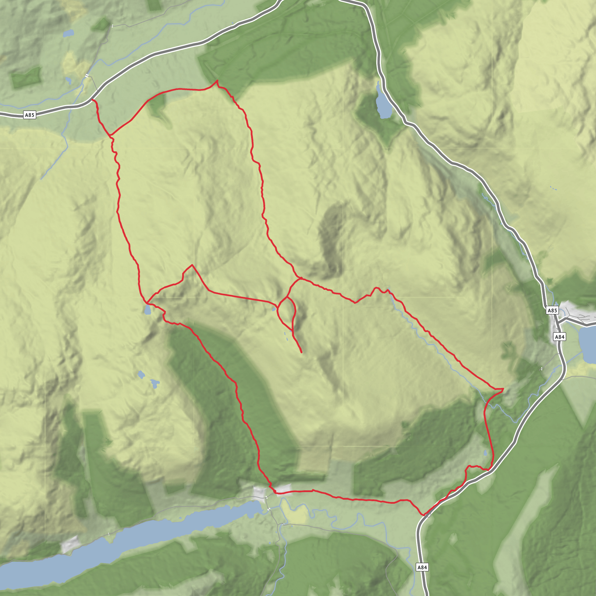
Surfaces
Unknown
Gravel
Asphalt
Comments and Reviews
User comments, reviews and discussions about the Meall an Fhiodhain and Meall an t-Seallaidh Loop, Scotland.
average rating out of 5
0 rating(s)
