Download
3D Flyover
Add to list
More
4.7 km
~1 hrs
37 m
Out and Back
“A leafy lochside circuit with island views and a fort-top panorama, best enjoyed carefully.”
This short circuit near Balmaha Visitor Centre, Balmaha, G63 0JQ, on the eastern shore of Loch Lomond, packs a lot into roughly 5 km / 3.1 miles with almost no sustained climbing overall, though there are a few short ups and downs around the wooded headland and fort. It is generally an easy walk, well suited to families and casual walkers, but the route is not completely flat underfoot: expect sections of rocky path, tree roots, steps, and a narrow lochside stretch that can feel more uneven than the distance suggests. (lochlomond-trossachs.org)
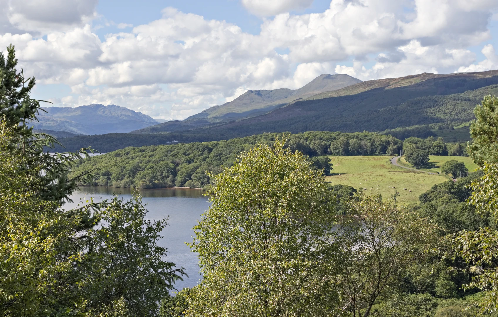
The walk begins from the main car park beside the National Park visitor facilities in Balmaha. From there, the route heads through the Millennium Forest, a pocket of native woodland that quickly gives the walk a sheltered, leafy feel before opening to views over the loch. The trail then works its way onto the wooded promontory of Craigie Fort, where the best viewpoint arrives surprisingly quickly for such a short outing. From the top, the outlook takes in Loch Lomond, several of its islands, and Ben Lomond rising across the water. (lochlomond-trossachs.org)
What to expect on the route
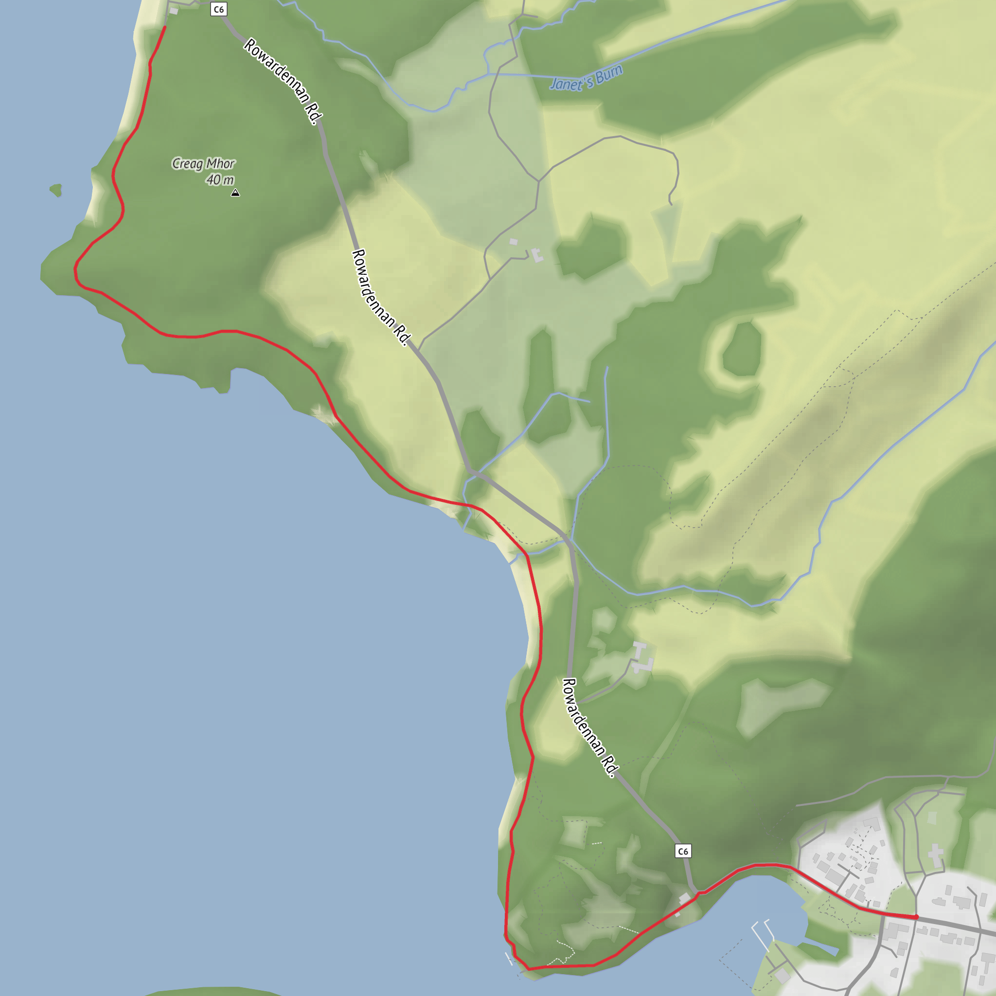
The first part is straightforward and easy to follow, especially with HiiKER for turn-by-turn confidence, but hikers should still pay attention at junctions near the village and where the path meets the road. One section runs parallel to the main road before continuing onto a quieter lochside lane, and care is needed when crossing the road. After that, the route climbs gently but noticeably onto Craigie Fort. Although the total elevation gain is often described as minimal, the approach to the viewpoint includes short steeper, rockier sections and some steps, so sturdy footwear is still worthwhile even on a dry day. (lochlomond-trossachs.org)
From Craigie Fort, the path descends on the far side to the loch shore, where the character of the walk changes. The woodland gives way to a more open shoreline section, including a bridge and a path cut close to the water’s edge. This is one of the most scenic parts of the circuit, but also one of the places to slow down, especially after rain when rock, roots, and timber can be slippery. The return leg then curves back toward Balmaha past a small jetty and rejoins the village lane. (lochlomond-trossachs.org)
Terrain, timing, and preparation
For most walkers, this is a route of about 1 to 1.5 hours, depending on how long is spent at the viewpoint and along the shore. The distance is short enough to feel relaxed, but the uneven ground means it is better approached as a proper walk rather than a paved village stroll. Waterproof shoes or light hiking boots are a sensible choice, and in wet or windy weather the exposed lochside sections can feel cooler than the sheltered forest. (loch-lomond-waterfront.co.uk)
Because the route stays low, there is no major ascent to manage, with elevation gain around 0 m / 0 ft overall in broad terms, though that should be read as “little net climbing” rather than “perfectly level.” Short rises and descents around the fort and shoreline are the main physical features to plan for. (lochlomond-trossachs.org)
Nature and wildlife
The Millennium Forest section is known for its native woodland, and this mix of trees, loch edge, and open viewpoints creates good habitat for common woodland and waterside birds. Hikers should keep an eye out for small songbirds in the trees, waterfowl on the loch, and changing seasonal colour in the forest. The area is also managed to protect native species, with the National Park noting work to control non-native plants such as rhododendron that can crowd out local woodland flora. (lochlomond-trossachs.org)
The shoreline views toward Inchcailloch add another layer of interest, as the islands and wooded slopes help give this part of Loch Lomond its distinctive character. On calm days the loch can appear gentle and sheltered, but the path remains close enough to the water that extra care is sensible with children, particularly on narrow sections and near bridges or jetties. (lochlomond-trossachs.org)
Historical significance
Craigie Fort is the key historic landmark on the walk. It is described locally as an Iron Age fort
Surfaces
Ground
Asphalt
Unknown
Comments and Reviews
User comments, reviews and discussions about the Craigie Fort and Arrochymore Point, Scotland.
average rating out of 5
0 rating(s)
