Download
3D Flyover
Add to list
More
23.7 km
~7 hrs 15 min
1508 m
Loop
“A wild, punishing Highland round of noble ridges, mining echoes, and Ben Lui’s commanding presence.”
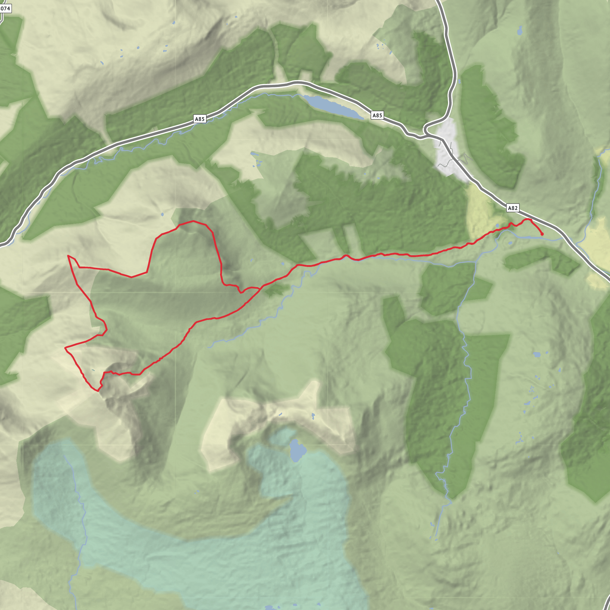
This is a big, serious mountain circuit in the Ben Lui group, linking Beinn Chùirn, Beinn Dubhchraig, Ben Lui, and Cìochan Beinn Laoigh in a long day of rough Highland terrain. Expect roughly 24 km / 15 miles with about 1,500 m / 4,920 ft of ascent, and a difficulty level that fits the “difficult” rating very well: there are long stretches of steep climbing, broad exposed ridges, potentially confusing descents in poor visibility, and a day length that leaves little margin for slow progress. The usual start is from the Dalrigh car park, just south of Tyndrum on the A82, the main access point for Glen Cononish. Dalrigh is the nearest clear landmark and practical trailhead for this loop. (walkhighlands.co.uk)
From the start, the route heads into Glen Cononish, following estate tracks and paths westward into a wide Highland glen beneath some of the finest mountain architecture in the southern Highlands. Early on, the walking is comparatively straightforward, giving you a chance to settle into the day before the climbing begins. The glen is also where one of the area’s most striking modern landmarks sits: Cononish, known for its gold mine and for much older lead-mining history around Tyndrum. That industrial thread gives the landscape an unusual character, where wild mountain scenery and mining heritage sit side by side. (scotgoldresources.com)
Terrain and route character
The first major objective, Beinn Chùirn, is often climbed from Glen Cononish by its south-east ridge, with old mine workings and the dramatic Eas Anie gorge and waterfalls adding interest on the ascent. This opening climb is steep and sustained, and it sets the tone for the day. Beinn Chùirn is lower than its Munro neighbours but still a substantial mountain, and from many angles it resembles a smaller companion to Ben Lui, with impressive corries cut into its flanks. (en.wikipedia.org)
After Beinn Chùirn, the loop becomes more committing. The line toward Beinn Dubhchraig and then Ben Lui involves a mix of ridge travel, steep re-ascent, and sections where the ground can feel loose, wet, or tiring underfoot. Beinn Dubhchraig rises above the headwaters of the River Cononish and is known for its rugged setting and the remnants of Coille Coire Chuilc, an ancient Scots pine wood below its northern corrie. (en.wikipedia.org)
Ben Lui is the dominant mountain of the group and one of the most admired peaks in the southern Highlands. Its Gaelic name, Beinn Laoigh, is often translated as “hill of the calf,” and the mountain is famous for its elegant ridges and steep corrie faces. The summit area feels properly alpine by Scottish standards, with broad views over the surrounding Munros and glens when the weather is clear. A lochan on Ben Lui’s slopes has been identified as the source of the River Tay, Scotland’s longest river, which adds another layer of geographical significance to the mountain. (en.wikipedia.org)
The final high point, Cìochan Beinn Laoigh, is usually less celebrated than Ben Lui itself but is an important part of the loop. It extends the day and keeps you high in exposed country for longer than many walkers expect. By this stage, fatigue often becomes the main challenge, especially if the weather has deteriorated or the ground is wet. The descent back toward Glen Cononish needs care, particularly in mist, because broad upper slopes can make line-finding less obvious than the map suggests. For navigation, carrying the route on HiiKER is a sensible way to keep track of key junctions, ridges, and descent lines.
What to expect underfoot
The day begins on estate track and good path, but much of the loop is not a simple path-walk. Expect a combination of **stalkers’ paths
Surfaces
Unknown
Gravel
Paved
Comments and Reviews
User comments, reviews and discussions about the Beinn Chuirn, Beinn Dubh, Ben Lui and Ciochan Beinn Laoigh Loop, Scotland.
average rating out of 5
0 rating(s)
