
Download
3D Flyover
Add to list
More
20.7 km
~6 hrs 10 min
1213 m
Loop
“A wild Highland horseshoe of bog, steep drops and big skies that feels tougher than it looks.”
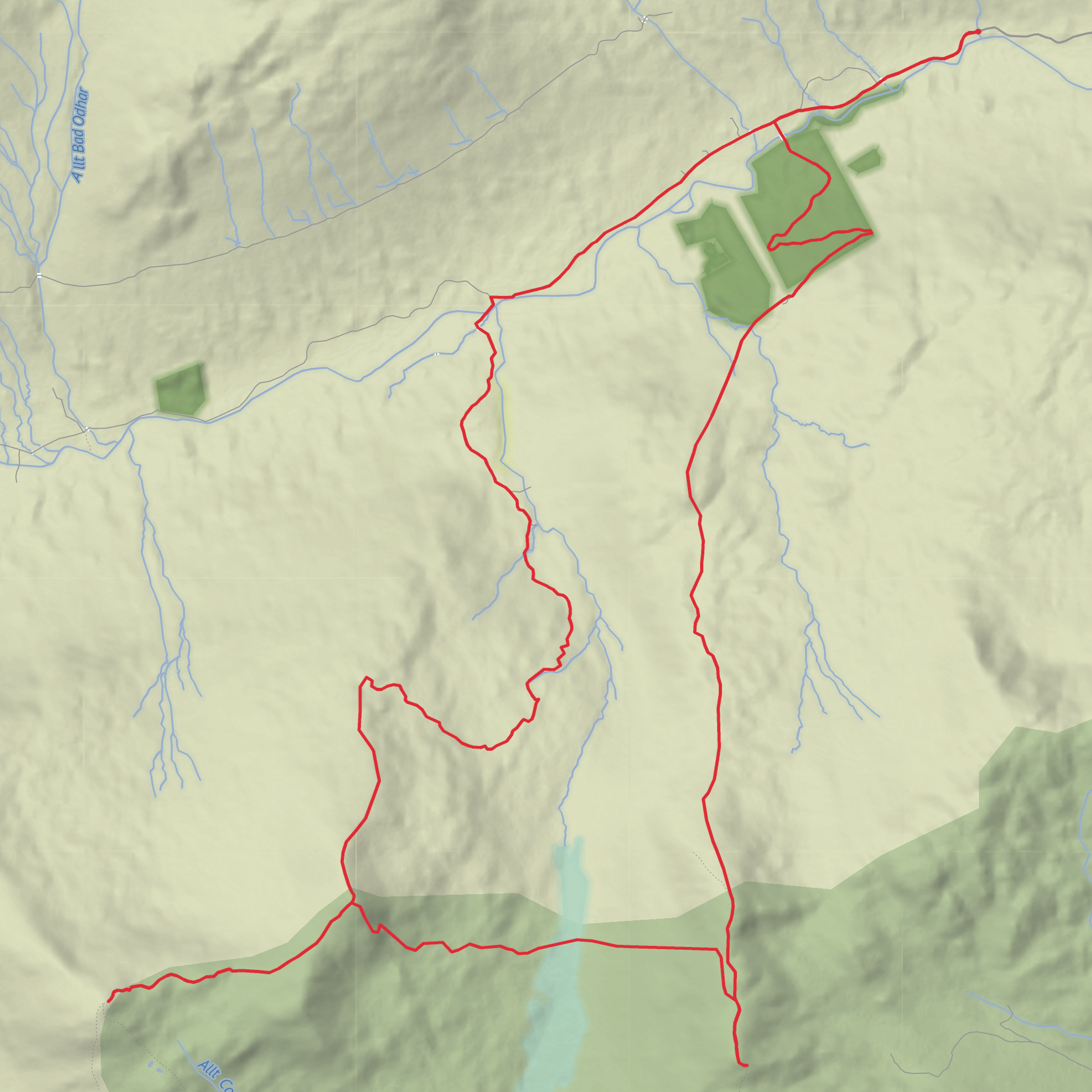
This is a big, committing hill day in the southern Highlands, linking four high points on a broad horseshoe above Glen Dochart: Beinn Cheathaich, Meall Glas, Sgiath Chùil, and Meall a’ Churain. Even if the distance is listed at around 21 km / 13 miles, expect it to feel more serious than the numbers suggest. Similar mapped versions from Auchessan or Auchlyne are often closer to 25.4 km / 15.8 miles with about 1,456 m / 4,777 ft of ascent, so a 21 km / 13 mile estimate likely assumes a slightly tighter line or excludes some undulation. Either way, this is a long mountain circuit with rough ground, steep descents, bog, and sections where progress can be much slower than expected. (hiiker.app)
The usual start is near Auchessan on the A85 in Glen Dochart, west of Killin and east of Crianlarich. That is the nearest clear landmark and practical trailhead reference for planning. The commonly used access point is the junction of the Auchessan track with the A85, where there is limited roadside or verge parking and care is needed not to block farm access. (en.wikipedia.org)
The terrain is classic Highland hillwalking rather than a neatly engineered trail. You begin on easier ground, but once higher up the route becomes a mixture of faint paths, wet moorland, grassy slopes, and steep mountain ridges. The hardest part for many hikers is not the climb out, but the rough middle of the circuit: the very steep drop from Sgiath Chùil toward the Lairig a’ Churain and the equally demanding re-ascent toward Beinn Cheathaich and Meall Glas. Walkhighlands specifically notes this descent as extremely steep and potentially slippery when wet, with the bealach more than 300 m / 985 ft below Sgiath Chùil. (walkhighlands.co.uk)
What the route feels like
From the A85 side, the opening kilometres are deceptive. The hills sit back from the road and at first the route crosses moorland and estate ground rather than dramatic mountain terrain. This lower section can be wet underfoot, especially after rain, and the line of travel may feel indirect before the route properly commits to the hills. If visibility is poor, this is where accurate navigation matters early, because broad, feature-light ground can make it easy to drift off line. For navigation planning, HiiKER is the best tool to use for checking the route shape, elevation profile, and escape awareness. (walkhighlands.co.uk)
As height is gained, the character changes from moorland to open mountain. Sgiath Chùil is the more rugged-feeling summit of the pair, with a prominent crag near the top and wide views across Breadalbane and toward Ben Lawers. The summit itself stands at 921 m / 3,022 ft. Meall Glas, at 959 m / 3,146 ft, is broader and grassier in character, with a small cairn on a rocky outcrop and a long curving ridge that includes Beinn Cheathaich. (en.wikipedia.org)
Beinn Cheathaich is not just a passing bump on the ridge. It is a distinct Munro Top at 937 m / 3,074 ft, about 1.5 km / 0.9 mi from Meall Glas along the curving eastern ridge. Meall a’ Churain, meanwhile, is the top associated with the broad ridge north of Sgiath Chùil and helps give the loop its full mountain circuit feel. (en.wikipedia.org)
Key sections to prepare for
Lower approach:
Expect estate tracks, grassy paths, stream crossings, and wet patches. This is the easiest walking of the day, but it can still be tiring if the ground is saturated. Waterproof footwear and gaiters are often worthwhile here.
Climb to Sgiath Chùil:
Surfaces
Unknown
Dirt
Comments and Reviews
User comments, reviews and discussions about the Beinn Cheathaich, Meall Glas, Sgiath Chuil and Meall a' Churain Loop, Scotland.
average rating out of 5
0 rating(s)

