
West Hill, Ward of Bressay, South Hill, Ovluss Natural Arch and Kirkabister Ness Loop
Download
3D Flyover
Add to list
More
13.4 km
~2 hrs 57 min
164 m
Loop
“A windswept island circuit of moor, sea views, lighthouse drama, and a striking natural arch.”
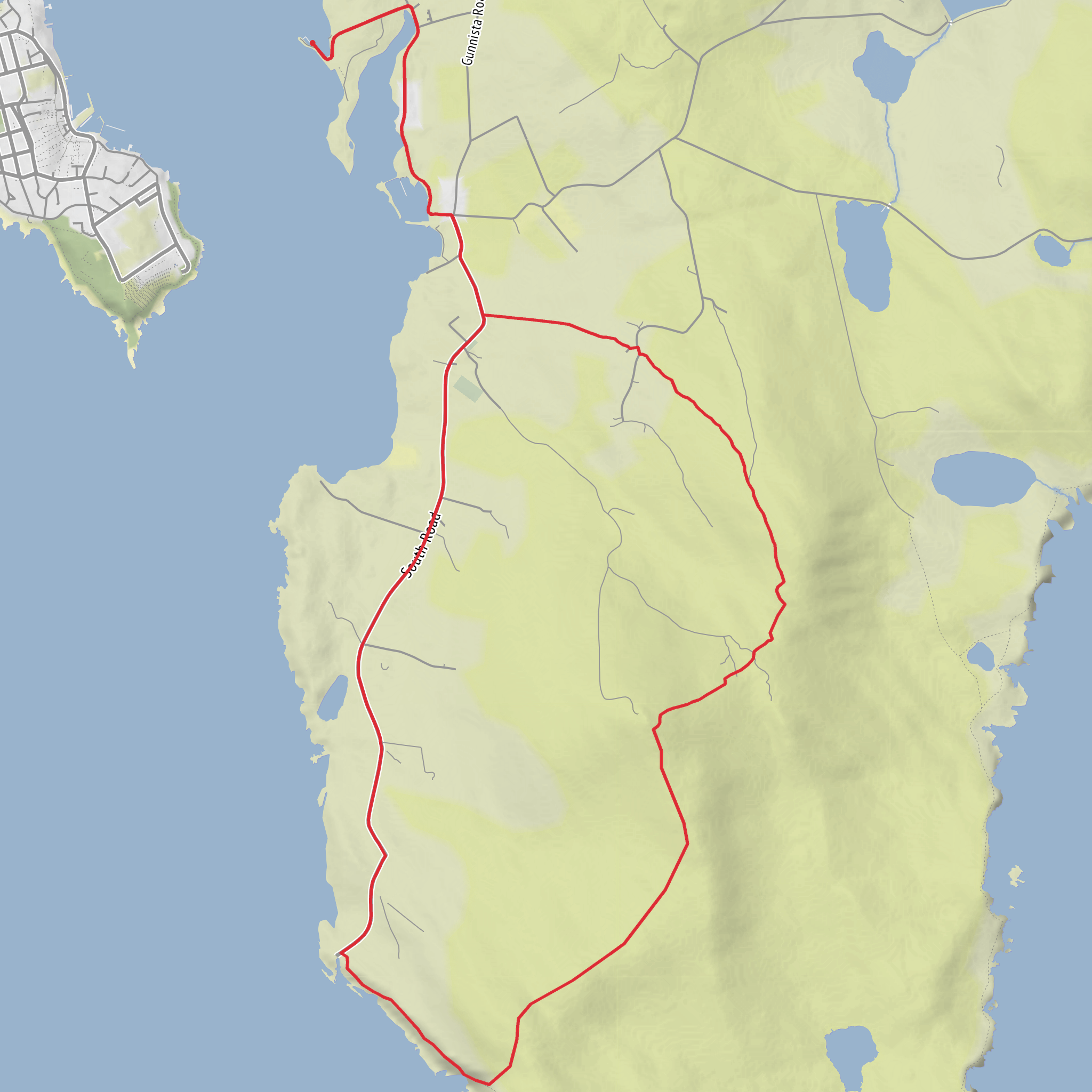
This 13 km (8.1 mile) loop on Bressay packs a surprising amount into an easy-grade day: a broad hill with far-reaching views, quieter inland stretches over open moor and grazing ground, and a dramatic finish at the south end of the island where cliffs, lighthouse buildings and the Ovluss sea arch give the route a real sense of place. Expect roughly 200 m (about 656 ft) of ascent overall, spread gently enough that the walk is more about steady progress than sustained climbing. The route is best thought of as a scenic island circuit with a few rougher, wetter sections rather than a polished waymarked trail. (northlinkferries.co.uk)
The walk starts near the Bressay Ferry Terminal at Maryfield, Bressay, the main arrival point from Lerwick and the nearest clear landmark for the hike head. Bressay lies just across Bressay Sound from Lerwick, and the crossing is short: the inter-island ferry runs seven days a week and carries both foot passengers and cars, with no booking requirement stated on the visitor information. If travelling by public transport, the simplest approach is to reach Lerwick first, then take the ferry across; on Bressay there are limited local bus services, including routes serving places such as Noss and Kirkabister on certain days, but timings are sparse enough that most hikers should plan around the ferry and expect to walk the route from the terminal. By car, drive to the ferry in Lerwick, cross to Bressay, and begin from the terminal area. (bressay.org)
From the ferry terminal, the opening section is usually the gentlest underfoot, using island roads and tracks as you head south into the quieter interior of Bressay. The island landscape quickly opens out into a mix of croft land, rough pasture, peatier ground and low heather moor, with wide views back across the sound to Lerwick. Because the island is relatively treeless and exposed, wind can be a bigger factor than the distance suggests; even on an easy-rated day, waterproof layers and an extra warm layer are worth carrying. Ground conditions can also change quickly after rain, with soft verges and boggy patches on less-defined sections.
Climbing to the higher ground
The route’s main high point is the Ward of Bressay, the hill that dominates the southern part of the island. It rises to about 226 m (741 ft) and is one of the defining landmarks of Bressay, visible from the ferry and from Lerwick. The name “Ward” comes from the Old Norse varda, meaning a watching place, which fits the hill’s role perfectly: from the top, the outlook extends across Shetland in multiple directions on a clear day. The summit is also marked by transmission masts; the site became the location of Shetland’s TV transmitter in 1964, so the hill combines ancient place-name history with more modern island infrastructure. (northlinkferries.co.uk)
Although the total ascent for the loop is modest, this is the section where the route feels most like a hillwalk. The climb is not especially long, but it can feel steeper in places if you leave the road and use rougher ground or ATV-style tracks. In mist, the broad open slopes can become less obvious to read than they first appear, so this is one of the sections where checking the route carefully on HiiKER is useful. In clear weather, though, the reward comes quickly: views over Bressay Sound, Lerwick, Noss, and the more broken coastline to the south make this one of the best viewpoints on an otherwise easy island circuit. (northlinkferries.co.uk)
After the Ward, the route continues over or around nearby southern high ground, including the area referred to as South Hill, before gradually trending toward the coast. This middle part often feels the most remote despite being on a small island. There may be sheep underfoot, faint trods rather than obvious paths, and wetter hollows between firmer ridges. Gaiters are helpful if the ground is saturated, and sturdy footwear is preferable to lightweight road shoes.
Coast, lighthouse and the natural arch
As the loop bends toward Kirkabister Ness, the character of the walk changes from inland moorland to coastal drama. The road at the south end of Bressay
Comments and Reviews
User comments, reviews and discussions about the West Hill, Ward of Bressay, South Hill, Ovluss Natural Arch and Kirkabister Ness Loop, Scotland.
average rating out of 5
0 rating(s)



