Download
3D Flyover
Add to list
More
6.2 km
~1 hrs 25 min
112 m
Out and Back
“Whalsay’s Ward of Clett circuit blends harbour bustle, wild coast, wartime echoes, and wide island views.”
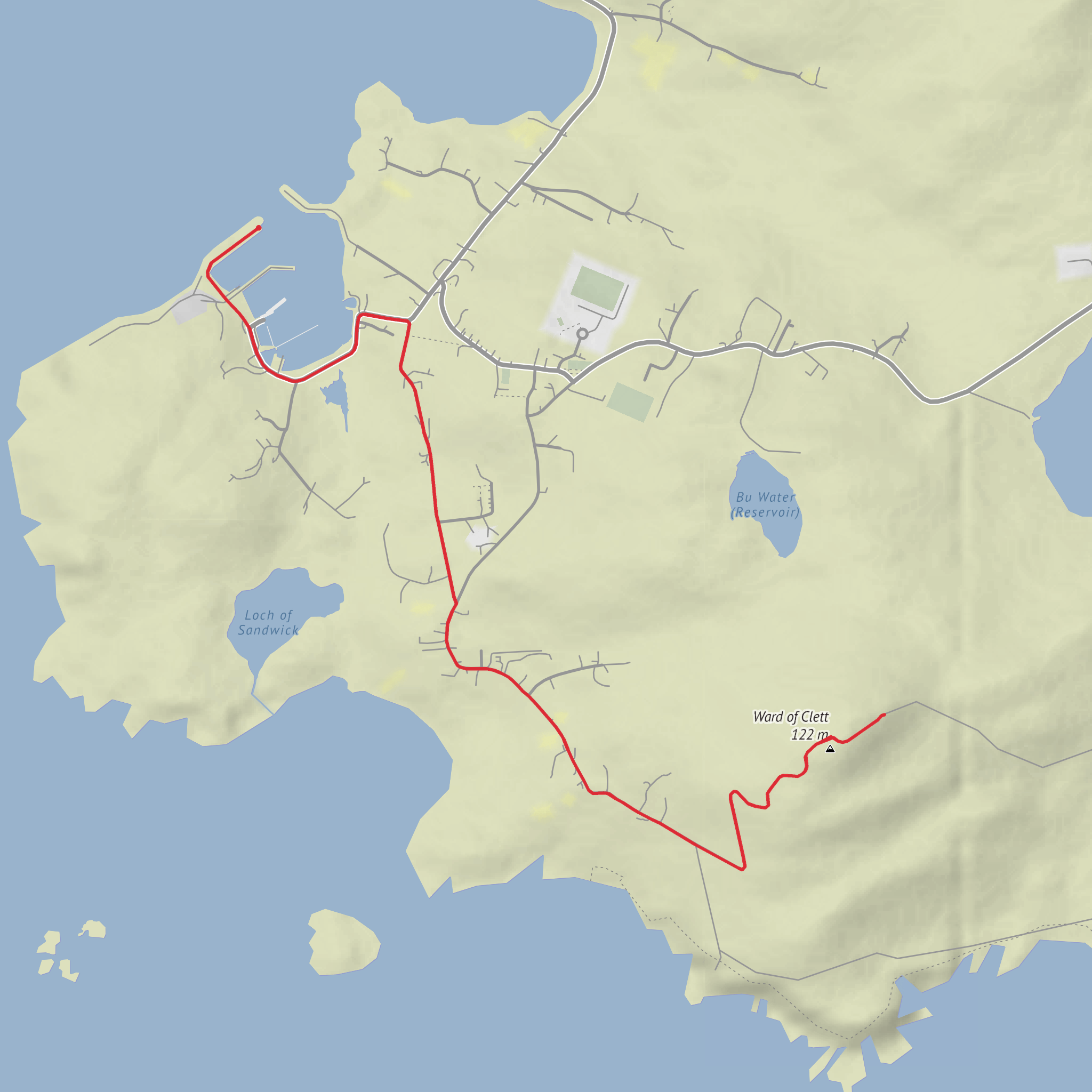
This easy circuit on Whalsay packs a lot into roughly 6.25 km / 4 miles, with about 165 m / 541 ft of ascent on the most commonly described route, though it can feel closer to 100 m / 328 ft if you think of the main sustained climb to the high ground rather than every small rise and dip along the coast. The walk begins at Symbister Ferry Terminal, Symbister, Whalsay, Shetland ZE2, which is the island’s main arrival point and the nearest clear landmark for the start. From there, the route threads through the harbour settlement, visits a striking stretch of coast, and then climbs to the Ward of Clett, the highest point on Whalsay at about 119 m / 390 ft, marked by a trig point and old wartime remains. (walkhighlands.co.uk)
The terrain is varied but not especially technical: expect minor roads near Symbister and Sandwick, grassy tracks, pasture edges, gates and stiles, and a coastal section where the ground can be uneven and damp. Even on an easy-rated outing, the route deserves respect because Shetland weather can change quickly, wind exposure is a real factor, and some of the coastal walking is close to cliff edges and rocky inlets. Waterproof footwear is a good idea, especially after rain, as parts of Whalsay can be soft underfoot. (walkhighlands.co.uk)
What the route feels like
From the ferry terminal, the first part is straightforward and useful for getting your bearings. You walk around Symbister Harbour, where the island’s fishing identity is immediately obvious in the mix of working boats and harbour activity. The route then heads inland briefly before turning toward Sandwick, where the walk starts to feel more rural and open. This opening section is gentle, with only modest climbing, and it gives you time to settle into the landscape before the more scenic coastal stretch begins. (walkhighlands.co.uk)
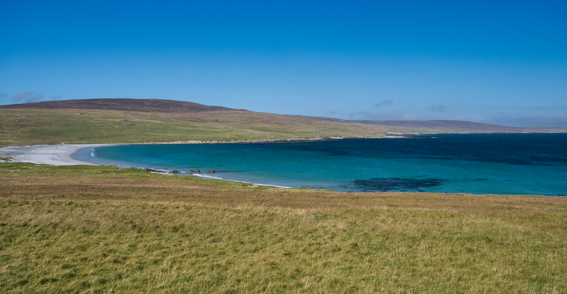
Beyond Sandwick, the route drops onto a grassy track and reaches the shore near Sandwick Bay. This is one of the most attractive parts of the walk: you follow field edges and the seaward side of fences, crossing stiles where needed and passing a series of small inlets. The walking here is easy in dry, calm weather, but it needs a little more care when wet or windy because the line stays close to the coast in places. Views open across the water toward Noss and Bressay, and there is a natural rock arch below the path at one point, a memorable landmark on an otherwise quiet shoreline. (walkhighlands.co.uk)
As the coast begins to rise, the route leaves the shore and joins a track heading inland. The climb to the summit is short rather than strenuous, but it is the main effort of the day. The track passes a barn, then zigzags uphill toward the trig point on the Ward of Clett. Because the summit is the island’s highest ground, even a modest ascent gives a much bigger sense of elevation than the numbers suggest. On a clear day, the top offers broad views over Symbister, the surrounding sea, and much of Whalsay’s patchwork of croft land and moor. (walkhighlands.co.uk)
Landmarks, wildlife, and local character
One of the most interesting features near the top is the presence of old military buildings associated with a Second World War radar station. These remains add a stark historical layer to the summit and are part of the reason the walk feels more distinctive than a simple island hill climb. The radar station formed part of Britain’s wartime defensive network and was used to detect low-flying aircraft. (walkhighlands.co.uk)
Lower down, the route also passes views of plantiecrubs—traditional circular or oval stone enclosures once used to shelter crops such as kale from the harsh Shetland wind. They are a small but very characteristic feature of the islands and a reminder that farming here has always had to adapt to exposure, salt-laden air, and thin soils. (walkhighlands.co.uk)
Wildlife is one of the pleasures of this walk, especially along the coast. Seabirds are likely to be the most noticeable companions, and the shoreline, inlets, and open sea views make this a good route for watching whatever is moving offshore. Sheep are common in the grazed fields, and in spring
Comments and Reviews
User comments, reviews and discussions about the Ward of Clett, Scotland.
average rating out of 5
0 rating(s)
