Download
3D Flyover
Add to list
More
6.1 km
~1 hrs 19 min
71 m
Loop
“Wild cliffs, ancient ruins, and sea-swept silence make Funzie Ness feel hauntingly alive.”
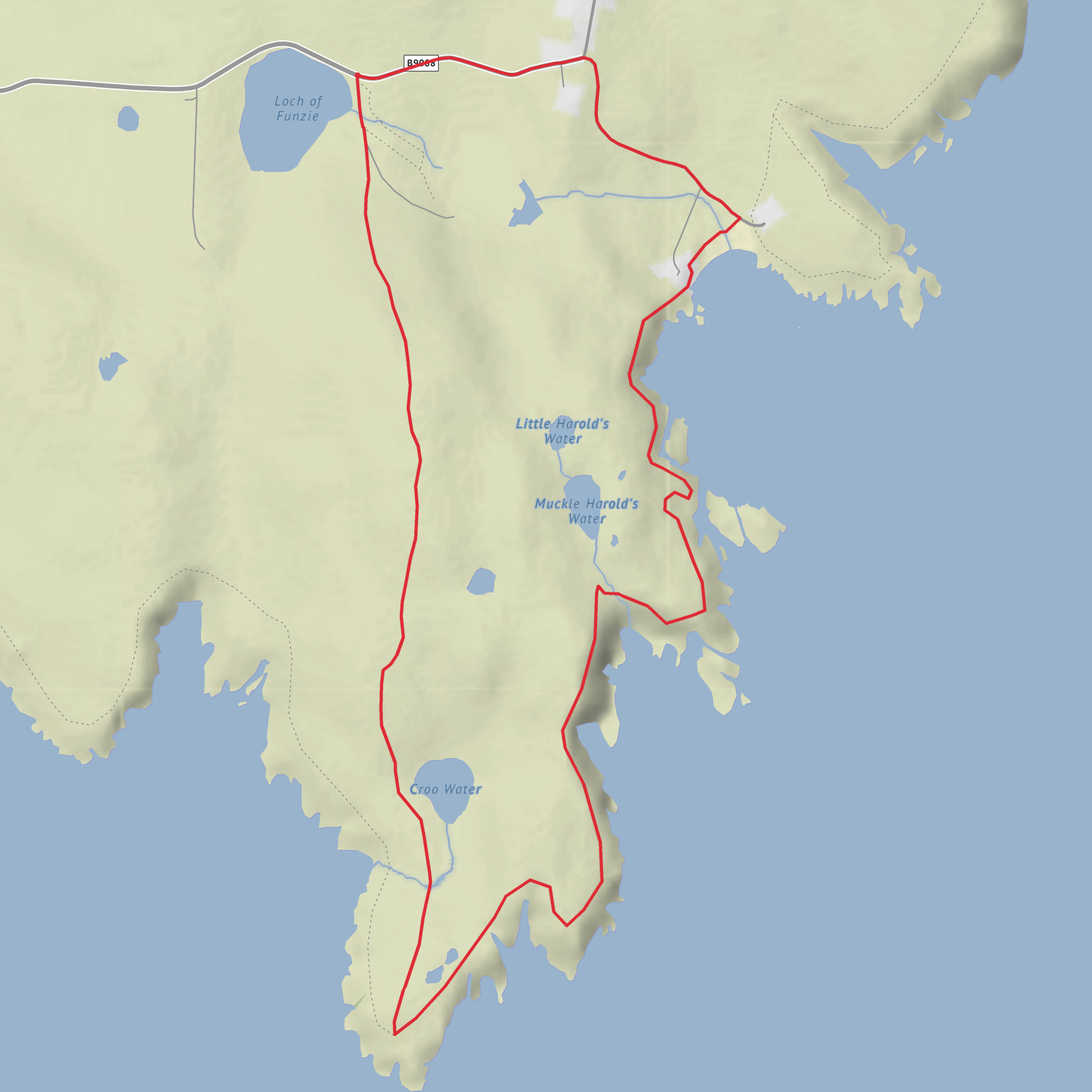
This easy coastal circuit on Fetlar in Shetland covers about 6 km / 3.7 miles with roughly 100 m / 330 ft of ascent, making it a manageable outing for most walkers with a reasonable level of fitness. The route begins near Funzie Bay, Fetlar, Shetland ZE2 9DJ, close to the signed walking start at the beach and the road end near the Loch of Funzie / Funzie Beach area. The ground is a mix of short grass, rough moorland, faint trods, and uneven coastal terrain, so although the distance is modest, sturdy waterproof footwear is still the better choice. The steepest effort usually comes early on as the route climbs away from the bay onto the clifftops. (shetland.org)
Getting to the start takes a bit of planning because Fetlar is one of Shetland’s more remote islands. By car, the usual approach is to drive north through Mainland Shetland, cross by ferry to Yell, continue north, then take the ferry from Belmont in Unst to Hamars Ness in Fetlar, and follow the island road toward Funzie Bay. Public transport is possible but limited and generally tied to ferry connections, so most walkers should check current Shetland inter-island ferry and bus timetables before setting out. The start point used for this walk is commonly given as HU 666 896, at Funzie Beach. (shetland.org)
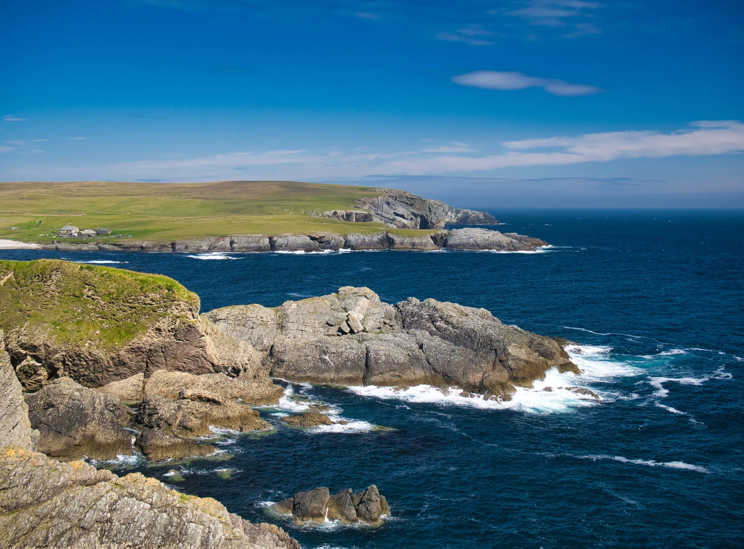
The walk opens beside one of Fetlar’s geological highlights. Funzie Bay is known for its remarkable beach material, where stones have been altered by immense tectonic forces and later exposed again by erosion. Almost immediately, the route begins to feel wilder than its short mileage suggests: sea air, open views, and a coastline cut into geos, stacks, and skerries give the walk a dramatic character from the outset. (shetland.org)
Along the cliffs and around Funzie Ness
From the bay, the route climbs the south side above the shore. This first rise gains much of the day’s elevation in a short stretch, but the reward is a broad view over jagged cliffs and offshore rock features. Care is needed here, especially in wind, wet grass, or poor visibility, because the cliff edge can be abrupt and the ground underfoot uneven. The route then curves around Funzie Ness, passing coastal features such as Hawks Geo, Butsa, and The Snap, with the sea constantly in view. Some versions of the circuit are described at around 5.5 km / 3.4 miles, while slightly extended variants are closer to 8.5 km / 5.3 miles; your stated 6 km / 3.7 mile outing fits the shorter circuit well. (shetland.org)
This is a good place to slow down and scan the water and lochans. Otters are regularly mentioned in the area, especially near the small lochs and burns draining toward the coast. Seabirds are a constant presence, and in the right season the nearby Loch of Funzie reserve is especially noted for birdlife, including the rare red-necked phalarope. Fetlar was also once famous for breeding snowy owls, though that is now part of the island’s wildlife history rather than something walkers should expect to see. (shetland.org)
Croo Water, archaeology, and abandoned crofting ground
As the route bends north and west past Croo Water, the landscape shifts from sheer coastal drama to a quieter, more layered scene of loch, heath, and old settlement traces. Around Croo Water there are several prehistoric house sites and evidence of ancient boundary dykes beneath the heather. If you take the optional detour up toward The Crooans, there are remains of a Neolithic chambered cairn, along with a later coastguard lookout hut nearby. That combination of prehistoric monument and more recent maritime watchpoint gives this short walk an unusually deep historical range. (shetland.org)
The inland side of the circuit crosses old crofting land where ruined buildings and tumbled walls still stand. These remains reflect the long human story of settlement on Fetlar and also the hardship that shaped it. Historical accounts tied to this area mention poor seasons, crop failures, the effects of a fishing disaster in the 1830s, and the wider pressures that contributed to depopulation and emigration, including the clearances around 1860. For walkers, these ruins are more than scenery: they are part of the social history of Shetland’s smaller islands and help explain why the landscape feels both inhabited and abandoned at the same time. (shetland.org)
Geologically, this is also one of the most interesting corners of Fetlar. The island includes ancient conglomerate as well
Comments and Reviews
User comments, reviews and discussions about the The Crooans, Funzie Ness, Croo Water and Funzie Bay, Scotland.
average rating out of 5
0 rating(s)
