Lunna Ness Loop via Taing of Kelswick, Grut Wick, Wick of Glachon, Feor Wick and Boatstroom Voe
Download
3D Flyover
Add to list
More
15.4 km
~3 hrs 15 min
107 m
Loop
“A windswept Shetland circuit of quiet voes, wild headlands, and sea-drawn solitude.”
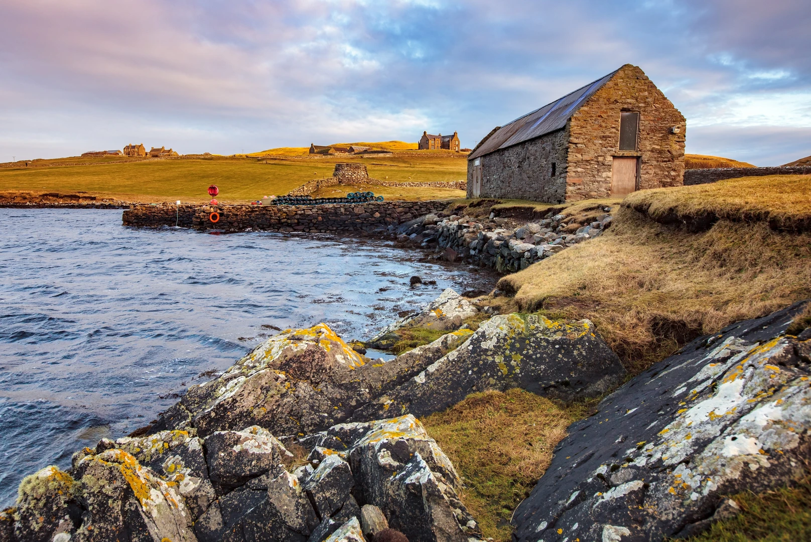
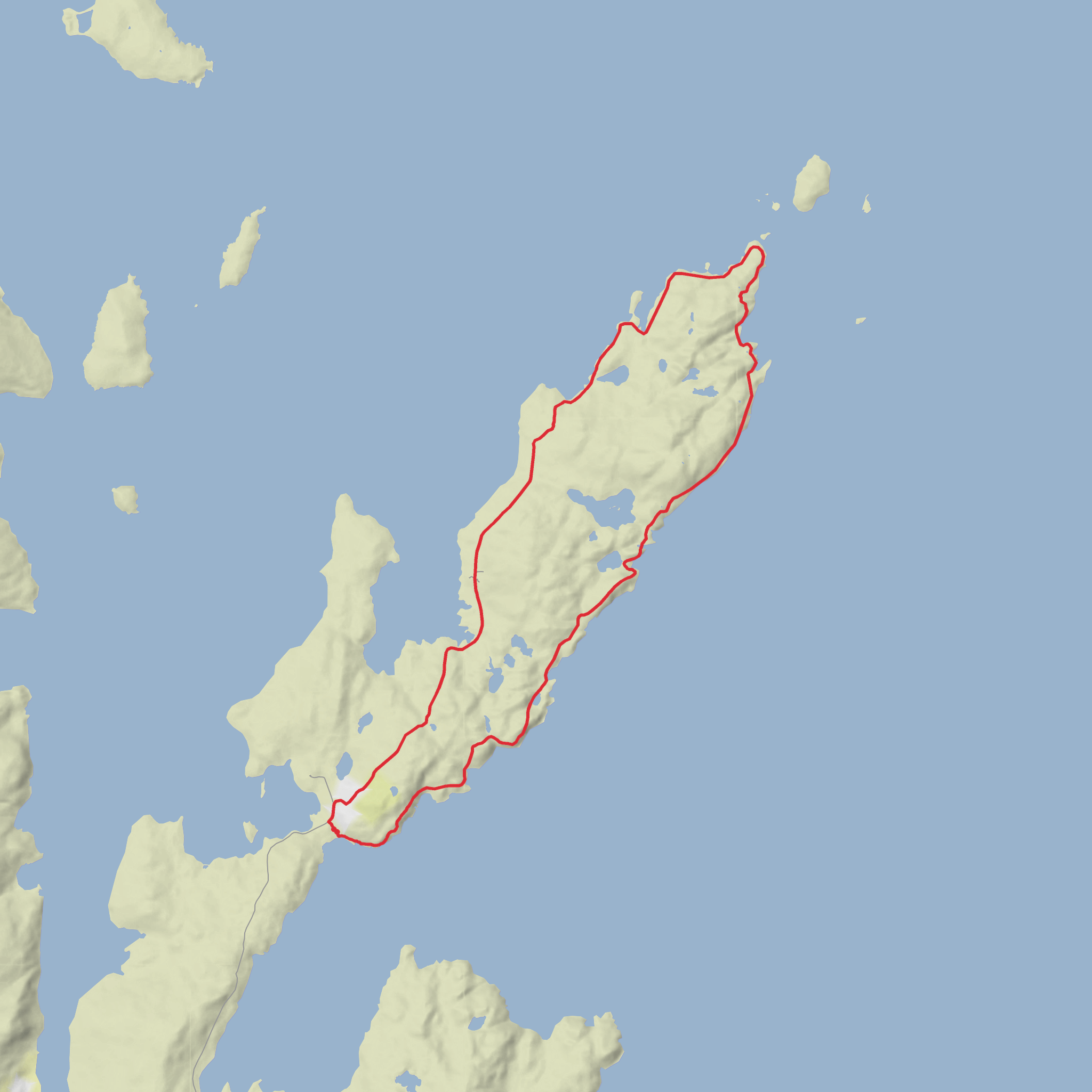
This is a long, low-level coastal circuit across the far northeastern reaches of Mainland Shetland, where the walking is defined less by climbing and more by space, shoreline, weather exposure, and the constant pull of the sea. At around 15 km / 9.3 miles with only about 100 m / 330 ft of ascent, it is physically quite gentle by hillwalking standards, but it still needs respect: much of the route is rough, pathless or faint in places, and the remoteness of Lunna Ness can make an easy-rated walk feel more serious in poor visibility or strong wind. The nearest useful landmark for the start is Outrabister, Lunna Ness, near Vidlin, Shetland, where walkers typically begin from the road end and track access on the peninsula. (walkhighlands.co.uk)
The character of the walk changes steadily as you go. Early on, you pass scattered crofting ground and the last houses before the route opens into a broad coastal landscape of grass, heather, peat, rock, and indented sea inlets. The terrain is mostly undulating rather than steep, so the elevation gain comes in small rises and dips rather than any sustained climb. That makes it a good choice for hikers who are comfortable covering distance over uneven ground, even if they are not looking for a mountainous day. Underfoot, expect a mixture of grassy trods, rough coastal ground, wetter patches, and stonier sections near the shore. After rain, some areas can be boggy and slow-going. (walkhighlands.co.uk)
What the route feels like on the ground
From the access track beyond the settled area, the route trends out toward the eastern side of the peninsula, where the coast becomes more broken and dramatic. Grut Wick is one of the first notable features, reached by descending toward a pebble-backed bay. This section gives a good sense of the walk as a whole: open views, little shelter, and a shoreline that alternates between inviting inlets and rougher, rockier edges. From there, the route continues across higher ground, staying inland enough to avoid the roughest coastal margins near the Wick of Glachon before curving onward toward the outer reaches of Lunna Ness. (walkhighlands.co.uk)
The Taing of Kelswick and the outer headlands give the walk its most remote feel. In Shetland, a “taing” usually refers to a narrow headland or tongue of land, and here that shape is very clear in the way the land reaches into the sea. The views extend toward nearby islands and skerries, including Lunna Holm, and the sense of exposure increases the farther out you go. Although the route is not high, wind can be a major factor, and on gusty days the headlands can feel much more committing than the elevation profile suggests. (en.wikipedia.org)
On the return side, the route passes the west-facing inlets, including Feor Wick and the area around Boatstroom Voe, where the coastline softens into quieter voes and coves. These western sections often feel more sheltered in certain wind directions and are especially rewarding for wildlife watching. The walking remains easy in gradient but can still be lumpy and uneven, with occasional wet ground and indistinct route choices, so steady navigation remains important all the way back. If using digital mapping, plan with HiiKER and do not rely on waymarking on the ground. (walkhighlands.co.uk)
Landmarks, wildlife, and landscape
The main appeal of this loop is the variety packed into a relatively modest distance. You get pebble beaches, narrow wicks, broader voes, low rocky headlands, moorland textures, and long sea views almost throughout. Lunna Ness is widely noted for its rocky shores and wildlife, especially seals and otters, while the wider Nesting and Lunnasting area is known for moorland birds such as golden plover. Feor Wick in particular is noted as a place where eider ducks and seals are often seen. Depending on season and luck, hikers may also spot seabirds working the coastline and, in quieter stretches, signs of otter activity along the shore. (shetland.org)
Geologically, the peninsula has a distinctly glaciated look, with hummocky ground, exposed rock, and numerous small lochs and inlets shaping the route. That gives the walk a rugged appearance without making it mountainous. The landscape can seem deceptively simple from a distance, but once on foot it breaks into many small features—rock ribs, wet hollows, coastal shelves, and minor rises—that slow progress a little more than the distance alone might suggest. (northlinkferries.co.uk)
Historical significance of the area
Lunna Ness has an importance out of all proportion to its size because
Comments and Reviews
User comments, reviews and discussions about the Lunna Ness Loop via Taing of Kelswick, Grut Wick, Wick of Glachon, Feor Wick and Boatstroom Voe, Scotland.
average rating out of 5
0 rating(s)
