Download
Preview
Add to list
More
17.8 km
~4 hrs 51 min
775 m
Loop
“Wild Unst unfurls in peat, heather, lochs and sea-cliffs, demanding care as much as wonder.”
This medium-grade coastal and moorland loop on Unst packs a remarkable amount of northern Shetland character into roughly 18 km / 11.2 miles, with about 800 m / 2,625 ft of cumulative ascent. Expect a route that feels wild rather than engineered: long stretches of open ground, rough coastal margins, peat and heather underfoot, and repeated short climbs that add up over the day. The terrain is often more demanding than the distance suggests, especially in wind, rain, or poor visibility, so it suits hikers who are comfortable with pathless or faint-path navigation and exposed cliff country. Using HiiKER before setting out is especially helpful here because the line of travel can be less obvious than on more waymarked walks.
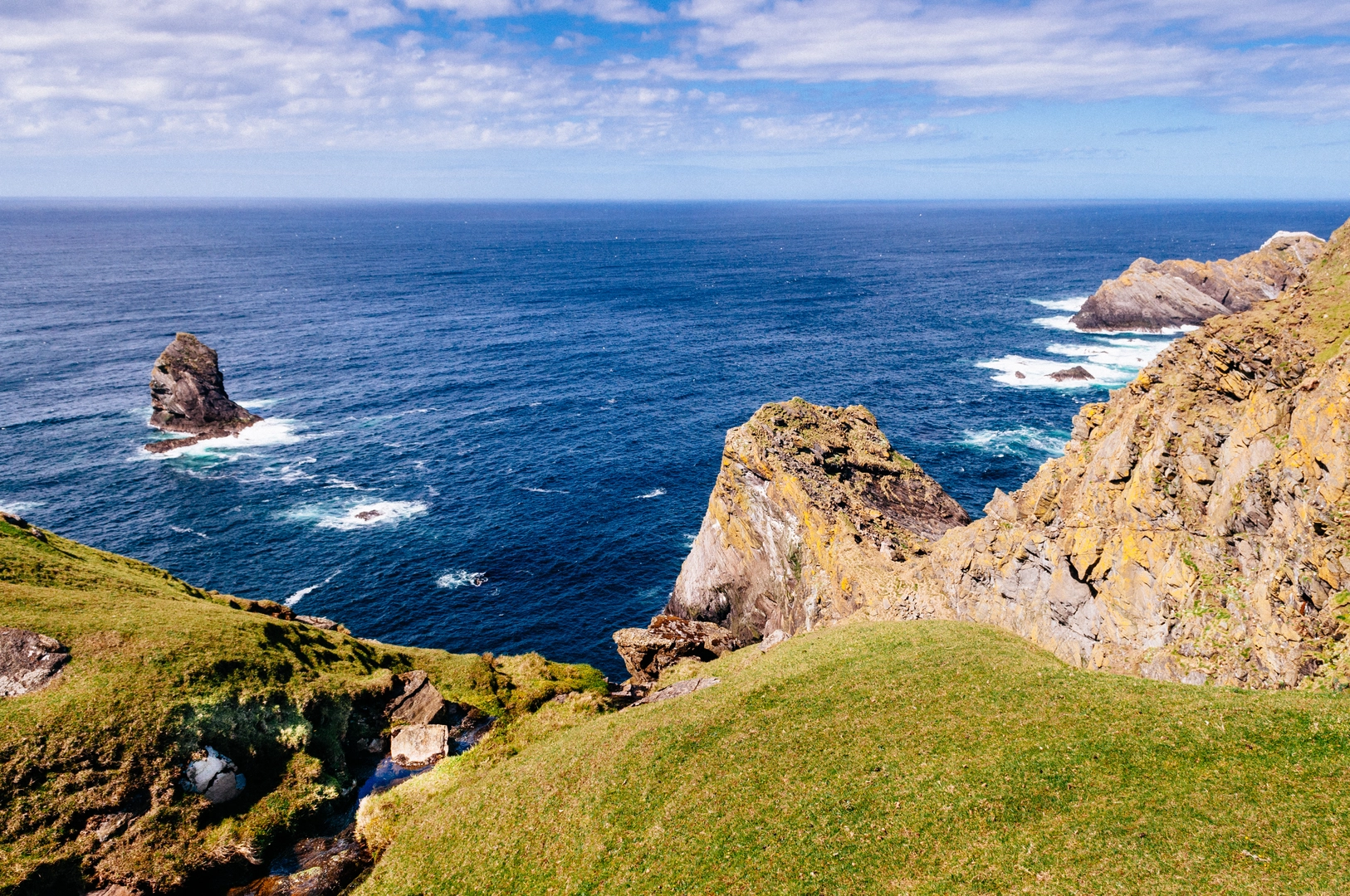
The route lies on Unst, the northernmost inhabited island in the UK, in the Burrafirth and Tonga area. Loch of Cliff is a major landmark in itself: it is the longest loch in Shetland, lying east of Burrafirth on low moorland near the west side of Unst. (lets.fish) The place names in this walk immediately hint at the landscape you will encounter: “wick” usually indicates a bay or inlet, “ayre” a shingle or storm beach, and “stack” an isolated sea pillar. That means the outing naturally alternates between inland water, indented coastline, beaches, cliffs, and offshore rock towers.
Getting to the start is part of the planning. By car from Lerwick, the usual approach is north on the A970 to Toft, ferry to Ulsta on Yell, then continue on the A968 to Gutcher and take the second ferry to Belmont on Unst before driving north across the island toward the Burrafirth side roads. Shetland’s visitor information for Unst confirms that reaching the island requires travel via Yell, and the inter-island ferry network links Mainland, Yell, and Unst. (shetland.org) If using public transport, daily North Isles bus services operate from Lerwick and connect with the ferries, but an overnight stay is often the practical choice when heading this far north. (shetland.org) The nearest obvious service hub and landmark for final approach planning is Haroldswick, Unst, ZE2 9ED, around the Unst Heritage Centre area, with the road onward toward Burrafirth opening access to the western side of the island. (shetland.org)
Terrain and what the day feels like
The opening section near Loch of Cliff is usually the gentlest part psychologically, even if the ground is already uneven. Around the loch and adjacent moor, expect wet patches, peat hags in places, and soft ground after rain. Because the loch is broad, shallow, and open to the weather, wind can be a constant factor even before you reach the coast. (lets.fish) This is a good place to settle into the rhythm of the day: steady pacing, careful foot placement, and frequent checks of direction.
As the loop trends toward Wood Wick and the outer coast, the walk becomes more dramatic. The coastline here is shaped by Atlantic exposure, and the scenery is likely to shift from open moor to broken cliff edge, geos, stacks, and

Surfaces
Unknown
Gravel
Wood
Comments and Reviews
User comments, reviews and discussions about the Loch of Cliff, Wood Wick, Ayre of Tonga and Tooa Stack Loop, Scotland.
average rating out of 5
0 rating(s)