Download
3D Flyover
Add to list
More
11.0 km
~2 hrs 57 min
452 m
Loop
“A wild Shetland circuit of cliffs, moor and weather, where every step feels thrillingly exposed.”
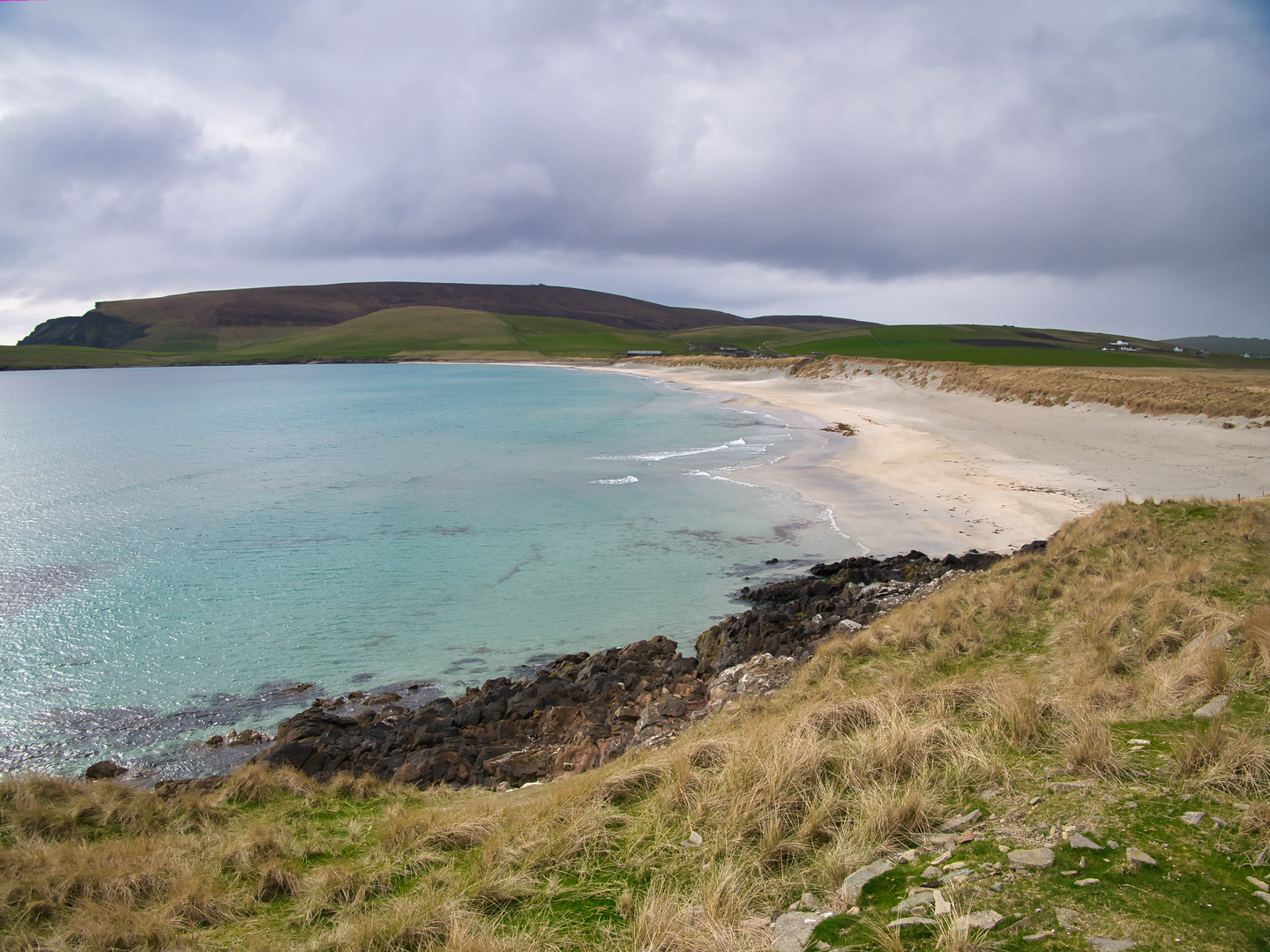
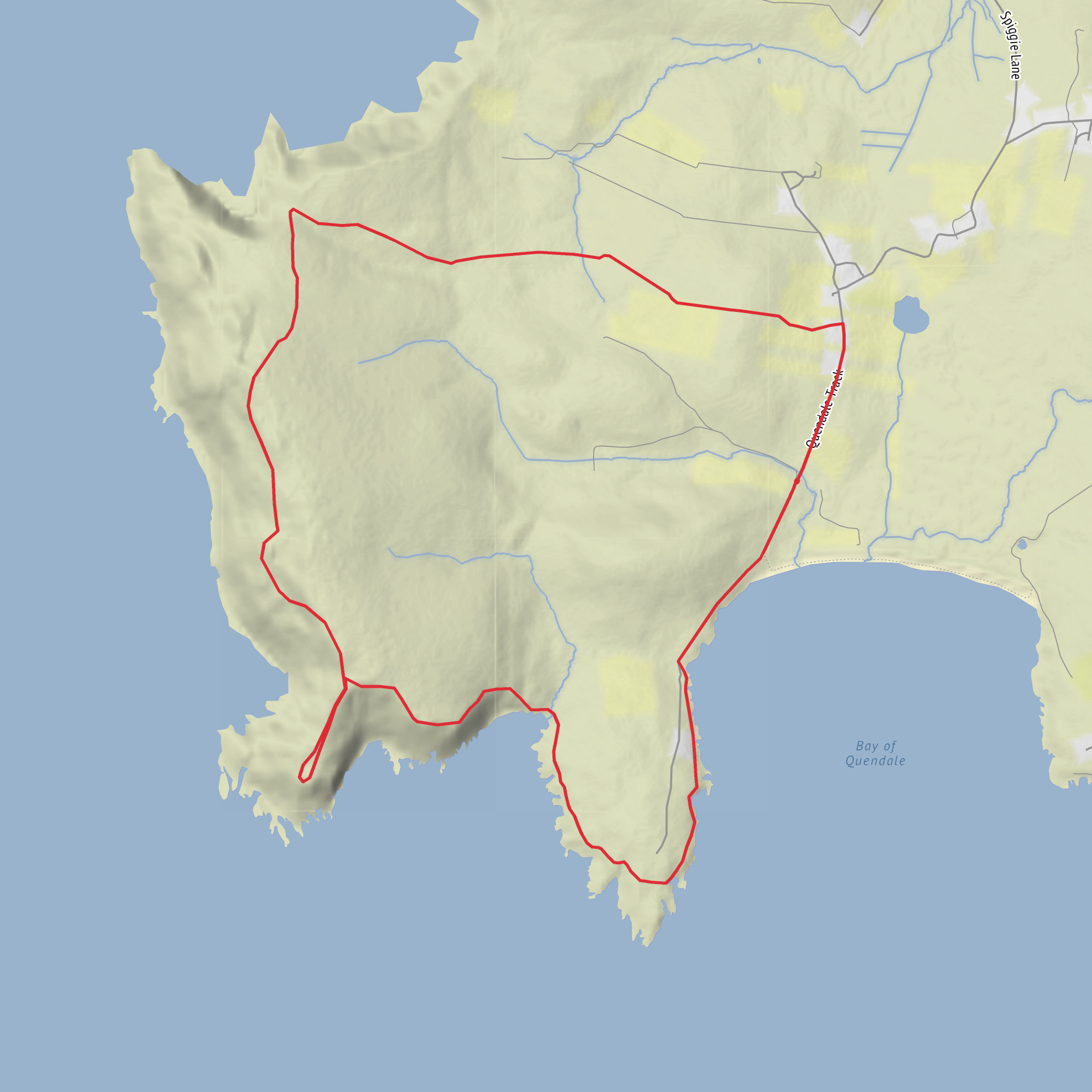
This medium-difficulty coastal loop explores one of the wildest corners of South Mainland, Shetland, linking Fitful Head with the lower ground of Siggar Ness and Garths Ness. Over roughly 11 km / 6.8 miles, with about 500 m / 1,640 ft of ascent, it combines steep grassy slopes, rough moorland, cliff-edge walking, old tracks and a long sense of exposure to sea and weather. The route is not especially long, but it feels serious in places because the terrain is uneven, the descents and re-ascents are sharp, and the coastline is dramatic rather than forgiving. Fitful Head itself rises to about 283 m / 928 ft and stands at the south-west corner of Shetland Mainland, around 6 km / 3.7 miles northwest of Sumburgh Head. (en.wikipedia.org)
The most practical start point is near Quendale Water Mill, Dunrossness, South Mainland, ZE2 9JD, which is the nearest clear address and the usual landmark for access into this area. From there, minor roads and estate tracks lead west toward the high ground and the old military buildings used as a parking reference for nearby coastal access. Shetland’s visitor information also places Quendale Mill “under the shadow of Fitful Head,” which is a good indication that you are in the right area for the loop. (shetland.org)
Getting there is straightforward by car from Lerwick via the A970 south through Dunrossness, then turning for Quendale and Quendale Water Mill; local directions for Garths Ness specifically say to continue past the mill turnoff area toward the disused military buildings at the road end, where walkers commonly park. By public transport, South Mainland is served by Service 6 to Sumburgh Airport, and Shetland’s transport guidance notes that buses are designed around local travel rather than direct tourist drop-offs, so expect to walk from the nearest stop and check current timetables carefully before setting out. In practice, public transport is possible but less convenient for this route than driving, especially if you want flexibility around weather and daylight. (shetland.org)
What the route feels like
The opening section is usually the easiest underfoot, following road or track as height is gained above Quendale. That gentler start does not last. As the route reaches the col and upper slopes, the landscape opens abruptly into sea cliffs, peat, cropped grass and rough moor. The walking becomes more committing, with sections where the line is obvious in clear weather but less so in mist or heavy rain. The broad shape of the day is a climb onto Fitful Head, a traverse of cliff-top ground, a descent toward the burn dividing Fitful Head from the Garths Ness peninsula, and then a return by track through lower farmland and coastal ground. Walkhighlands notes boggy grassland, rough moorland, a steep final climb to the summit area, and a steep descent toward the burn near Garths Ness, which matches the character hikers should expect on a loop of this length and ascent. (walkhighlands.co.uk)
Although the route is rated medium, the difficulty comes from terrain and exposure rather than technical scrambling. In dry, calm weather it is a rewarding coastal circuit; in strong wind, low cloud or persistent rain it can feel much more demanding. The cliffs are a constant hazard, especially where the ground is soft or visibility is poor. Good waterproofs, grippy footwear and confident footing on steep grass are more important here than speed.
Cliffs, headlands and route-finding
Fitful Head is the visual and physical high point of the walk. The summit area is marked by a trig point beside a NATS installation, reached by a restricted access service road from Quendale. The road can make the ascent simpler than a fully pathless climb, but the more memorable parts of the loop are the rough coastal sections beyond it. West-facing cliffs run for about 3 km / 1.9 miles below the headland, with sea stacks and islets scattered at their base, giving the route a very dramatic edge for much of the traverse. (en.wikipedia.org)
From the summit area, the ground toward Siggar Ness and the Noup is wilder and less defined. One of the key planning points is that dropping all the way to Siggar Ness costs extra
Comments and Reviews
User comments, reviews and discussions about the Fitful Head, Siggar Ness and Garths Ness Loop, Scotland.
average rating out of 5
0 rating(s)
