
Download
3D Flyover
Add to list
More
5.6 km
~1 hrs 22 min
152 m
Out and Back
“A windswept ridge-and-moor adventure with dramatic escarpments, big Shetland views, and rewarding navigation challenges.”
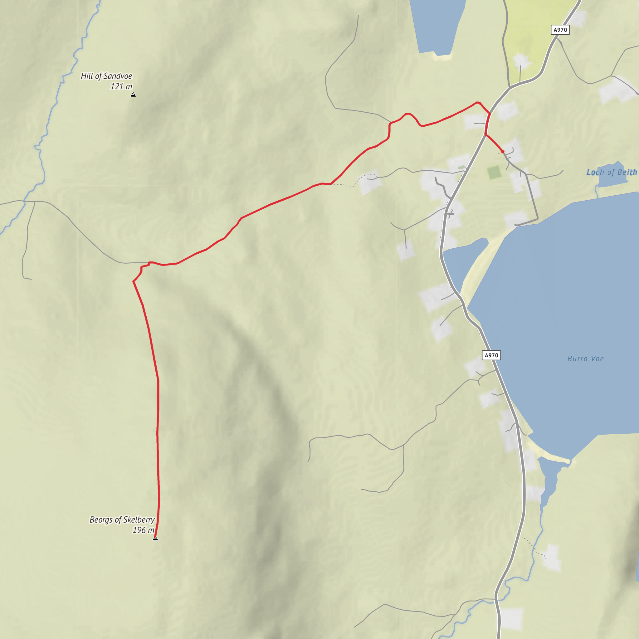
This medium-difficulty outing explores one of the striking ridge-and-moor landscapes of North Roe in northern Mainland, Shetland, with roughly 6 km / 3.7 miles of walking and about 200 m / 656 ft of ascent. The route is best thought of as a short hill walk rather than a waymarked trail: expect open ground, rough moor, and sections where the line on the ground may be faint or absent, so careful route-finding is part of the day. The summit of Beorgs of Skelberry rises to about 198 m / 650 ft and is marked by a trig point and cairns. (mudandroutes.com)
The hill stands above the small settlements of Skelberry and North Roe, on the North Roe peninsula in the Northmavine area of Shetland. The nearest practical landmark for the start is North Roe village / North Roe school area, where the public road reaches the far north of the mainland side of the peninsula; from there, access is typically made onto the open hillside. Just beyond the school, a rough metalled track heads west toward Uyea, which helps identify the general access area for walks in this part of North Roe. (shetland.org)
Because the hike head was left incomplete, the most sensible planning assumption is a start near North Roe, Shetland, Scotland, close to the end of the public road and the school/village area rather than from an isolated roadside pull-in. That puts you close to the eastern foot of the Beorgs and within easy reach of the lower slopes above Skelberry and North Roe. This is also the most useful place to aim for if you are navigating with HiiKER. (shetland.org)
What the walk feels like
Although the distance is modest, the terrain can make it feel more serious than the numbers suggest. The ascent is not especially high, but the ground is exposed and often uneven, with heather, peat, wet patches, rock, and short steep pulls as you gain the ridge. In poor visibility, the broad moorland and subtle trods can become confusing, so this is a route for hikers comfortable with basic hill navigation rather than those expecting a signed path throughout. The “medium” rating fits well: physically it is manageable for regular walkers, but weather, wind, and underfoot conditions can quickly raise the seriousness. (de.wikipedia.org)
One of the defining features of the walk is the dramatic eastern scarp of Beorgs of Skelberry, a steep flank that runs for roughly 3 km / 1.9 miles north to south. As you climb, the views open over Burra Voe, North Roe, nearby lochs, and the wider Northmavine landscape. To the north the hill merges toward the Hill of Sandvoe, while to the south the land dips before rising again toward the Beorgs of Housetter. (de.wikipedia.org)
At the top, expect a broad, windswept summit area rather than a sharply pointed peak. The trig pillar and cairns give a clear focal point, and on a clear day the outlook is one of the main rewards: a mosaic of sea inlets, crofting land, moor, and lochans, with the larger wild interior of North Roe and Ronas Hill beyond. (mudandroutes.com)
Landmarks, geology, and landscape character
This is a particularly interesting hill for anyone who enjoys geology. Beorgs of Skelberry sits on a major geological boundary between the granites and granophyres of the Northmaven Complex to the west and older metamorphic rocks to the east. That contrast helps explain the abrupt, rugged shape of the Beorgs and the strong visual drama of the escarpment.
Comments and Reviews
User comments, reviews and discussions about the Beorgs of Skelberry, Scotland.
average rating out of 5
0 rating(s)


